Front Passing Through Today; Lower Heat Levels Ahead
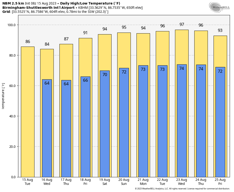
AUGUST FRONT: We have a broken band of showers and a few thunderstorms on radar early this morning over the northern half of Alabama in advance of a surface front that is drifting southward. This front will bring some needed heat relief to the northern half of the state today, and statewide tomorrow. Highs will be only in the 85-89 degree range across North Alabama today, and in the mid 80s tomorrow. South Alabama will still be well into the 90s today, but the high there tomorrow will be in the low 90s, much more tolerable than recent days.
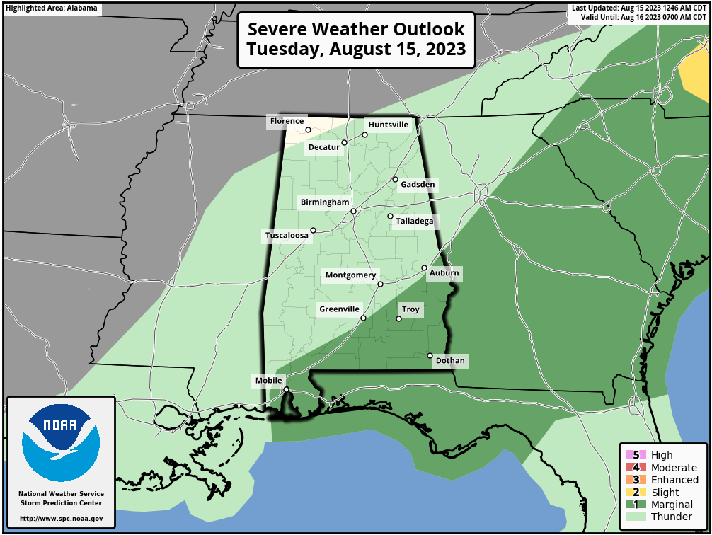
We note that SPC has defined a “marginal risk” (level 1/5) of severe thunderstorms this afternoon for areas south of a line from Opelika to Greenville to Mobile. A few storms across South Alabama ahead of the front could produce strong gusty winds later today.
REST OF THE WEEK AND THE WEEKEND: Morning lows will drop well down into the 60s over the northern 2/3 of the state early tomorrow and Wednesday morning, and some of the cooler spots could dip into the upper 50s for a little taste of fall. Heat levels rise late in the week, and by the weekend we expect highs back in the mid 90s along with slowly increasing humidity levels.
Most of the state will be dry tomorrow through the weekend with mostly sunny days and fair nights. Isolated afternoons will be confined to far South Alabama, and even there the risk of any one spot getting wet will be low (20 percent).
NEXT WEEK: Next week looks quiet as well with hot and mostly dry conditions; highs will be in the 90s and isolated afternoon thunderstorms will remain over the southern quarter of the state. After today no sign of any organized severe thunderstorm threat for 7-10 days for a change. See the video briefing for maps, graphics, and more details.
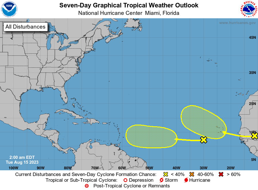
TROPICS: NHC is monitoring a tropical wave in the far eastern Atlantic, and another one will will emerge off the coast of Africa tonight or tomorrow. The lead wave will be in a hostile environment and has only a 10 percent chance of development over the next seven days. The wave coming off the African continent has a 30 percent chance of development in the 4-7 day time frame. No tropical systems are expected to be near the Gulf of Mexico or the U.S. for at least the next seven days.
ON THIS DATE IN 1787: Tornadoes were reported in Connecticut, Rhode Island, Massachusetts, and New Hampshire. Wethersfield, Connecticut was hard hit by the tornado outbreak. There, a woman and her family were caught in the open. She and her son were killed. Clothes from the family farm were carried three miles away. This event is regarded to be the most significant tornado outbreak in early New England history.
ON THIS DATE IN 1983: Hurricane Alicia formed on this day and was the costliest tropical cyclone in the Atlantic since Hurricane Agnes in 1972. It struck Galveston and Houston, Texas directly three days later, causing $2.6 billion (1983 USD) in damage and killing 21 people. This storm was the worst Texas hurricane since Hurricane Carla in 1961.
Look for the next video briefing here by 3:00 this afternoon… enjoy the day!
Category: Alabama's Weather, ALL POSTS, Weather Xtreme Videos
About the Author (Author Profile)
James Spann is one of the most recognized and trusted television meteorologists in the industry. He holds the AMS CCM designation and television seals from the AMS and NWA. He is a past winner of the Broadcast Meteorologist of the Year from both professional organizations.Subscribe
If you enjoyed this article, subscribe to receive more just like it.


