Just A Few Isolated Showers Around Through Tomorrow
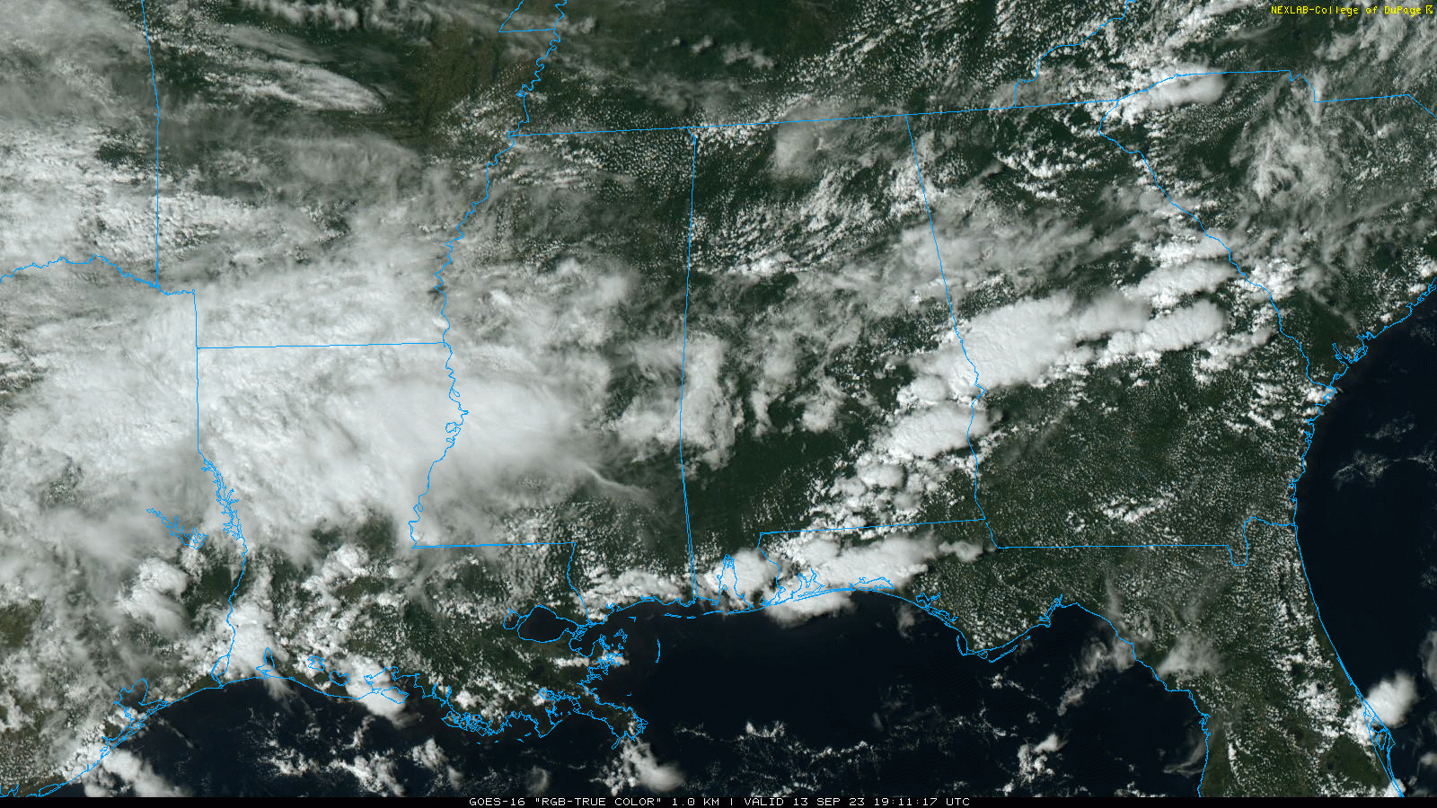
RADAR CHECK: Showers and thunderstorms are most active this afternoon south of a line from Auburn to Greenville to Mobile… ahead of a surface front that continues to sag southward. Showers are very isolated over the northern half of the state. And, as advertised, heat levels are down with temperatures mostly in the low to mid 80s this afternoon. A few spots across Southeast Alabama are at the 90 degree mark.
Showers will fade this evening; we expect lows early tomorrow ranging from the upper 50s across the Tennessee Valley to the upper 60s over the southern quarter of the state.
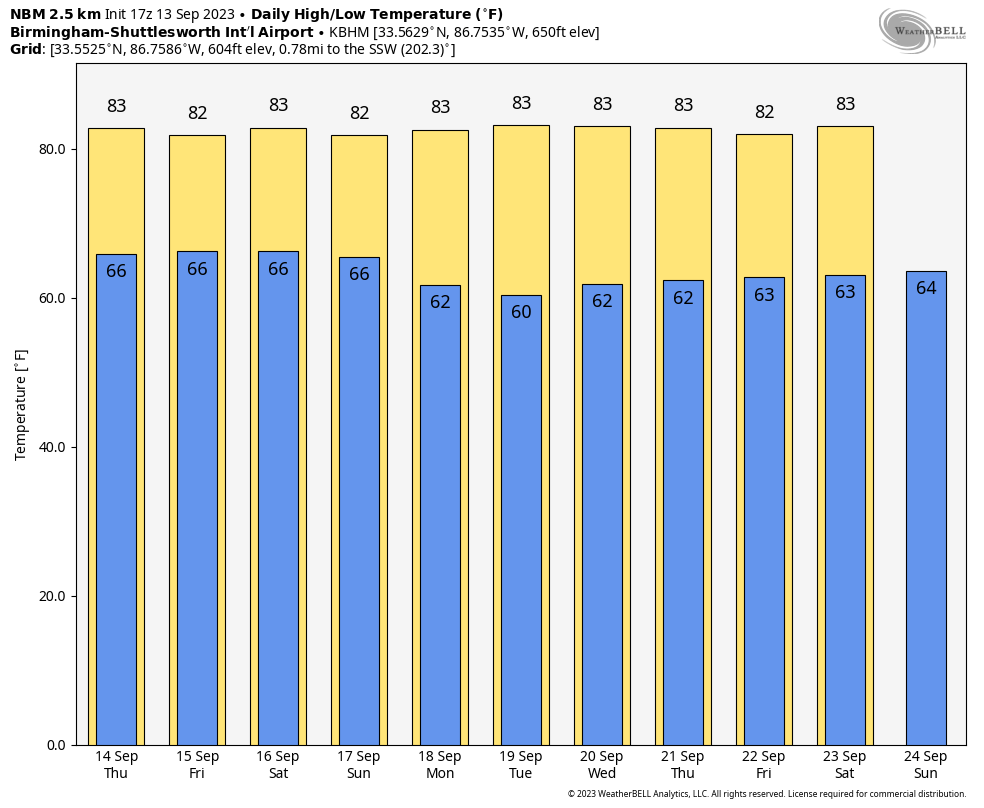
The weather won’t change much tomorrow… it will be a partly sunny day with just a few isolated showers or storms around. The high will be in the mid 80s, not far from average for mid-September in Alabama.
FRIDAY AND THE WEEKEND: Models are trending drier for Friday and Saturday. There will still be a chance of showers both days, but they will be scattered in nature… chance of rain for any one given spot Friday and Saturday has dropped into the 20-30 percent range. The sky will be occasionally cloudy both days with highs in the 80s. Then, Sunday looks mostly dry with only a small risk of a stray shower; the high will be in the mid 80s.
NEXT WEEK: At this point next week looks mostly rain-free for Alabama and the Deep South with highs in the 80s and lows in the 60s. See the video briefing for maps, graphics, and more details.
FOOTBALL WEATHER: For the high school games Friday night, we have a risk of scattered showers, but nothing especially widespread or heavy. Temperatures will fall through the 70s.
Saturday, Alabama travels to Tampa to take on South Florida (2:30p CT kickoff)… the day will be hot and humid with a kickoff temperature around 90 degrees. A passing shower or thunderstorm is possible during the game.
Auburn hosts Samford Saturday evening at Jordan-Hare Stadium (6:00p CT kickoff)… the sky will be mostly cloudy with a passing shower possible. Temperatures will be in the mid to upper 70s.
And, UAB will host Louisiana Saturday evening in downtown Birmingham at Protective Stadium (6:00p CT kickoff)… much like Auburn, a shower can’t be totally ruled out during the game. Mostly cloudy conditions with temperatures falling from near 80 at kickoff, to mid 70s by the fourth quarter.
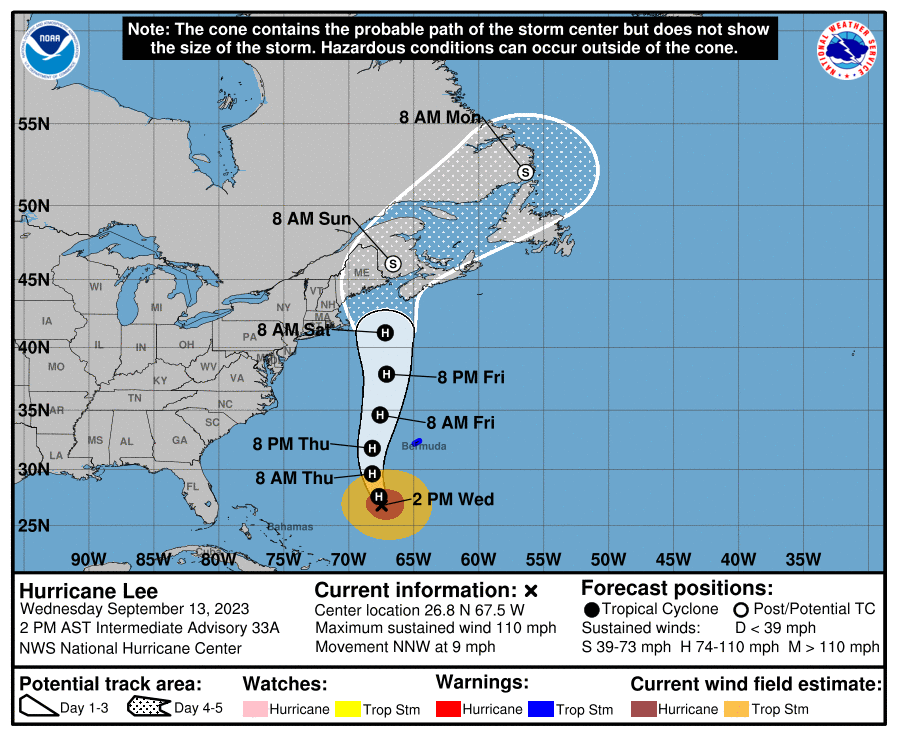
TROPICS: Hurricane Lee is packing sustained winds of 110 this afternoon, and is about 420 miles south/southwest of Bermuda. Lee is expected to gradually weaken as it moves into an environment of increasing vertical wind shear, slightly drier air, and over progressively cooler waters during the next few days. However, the large size of the system suggests that the weakening process should be slow. In addition, Lee is expected to grow in size as it gains latitude during the next few days. Regardless of the details, there is high confidence that Lee will be a large hurricane near the coast of New England Friday night and Saturday.
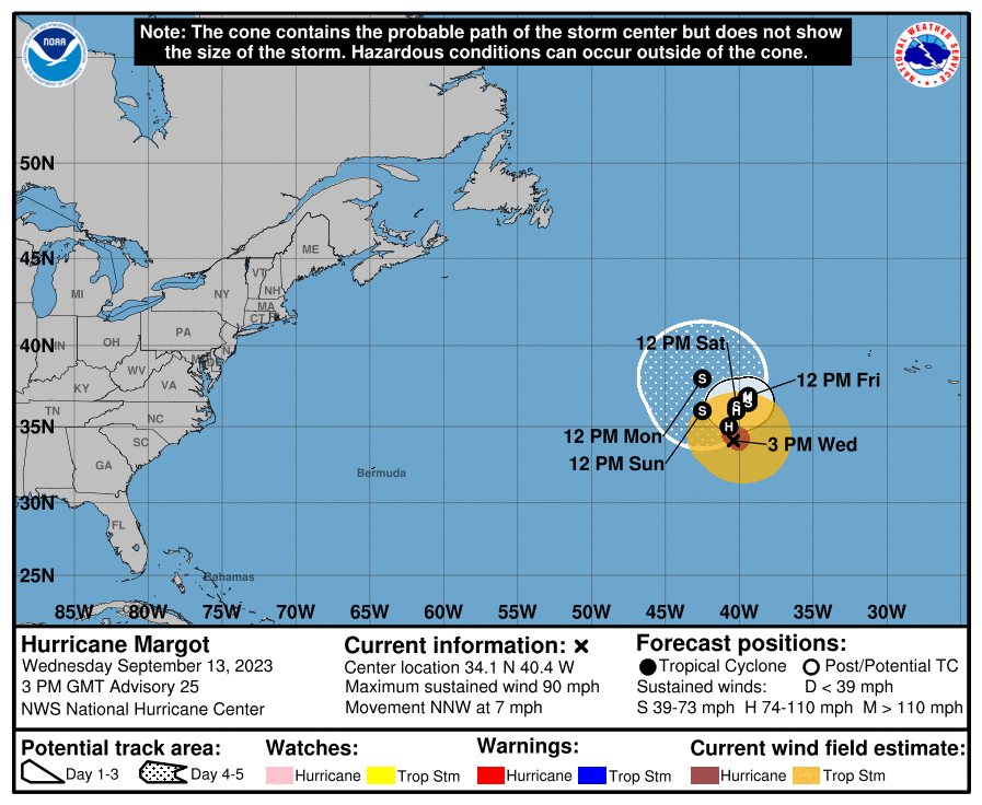
Margot is a hurricane in the central Atlantic with winds of 90 mph. It will move little and slowly weaken over the next five days… not close to any land mass.
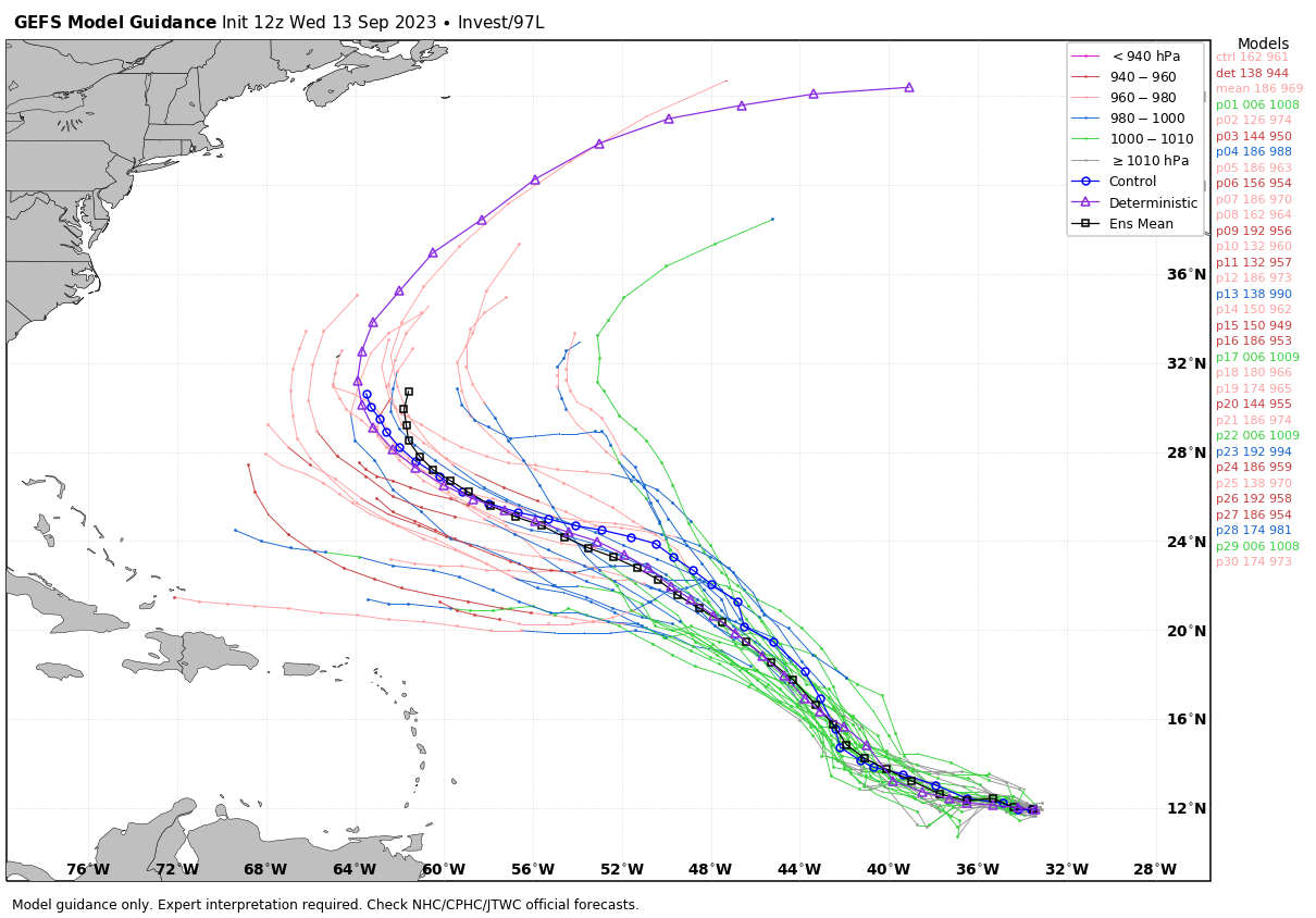
And, in the eastern Atlantic Invest 97L will likely become Tropical Storm Nigel, but global models suggest it will turn north and miss the U.S. No tropical systems will threaten the Gulf of Mexico for at least the next seven days.
ON THIS DATE IN 1978: Little Rock, Arkansas saw 8.10 inches of rain which caused major flash flooding. Ten people were killed.
ON THIS DATE IN 1988: Hurricane Gilbert smashed into the Cayman Islands, and as it headed for the Yucatan Peninsula of Mexico strengthened into a monster hurricane, packing winds of 175 mph. The barometric pressure at the center of Gilbert reached 888 mb, a record for any hurricane in the Caribbean, Gulf of Mexico, or the Atlantic Ocean until Hurricane Wilma in 2005. Gilbert covered much of the Gulf of Mexico, producing rain as far away as the Florida Keys.
ON THIS DATE IN 2008: Hurricane Ike made landfall as a Category 2 storm near Galveston, Texas. Due to its immense size, Ike caused devastation from the Louisiana coastline all the way to the Kenedy County region near Corpus Christi, Texas.
Look for the next video briefing here by 6:00 a.m. tomorrow…
Category: Alabama's Weather, ALL POSTS, Weather Xtreme Videos
About the Author (Author Profile)
James Spann is one of the most recognized and trusted television meteorologists in the industry. He holds the AMS CCM designation and television seals from the AMS and NWA. He is a past winner of the Broadcast Meteorologist of the Year from both professional organizations.Subscribe
If you enjoyed this article, subscribe to receive more just like it.


