Warm Afternoons, Cool Nights, Dry Through Saturday
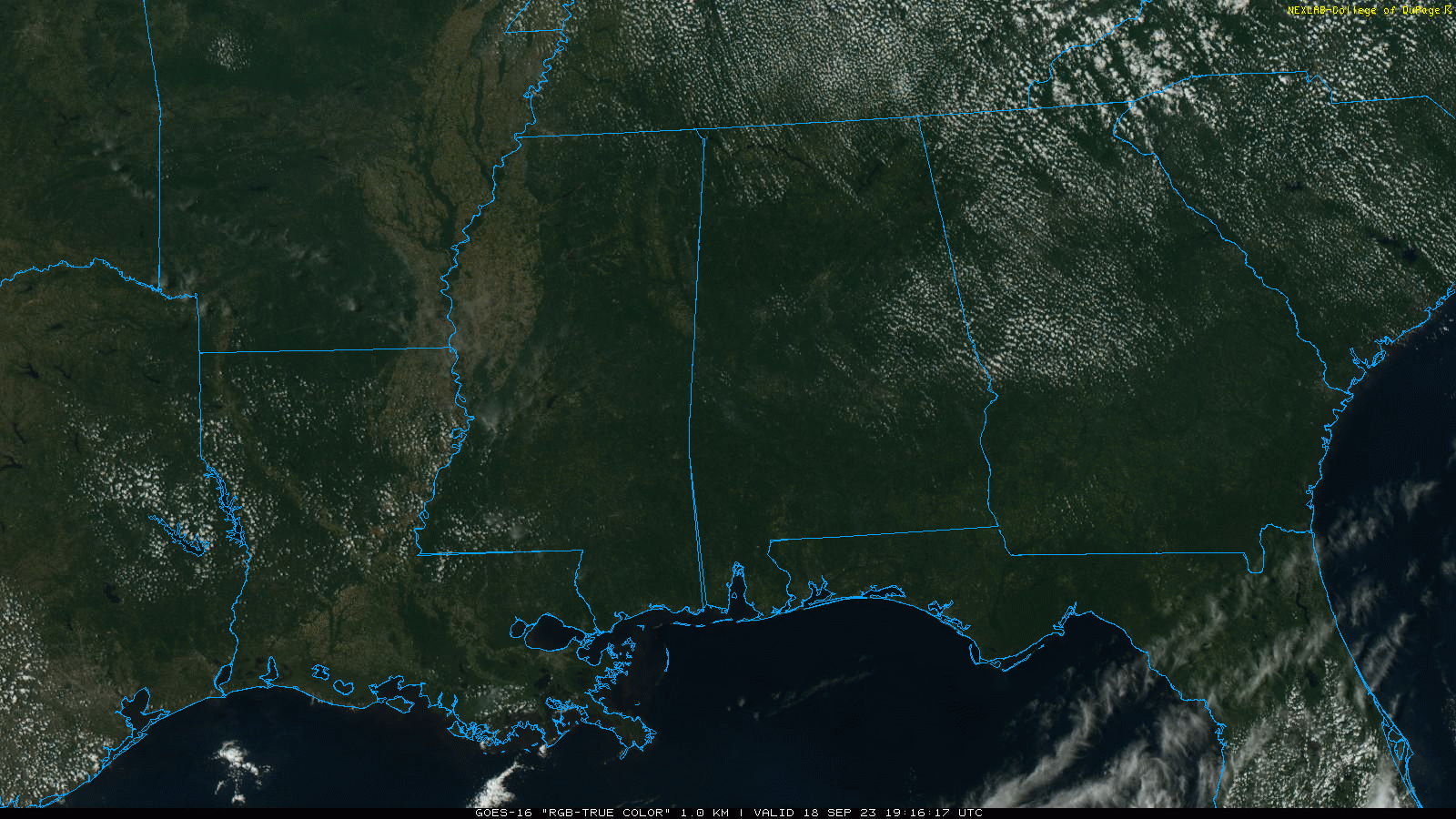
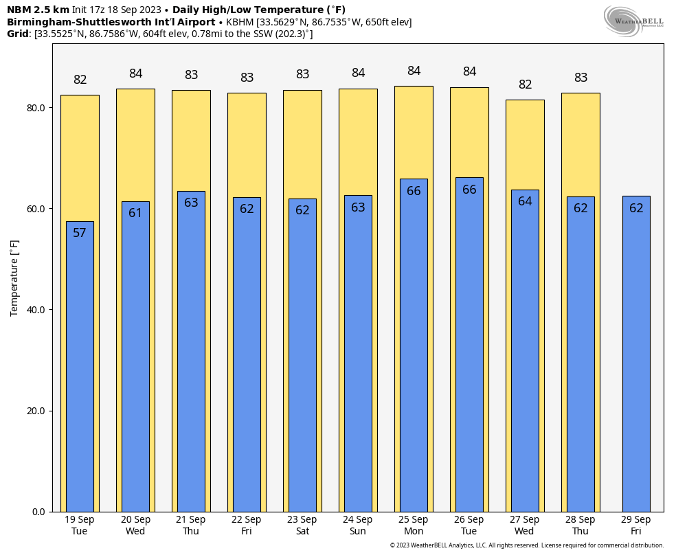
SUNNY SEPTEMBER DAY: With a sunny sky, temperatures across Alabama range from the upper 70s over the northern counties to the upper 80s over the southern third of the state. Tonight will be clear and cool with a low in the 50s and 60s.
REST OF THE WEEK: Dry air stays in place, meaning sunny warm days and clear pleasant nights. Highs in the 80s, lows in the upper 50s and 60s.
THE WEEKEND: Saturday will be another sunny day with a high in the 80s, but global models are hinting at some risk of showers now Sunday afternoon and Sunday night ahead of a cold front. If we do see rain, it probably won’t be too heavy or widespread.
NEXT WEEK: At the moment much of next week is looking dry with seasonal temperatures… See the video briefing for maps, graphics, and more details.
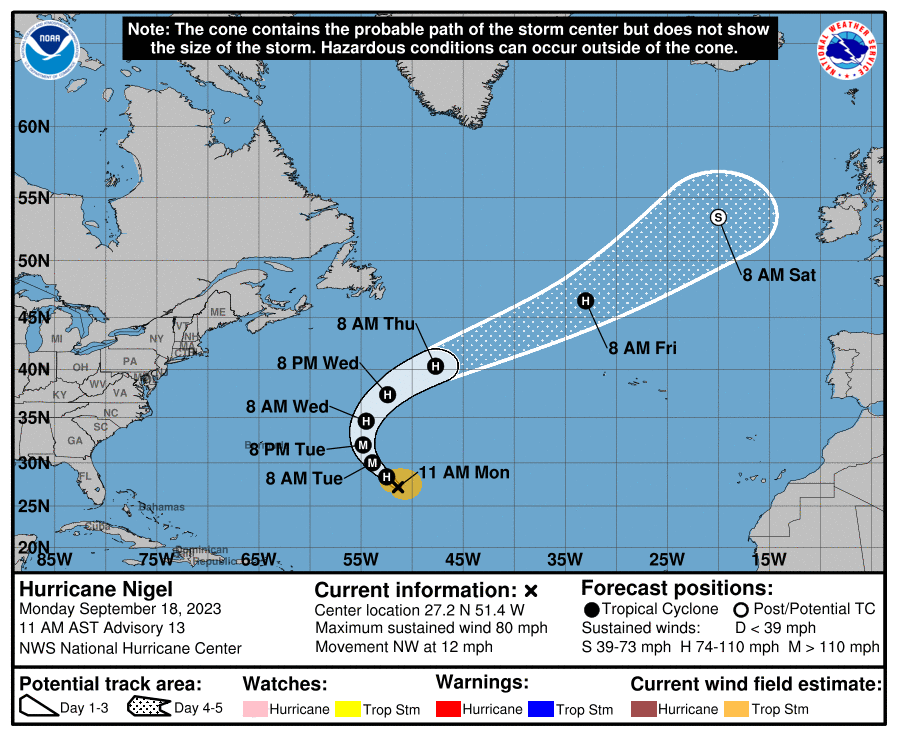
TROPICS: Hurricane Nigel is in the Atlantic with winds of 80 mph. It is expected to become a major hurricane tomorrow, but it will turn north, then northeast, remaining far from land.
A tropical wave will emerge off the coast of Africa by Wednesday, and NHC gives it a 70 percent chance of development over the next seven days. Too early to know if this will impact any land areas.
And, closer to home, a non-tropical area of low pressure is forecast to form near the southeastern coast of the United States late this week. This system could acquire some subtropical characteristics this weekend if it remains offshore while it moves slowly northward or northwestward.
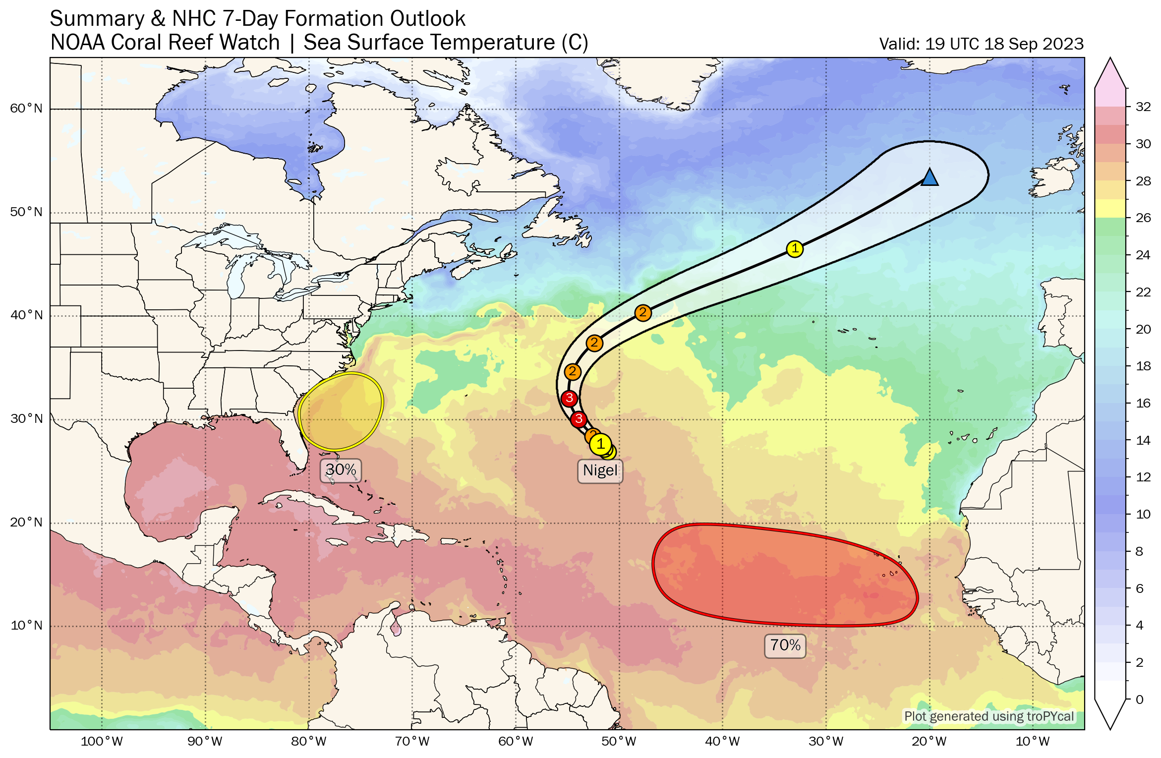
No tropical systems are expected near the Gulf of Mexico for at least the next seven days.
ON THIS DATE IN 1926: The great “Miami Hurricane” produced winds of 138 mph that drove ocean waters into the Biscayne Bay drowning 135 persons. The eye of the hurricane passed over Miami, at which time the barometric pressure reached 27.61 inches. Tides up to twelve feet high accompanied the storm, which claimed a total of 372 lives.
ON THIS DATE IN 2003: Hurricane Isabel made landfall on the Outer Banks of North Carolina, with winds of 105 mph. The storm surge from Isabel washed out a portion of Hatteras Island to form what was unofficially known as Isabel Inlet. Damage was greatest along the Outer Banks, where thousands of homes were damaged or even destroyed. The worst of the effects of Isabel occurred in Virginia, especially in the Hampton Roads area and along the shores of rivers as far west and north as Richmond and Baltimore. Virginia reported the most deaths and damage from the hurricane.
Look for the next video briefing here by 6:00 a.m. tomorrow…
Category: Alabama's Weather, ALL POSTS, Weather Xtreme Videos
About the Author (Author Profile)
James Spann is one of the most recognized and trusted television meteorologists in the industry. He holds the AMS CCM designation and television seals from the AMS and NWA. He is a past winner of the Broadcast Meteorologist of the Year from both professional organizations.Subscribe
If you enjoyed this article, subscribe to receive more just like it.


