Scattered Showers/Storms Around Through Wednesday
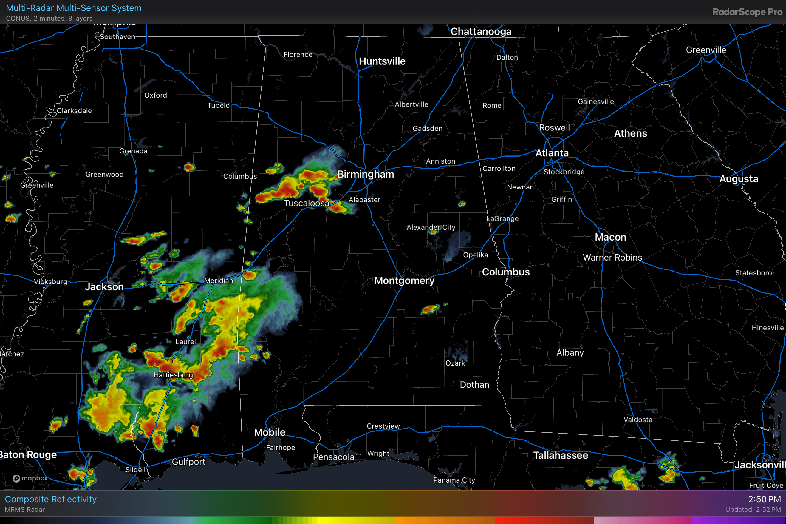
RADAR CHECK: Scattered showers and storms are slowly increasing across Alabama this afternoon… some of the heaviest rain is falling across parts of Pickens, Tuscaloosa, and Bibb counties in West Alabama as I write this. The storms are not severe, but they are producing heavy rain and some lightning. Away from the storms, the sky is partly sunny with temperatures mostly in the 80s. A few scattered showers will remain possible tonight.
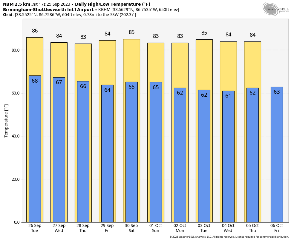
REST OF THE WEEK: Scattered showers and thunderstorms will remain possible statewide tomorrow and Wednesday. We can’t promise rain for everyone; odds of any one spot seeing rain both days are 30/40 percent. Highest coverage of rain will likely come on Wednesday across the southern counties. Then, we trend drier Thursday with only a small risk of a shower. Friday looks rain-free with a good supply of sunshine. Highs will hold in the 80s through the week, with lows mostly in the 60s.
THE ALABAMA WEEKEND AND NEXT WEEK: For now the weather looks dry over the weekend, and through much of next week with mostly sunny warm days and fair pleasant nights. Highs in the 80s, lows in the 60s. See the video briefing for maps, graphics, and more details.
TROPICS: Tropical Storm Philippe is in the Atlantic far from land with winds of 50 mph. It is about 1150 miles east of the northern Leeward Islands. The official forecast from NHC keeps the system under hurricane strength through the week, and shows a gradual gain in latitude.
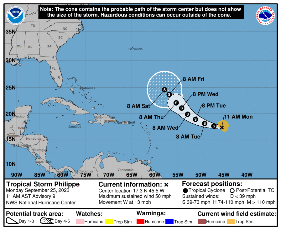
A good bit of uncertainty remains in the forecast track; the American GFS model shows a stronger system that turns north, then heading out to sea far from any land area. But, the European global model shows a weaker system that keeps moving toward the west/northwest. We will keep an eye on it.
Closer to home, a trough of low pressure is producing limited shower activity over portions of the eastern Gulf of Mexico. This disturbance is moving westward into unfavorable environmental conditions, and development is not expected. NHC gives it a zero percent chance of development.
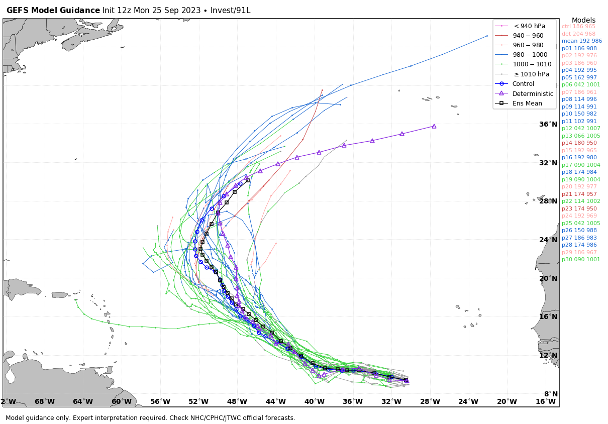
A tropical wave located several hundred miles west-southwest of the Cabo Verde Islands continues to produce disorganized showers and thunderstorms. Environmental conditions are forecast to be conducive for gradual development, and a tropical depression is likely to form within the next few days as the system moves west-northwestward across the central tropical Atlantic. NHC gives it an 80 percent chance of development, but it will likely turn north and won’t be a threat to land.
No tropical systems are expected near the Gulf of Mexico for at least the next seven days.
ON THIS DATE IN 1848: The Great Gale of 1848 was the most severe hurricane to affect Tampa Bay, Florida and is one of two major hurricanes to make landfall in the area. This storm produced the highest storm tide ever experienced in Tampa Bay when the water rose 15 feet in six to eight hours.
ON THIS DATE IN 1998: Four hurricanes were spinning simultaneously in the Atlantic basin: Georges, Ivan, Jeanne, and Karl. That was the first time this had happened since 1893.
Look for the next video briefing here by 6:00 a.m. tomorrow…
Category: Alabama's Weather, ALL POSTS, Weather Xtreme Videos
About the Author (Author Profile)
James Spann is one of the most recognized and trusted television meteorologists in the industry. He holds the AMS CCM designation and television seals from the AMS and NWA. He is a past winner of the Broadcast Meteorologist of the Year from both professional organizations.Subscribe
If you enjoyed this article, subscribe to receive more just like it.


