Freezing Temperatures Tonight For North/Central Alabama
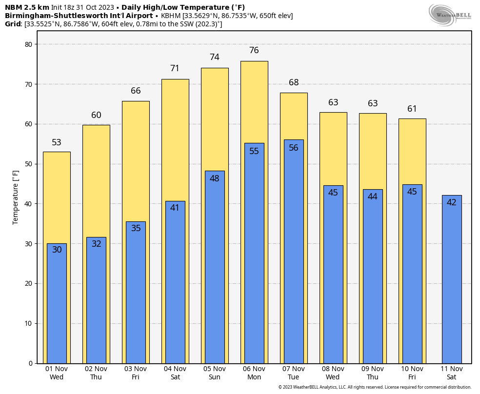
FREEZE WARNING: A freeze warning is in effect tonight for roughly the northern half of the state. With a clear sky and diminishing wind, we project a low in the 26-32 degree range for most communities in the warning area. Upper 30s are likely as far south as I-10.
Tomorrow will be a sunny, cool day with a high in the 50s, and another freeze is likely early Thursday… this one extending down into South Alabama, where a freeze watch is in effect. Then, during the day Thursday the sky will be sunny with a high in the upper 50s and low 60s. The danger of wildfires will remain high; no outdoor burning.
FRIDAY AND THE WEEKEND: Dry weather continues with a warming trend. Highs in the 60s Friday, followed by low to mid 70s over the weekend with mostly sunny days and fair nights. Clouds will increase late Sunday and Sunday night.
NEXT WEEK: Models suggest a disturbance will bring a chance of rain to Alabama and the Deep South Monday, but amounts will likely be under 1/4″ for most places. New global model guidance suggests the rest of the week will be dry with a new surge of cooler air moving in… See the video briefing for maps, graphics, and more details.
FOOTBALL WEATHER: Expect a clear sky for the high school games across Alabama Friday night with temperatures falling through the 50s.
Saturday, UAB hosts Florida Atlantic at Protective Stadium in downtown Birmingham (2:00p CT kickoff). The sky will be sunny with temperatures in the low 70s.
Auburn travels to Nashville to take on Vanderbilt (3:00p CT kickoff)… the sky will be clear with upper 60s at kickoff, dropping into the low 60s by the final whistle.
And, Alabama will host LSU Saturday evening at Bryant-Denny Stadium (6:45p CT kickoff)… the sky will be clear with temperatures falling through the 60s. A perfect night for football in Tuscaloosa.
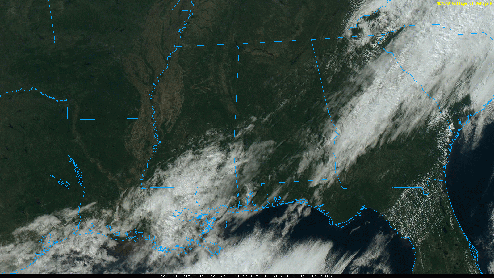
TROPICS: Shower and thunderstorm activity in association with a trough of low pressure (Invest 97L) over the eastern Caribbean Sea has diminished and not become any better organized this afternoon. Although environmental conditions appear marginally conducive for further development during the next several days while the system moves westward over the central and southwestern Caribbean Sea, a tropical depression could form by the latter part of this week. Regardless of development, this system has the potential to produce heavy rains over portions of Central America towards the end of the week. NHC gives it a 60 percent chance of development.
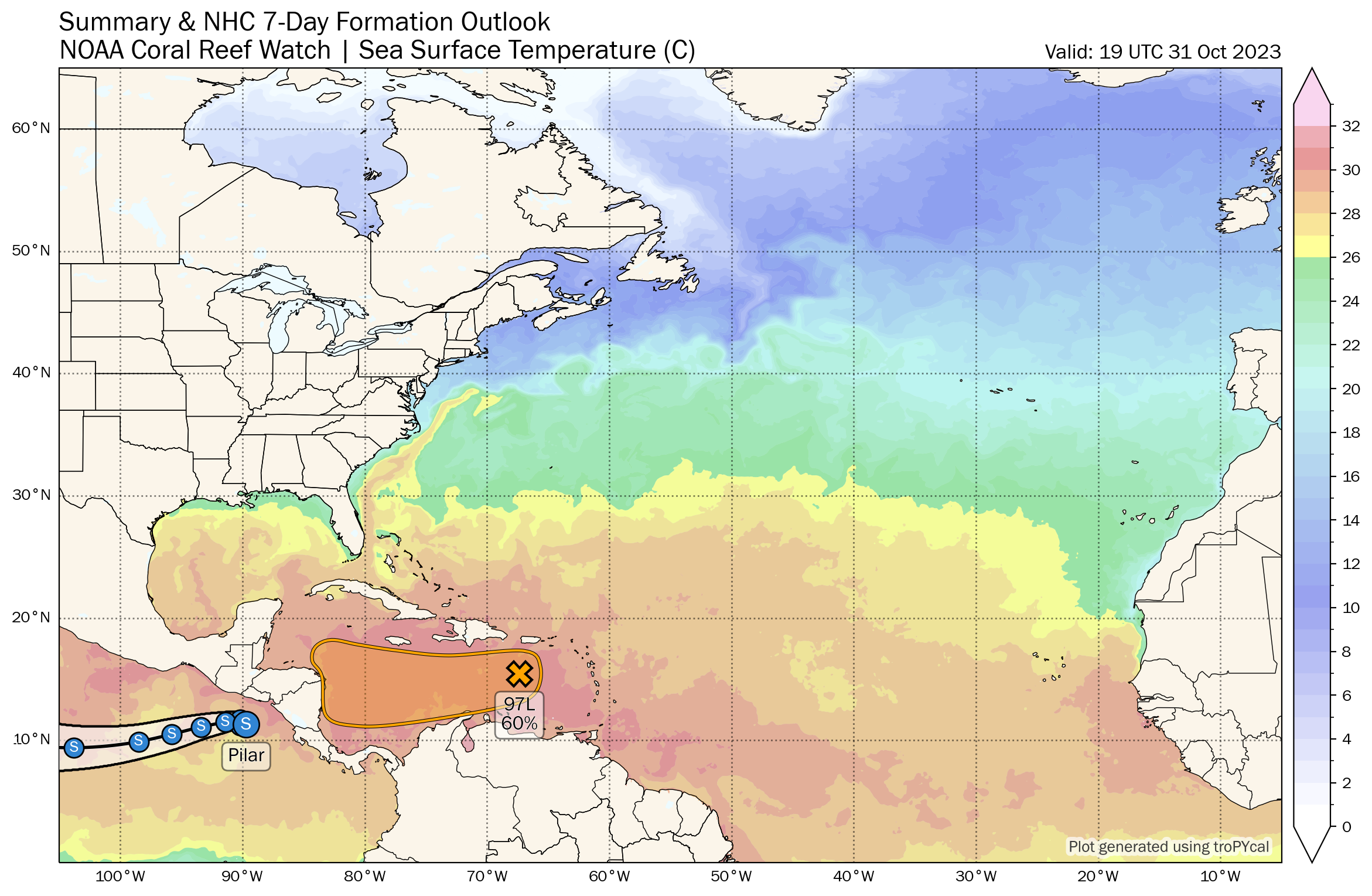
The rest of the Atlantic basin is quiet; no tropical systems will threaten the U.S. for at least the next seven days. Hurricane season ends in one month.
ON THIS DATE IN 1991: A severe winter storm, dubbed the Great Halloween Mega Storm, struck the upper Midwest. Minnesota bore the brunt of this storm. Blizzard conditions occurred with winds gusting frequently to 40 and 50 mph. By the time it was all over on November 2nd, Duluth recorded 37 inches, Minneapolis 28 inches, International Falls 18 inches and 11.2 inches in 24-hours at Sioux Falls, SD, their earliest heavy snowfall of 6 inches or more and snowiest October on record. For Duluth and Minneapolis, the snow amounts set new all-time records for the greatest amount of snow in a single storm.
Look for the next video briefing here by 6:00 a.m. tomorrow…
Category: Alabama's Weather, ALL POSTS, Weather Xtreme Videos
About the Author (Author Profile)
James Spann is one of the most recognized and trusted television meteorologists in the industry. He holds the AMS CCM designation and television seals from the AMS and NWA. He is a past winner of the Broadcast Meteorologist of the Year from both professional organizations.Subscribe
If you enjoyed this article, subscribe to receive more just like it.


