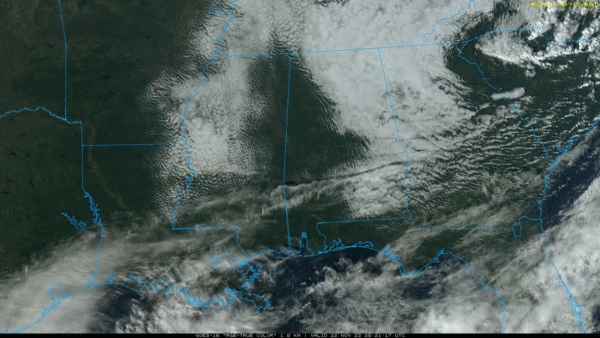
Cool, Quiet Weather Pattern Continues Through The Weekend
**No afternoon video today; we are on a holiday schedule**
CLEARING: The sky has cleared over much of West and South Alabama this afternoon, and the stubborn clouds over the northern and eastern counties should move out this evening. Tonight will be mostly fair and cold with a low in the 30s.
Thanksgiving Day tomorrow will be cool and dry with a partly to mostly sunny sky… after a low in the 30s the high will be in the 56-64 degree range across the state. Clouds will increase late in the day, and a feature in the northern Gulf of Mexico could bring some scattered light rain to the southern 2/3 of Alabama tomorrow night into Friday morning. Rain amounts will be light and spotty with limited moisture. Otherwise, Friday will feature a mix of sun and clouds with highs in the 50s over North Alabama, with 60s to the south.
THE WEEKEND AND NEXT WEEK: Cool, dry weather continues Saturday with a good supply of sunshine. A disturbance will bring clouds to the state Sunday, and some scattered light rain could break out Sunday afternoon/Sunday night, but amounts will be very light and limited moisture. Afternoon highs will hold be in the 58-65 degree range, not far from average values for late November in Alabama.
A new surge of cooler air will arrive Monday, and at this point most of next week looks dry with highs mostly in the 50s and lows in the 30s. A freeze is likely over the northern half of the state during the early morning hours Tuesday through Thursday. Global models suggest some chance of rain could return by Friday (December 1). See the video briefing for maps, graphics, and more details.
IRON BOWL: The weather will be just about perfect for Saturday’s Iron Bowl in Auburn (Alabama at Auburn; 2:30p CT kickoff). The sky will be mostly sunny with a kickoff near 63 degrees, falling into the 50s by the fourth quarter.
TROPICS: An area of low pressure is expected to develop along a frontal boundary over the central subtropical Atlantic in a day or so. This non-tropical low is forecast to move southeastward across the central subtropical Atlantic over warmer sea surface temperatures during the next couple of days, and environmental conditions are marginally conducive for this system to acquire tropical or subtropical characteristics. A subtropical or tropical storm could form by the latter part of this week or this weekend, as the system turns northeastward by the weekend.
NHC gives it a 50 percent chance of development; it will remain far from land. Hurricane season ends in 8 days.
ON THIS DATE IN 1874: At least 4 tornadoes touched down in Alabama, killing 16 people. The fatalities happened in Montevallo and Tuscumbia/Rogersville.
ON THIS DATE IN 1992: A total of 45 tornadoes touched down in the Tennessee and Ohio Valleys. Alabama had a total of 13 tornadoes touch down ranging in strength from F0 to F2, with no deaths and 53 injuries. The tornado with the most injuries occurred just outside of Sardis City where multiple structures were damaged and twelve people were injured. Tennessee only had one tornado for the day, but it was a deadly one. An F1 touched down just northwest of Bolivar and stayed on the ground for 16 miles before lifting west of Toone. One person was killed and three others were injured
ON THIS DATE IN 2010: A rare November ice storm prompts Fairbanks officials to advised residents to stay off the roads. Ice storm advisories are hoisted across a 950 mile stretch of the state that extends from Anchorage to Nome.
Look for the next video briefing here by 6:00 a.m. tomorrow…
Category: Alabama's Weather, ALL POSTS


