Cold Night Ahead; Rain Returns Thursday Night Into Friday
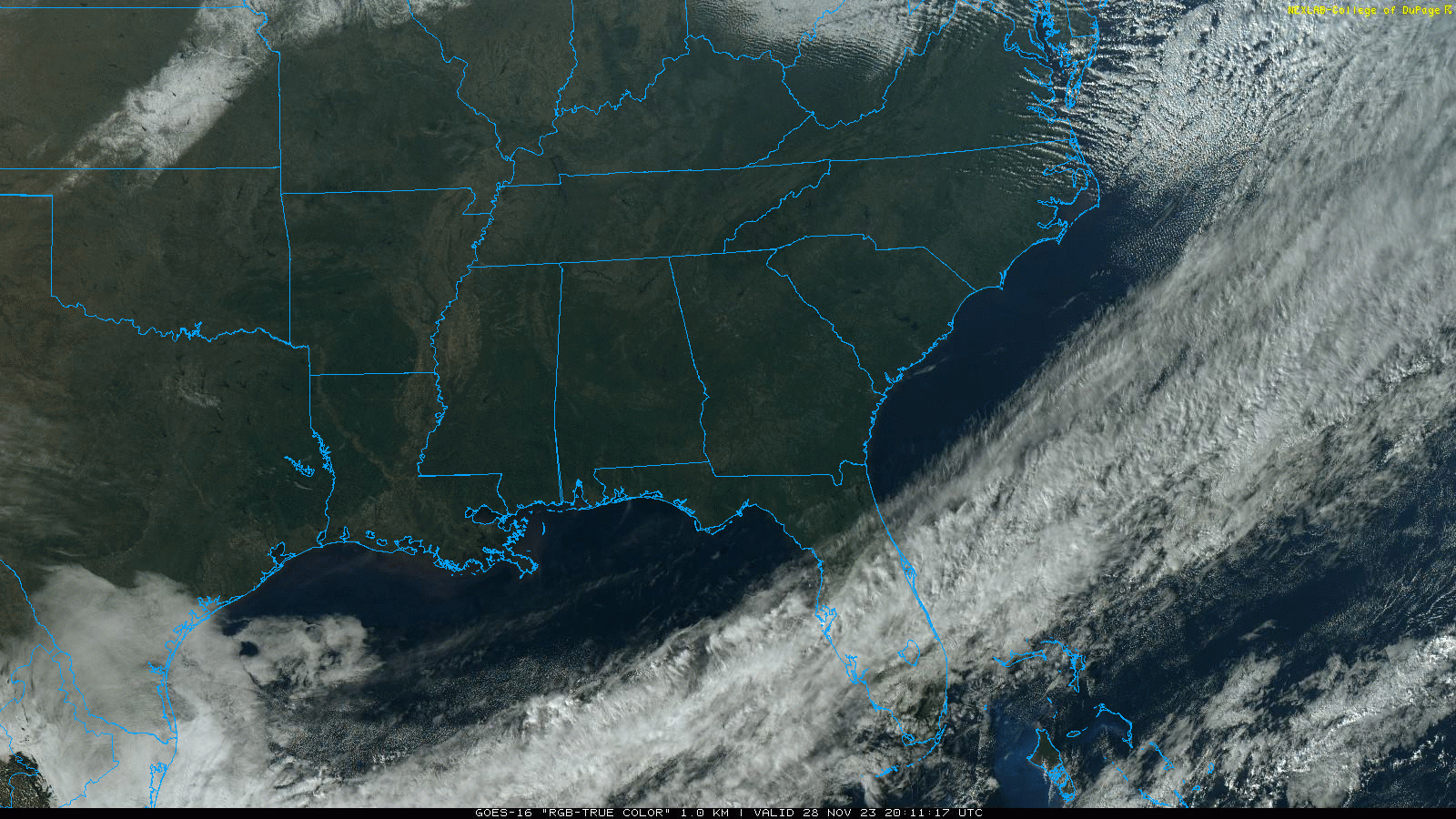
SEVERE CLEAR: Not a cloud in the sky across Alabama this afternoon; temperatures range from the upper 40s across the Tennessee Valley to the low 60s near the Gulf Coast. Tonight will be clear and cold; a freeze is likely all the way down to I-10. Most places will see lows in the mid to upper 20s. For some tonight will be the coldest night so far this season.
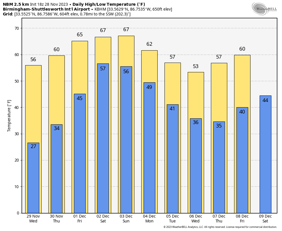
Tomorrow will be a sunny day with highs in the 50s and 60s, and the day Thursday will be dry with most of the state reaching the 60s by afternoon. Clouds will increase late in the day, and rain is likely across Alabama Thursday night into Friday. We still have potential for a break in the rain late Friday and Friday night over the northern half of Alabama, but models are trending wetter.
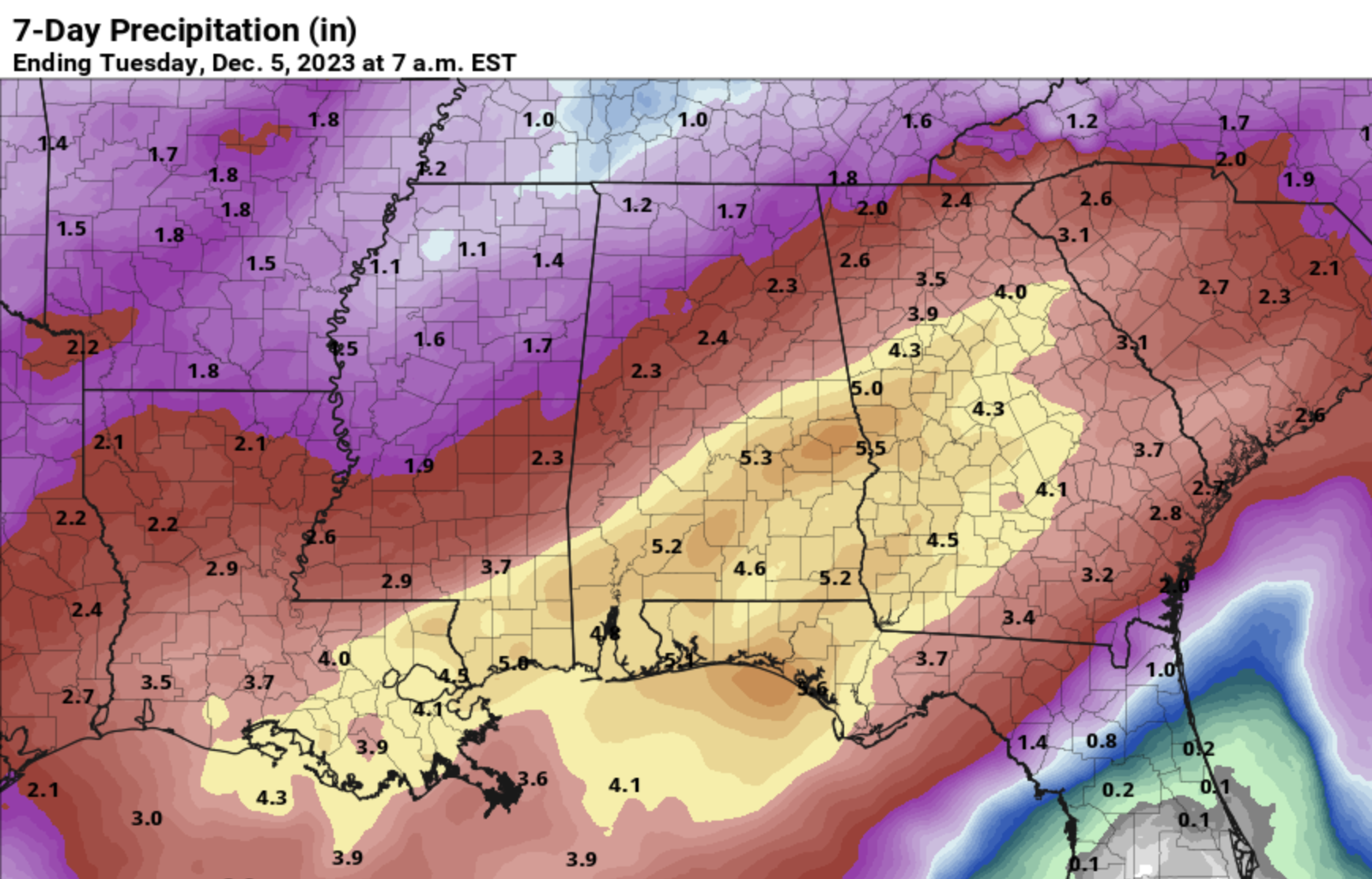
THE WEEKEND: We will deal with more rounds of rain over the weekend. The weekend won’t be a total washout, but occasional rain is likely, and the rain cold be heavy at times, especially over South Alabama. A few thunderstorms are possible, but for now severe storms look unlikely. The latest global model suggests the rain will end Sunday morning, with drier air slowly moving into the state Sunday afternoon and Sunday night. Highs will be in the mid to upper 60s both days.
South Alabama has potential for 3-5 inches of rain through Sunday night, with 1-3 inches over the northern half of the state. Very beneficial considering the ongoing drought.
NEXT WEEK: For now most of the week looks dry with seasonal temperatures. See the video briefing for maps, graphics, and more details.
FOOTBALL WEATHER: For the high school playoff games Friday night, rain is possible statewide, but most likely over the southern counties of the state. Temperatures will be in the 50s.
For fans headed to Saturday’s SEC Championship game in Atlanta (Alabama vs Georgia, 3p CT kickoff)… the game is being played at Mercedes-Benz Stadium under the dome, but outside the stadium rain is likely with temperatures in the low to mid 60s.
TROPICS: The Atlantic basin is quiet, and hurricane season ends Thursday.
ON THIS DATE IN 1921: New England was in the midst of a four-day ice storm, their worst of record. Ice was more than three inches thick in many places following the storm, and property damage was in the millions of dollars. Northern New England received heavy snow with more than two feet reported in some areas. Overnight freezing rains continued through the day at Worcester, MA while the wind increased to a gale. Streets become impassable even on foot, and whole towns were plunged into darkness without communication.
ON THIS DATE IN 1988: An F4 tornado moved across five North Carolina counties with an 83 mile track. Four people were killed, and 154 were injured.
ON THIS DATE IN 2005: Six tornadoes touched down across Alabama; all were rated either EF0 or EF1. In Jefferson County, short lived tornadoes touched down near Corner/Bagley, and Concord.
Look for the next video briefing here by 6:00 a.m. tomorrow…
Category: Alabama's Weather, ALL POSTS, Weather Xtreme Videos
About the Author (Author Profile)
James Spann is one of the most recognized and trusted television meteorologists in the industry. He holds the AMS CCM designation and television seals from the AMS and NWA. He is a past winner of the Broadcast Meteorologist of the Year from both professional organizations.Subscribe
If you enjoyed this article, subscribe to receive more just like it.


