Dry, Colder Weekend Ahead; Arctic Blast Next Week
RADAR CHECK: Heavier showers and a few thunderstorms are pushing through Southeast Alabama this afternoon; a few stray showers are over the central counties of the state. But, the sky has started to clear over West Alabama, and that clearing will continue this evening as dry air pushes into the state.
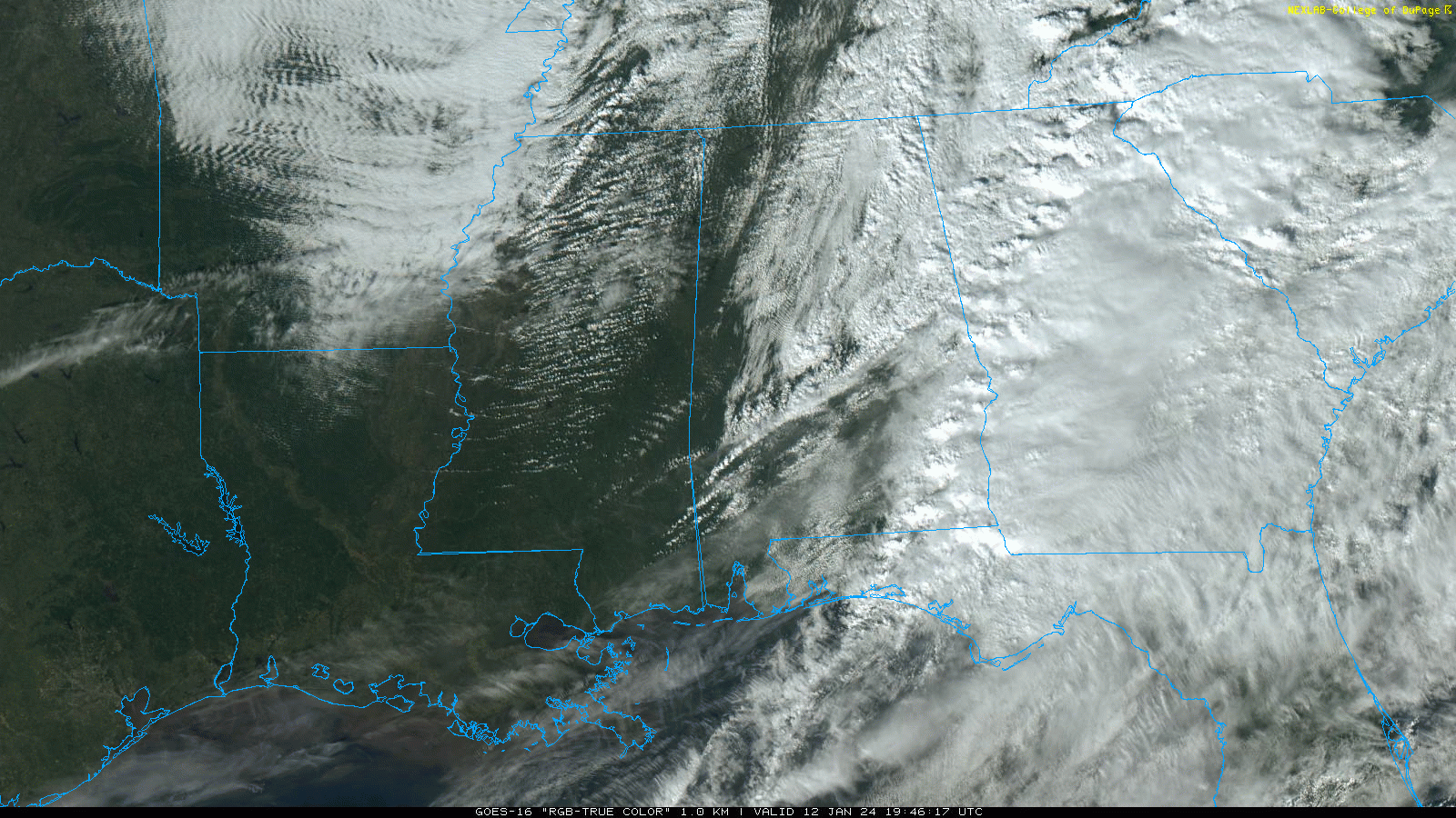
Thankfully severe thunderstorms were a no-show across Alabama today; the air was simply too stable over the northern counties, and the dynamic support lifted northward away from the unstable air over the southern counties of the state. However, gradient winds gusted to 45 mph in spots and a number of trees were blown down.
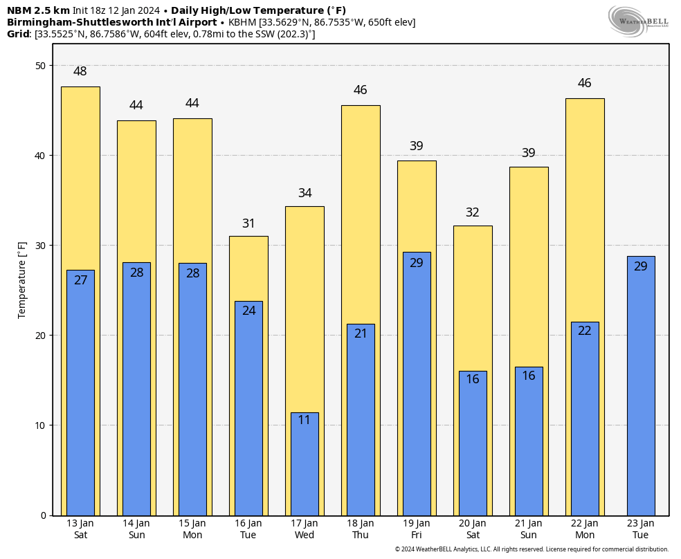
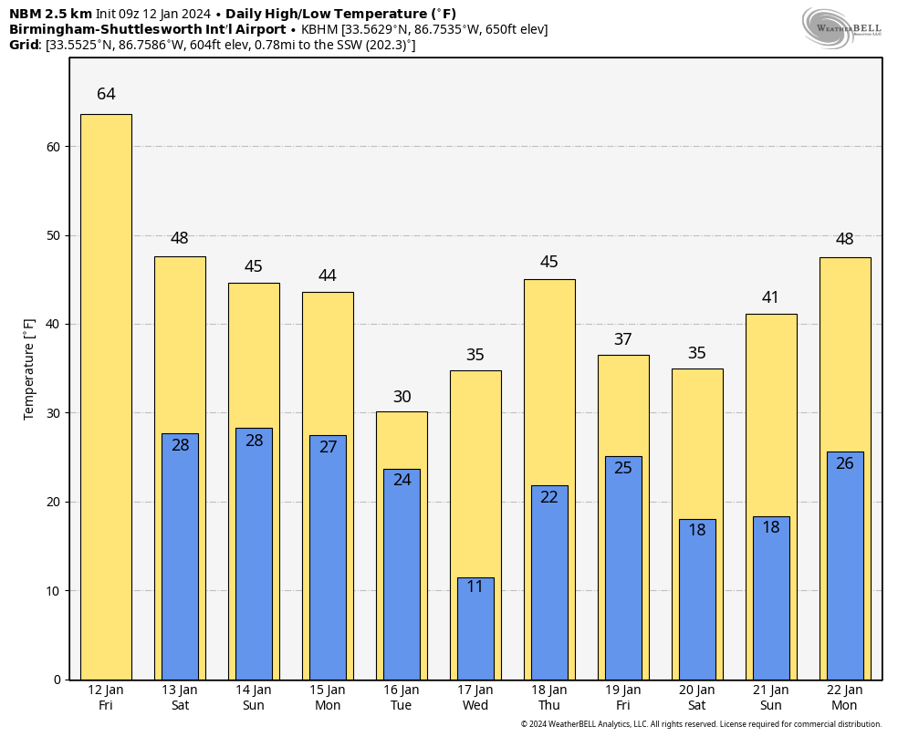
THE WEEKEND: Expect dry and colder weather tomorrow and Sunday. Lows will range from the upper 20s over North Alabama to the upper 30s near the coast. Highs will be in the 40s and 50s.
ARCTIC BLAST: The coldest air so far this season will invade the Deep South next week, and some snow is possible as the Arctic air arrives early in the week.
Here are the key messages….
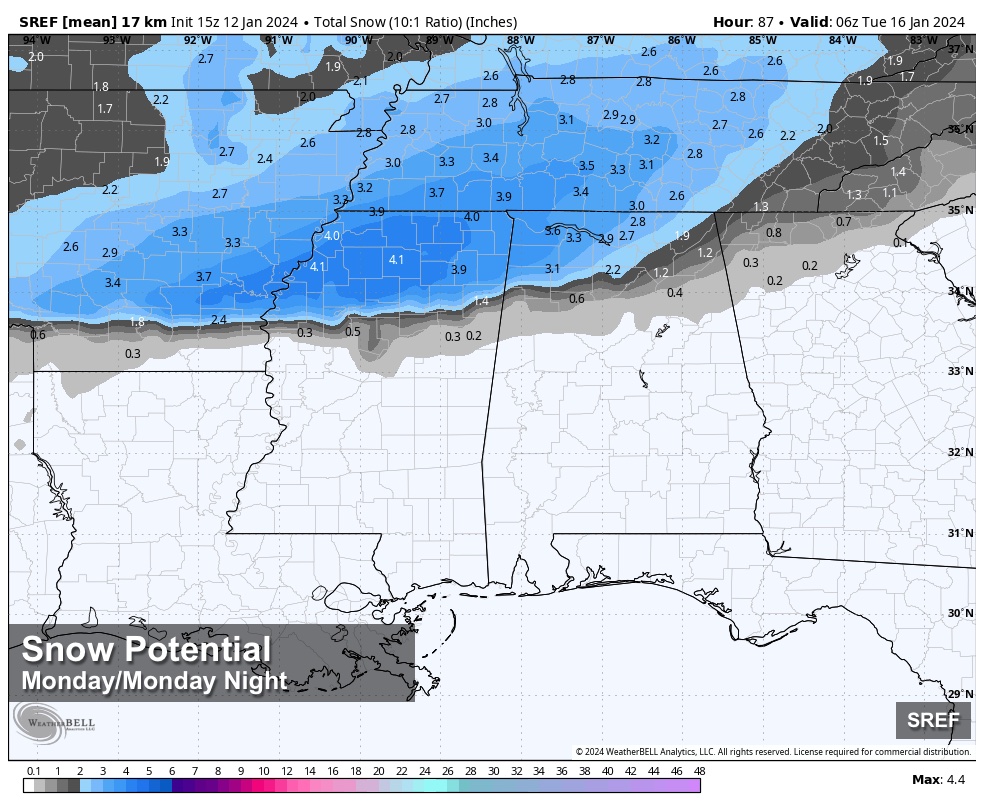
*Some snow is likely over the northern third of the state Monday, Monday night, and early Tuesday. Some sleet could in the mix as well.
*The best chance of accumulating snow is along and north of U.S. 278 (Hamilton to Cullman to Gadsden). However, some snow or sleet is possible as far south as I-20 (Tuscaloosa to Birmingham to Anniston).
*Some light freezing rain is possible south of I-20 across Central Alabama Monday night and early Tuesday. Freezing rain is precipitation falling in liquid form, but with surface temperatures at or below freezing. This can lead to ice accumulating on exposed objects.
*For now, it looks like moisture will be limited. Global models and the ensembles are in good agreement, suggesting snow totals of 1-2 inches are possible north of U.S. 278, especially over the Tennessee Valley of North Alabama. Isolated amounts to 3 inches are possible.
*With rapidly falling temperatures, some travel impact is likely where snow or ice accumulates. The highest potential for icy travel is north of U.S. 278, but icy patches are possible down into Central Alabama where freezing rain falls.
*Temperatures will stay below freezing all day Tuesday, so icy travel issues will likely linger Tuesday into part of the day Wednesday (where snow accumulates, or freezing rain falls).
*A winter storm watch has been issued for much of North Mississippi, and adjacent parts of Arkansas and Louisiana.
Temperatures will drop into the 7-14 degree range by daybreak Wednesday over the northern half of Alabama; teens are likely all the way down to the Gulf Coast.
Models suggest another shot of Arctic air arrives by the following weekend (January 20-21).
Understand this forecast can, and probably will change! Keep an eye on updates over the weekend… See the video briefing for maps, graphics, and more details.
ON THIS DATE IN 1888: The Children’s or Schoolhouse Blizzard occurred on this day. The blizzard killed 235 people, many of whom were children on their way home from school, across the Northern Plains.
ON THIS DATE IN 2023: A total of 14 tornadoes touched down in Alabama. An EF-3 that moved through Autauga County was responsible for seven deaths in the Old Kingston community north of Prattville. An EF-2 tornado moved through the heart of Selma.
Look for my next video briefing here by 6:00 a.m. Monday… enjoy the weekend!
Category: Alabama's Weather, ALL POSTS, Weather Xtreme Videos
About the Author (Author Profile)
James Spann is one of the most recognized and trusted television meteorologists in the industry. He holds the AMS CCM designation and television seals from the AMS and NWA. He is a past winner of the Broadcast Meteorologist of the Year from both professional organizations.Subscribe
If you enjoyed this article, subscribe to receive more just like it.


