Showers Tonight; A Few Thunderstorms Possible
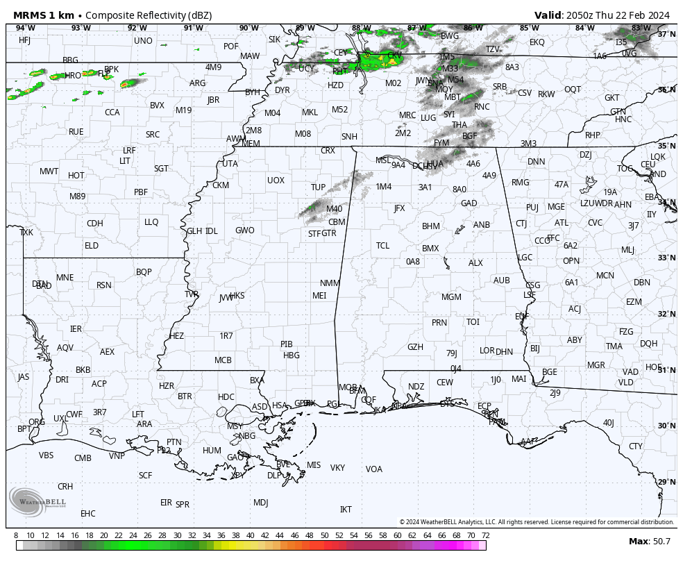
MILD AFTERNOON: Temperatures are in the 68-72 degree range across much of Alabama this afternoon; clouds continue to increase ahead of a cold front. Showers are likely tonight along with the potential for a thunderstorm or two. Most of the rain will come from 9:00 p.m. until 3:00 a.m…. and amounts should be 1/2 inch or less for most places.
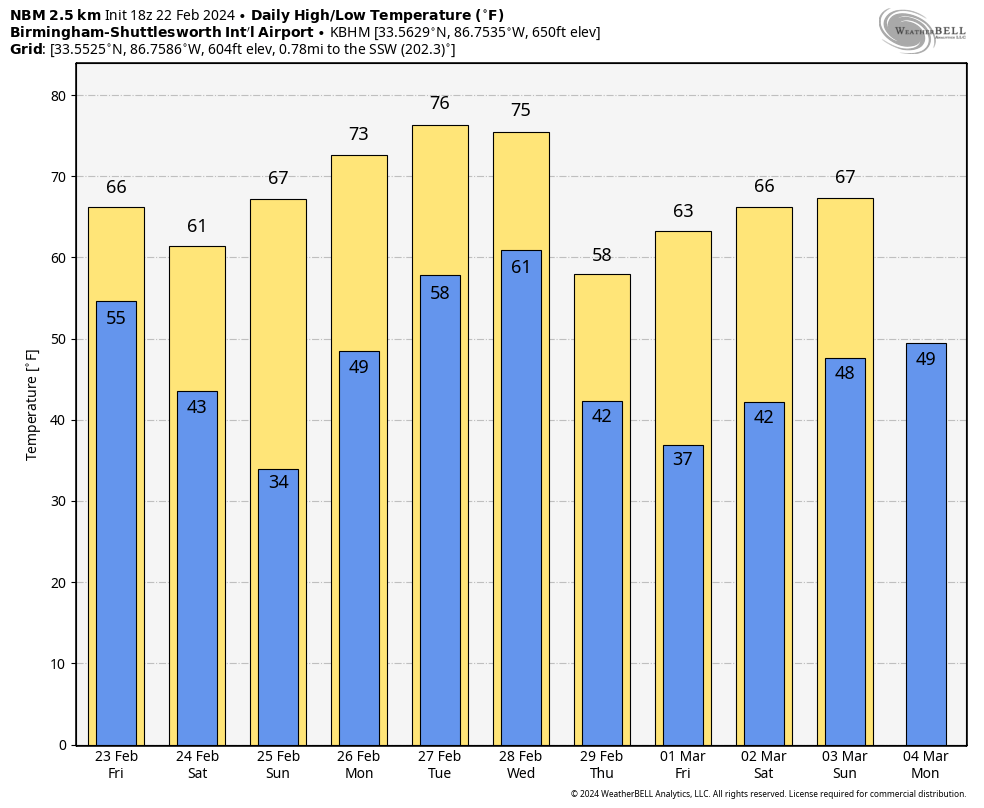
TOMORROW AND THE WEEKEND: Some rain could linger across Southeast Alabama tomorrow morning… otherwise look for a clearing sky tomorrow with a high in the 60s. Dry weather continues over the weekend with sunny days and fair nights.. Saturday will be a bit cooler with a high in the 57-64 degree range. Then, temperatures rise into the upper 60s and low 70s Sunday as another warming trend begins.
NEXT WEEK: Expect the warmest weather so far this year during the first half of the week with highs in the mid to upper 70s. Some South Alabama communities could reach the 80 degree mark by Tuesday. A cold front will bring showers and thunderstorms into Alabama Wednesday afternoon into early Thursday morning; SPC has defined a risk of severe thunderstorms for about the northern 2/3 of the state.
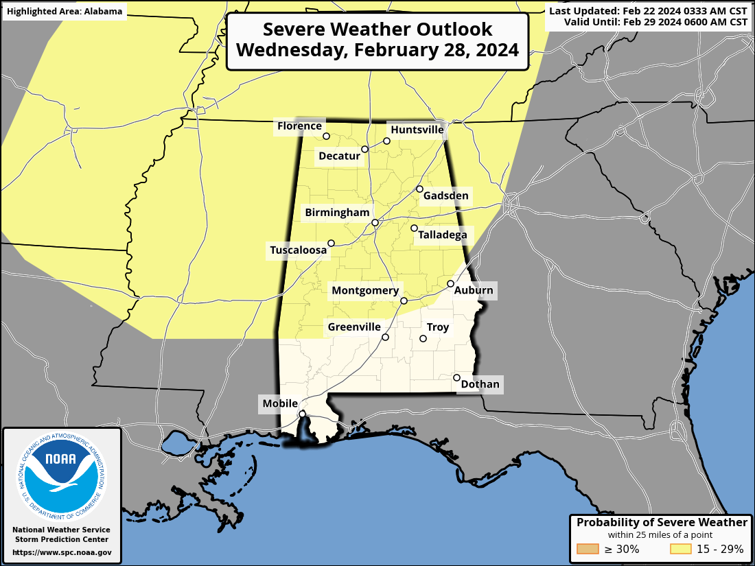
At this point it looks like a line of storms will pass through Wednesday afternoon/night. The main upper support and strong wind fields will be well north of Alabama, and instability values look low. Accordingly, the best chance of severe storms will likely be north and west of Alabama with this event, but know we are 6-7 days out and this could easily change. For those with weather anxiety/storm phobia, understand this is simply something to watch for now.
Cooler air follows on Thursday and Friday with highs close to 60 degrees. See the video briefing for maps, graphics, and more details.
ON THIS DATE IN 1971: One of the worst snowstorms in Oklahoma history dumped up to 3 feet of snow on northwest Oklahoma from February 20nd to February 22. By the time the snow ended on the 22nd, the city of Buffalo had 36 inches of snow on the ground, setting the state record for storm-total snowfall. Winds of 30 to 50 mph caused snowdrifts up to 20 feet high. Follett, Texas, picked up 26 inches while Amarillo recorded 14 inches.
ON THIS DATE IN 1998: Seven tornadoes struck east-central Florida late on this day and early on the 23rd. Three of the tornadoes were rated F3 on the Fujita scale. Twenty-four people were killed in Kissimmee alone. A total of 42 people were killed, 265 injured, and the total damage was $106 million.
Look for the next video briefing here by 6:00 a.m. tomorrow…
Category: Alabama's Weather, ALL POSTS, Weather Xtreme Videos
About the Author (Author Profile)
James Spann is one of the most recognized and trusted television meteorologists in the industry. He holds the AMS CCM designation and television seals from the AMS and NWA. He is a past winner of the Broadcast Meteorologist of the Year from both professional organizations.Subscribe
If you enjoyed this article, subscribe to receive more just like it.


