Midday Nowcast: Marvelous Monday
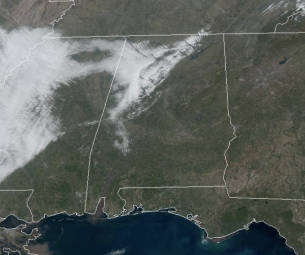
OH SO NICE: After the great weekend of weather across Alabama, the new work week is starting out with even better weather. It is a marvelous Monday with more sunshine than clouds and temperatures are surging into the mid and upper 70s this afternoon. Average high for Birmingham this time of year is 62°, so temperatures are well-above average. Tonight, clouds will increase, and a few scattered showers are possible across the Tennessee Valley. Lows tonight will be in the upper 50s and lower 60s. Some showers will remain possible tomorrow morning over the northern third of the state, but any rain will be light. Tomorrow will also feature more clouds than sun, but it will be a very warm day, and likely the warmest day so far this year as highs are going to be in the upper 70s and lower 80s.
USA BRIEF: A strong winter storm will continue to progress into the Northern Rockies and Great Basin, bringing heavy mountain snow and strong winds through Tuesday. Heavy snow combined with strong winds will produce near-blizzard conditions, with snow rates of 1 to 2 inches per hour. Dry, gusty winds will create widespread critical fire weather conditions in the southern High Plains through Monday.
MIDWEEK FRONT: A cold front will push into Alabama, bringing a band of showers and possibly a thunderstorm or two; there is no risk of severe storms. Temperatures will likely rise into the 70s by midday, but as the front pushes south, temperatures will take a tumble falling through the 60s and into the 50s during the afternoon. In fact, there will be a very sharp thermal gradient across the state Wednesday; temperatures will be in the 40s over the northern third of the state, while South Alabama will be in the 70s and 80s.
COOLER END TO WEEK: Thursday will be dry and cool, with highs in the 50s over North/Central Alabama with more clouds than sun. On Friday, a wave of low pressure will bring rain back to the state. It will be a cool rain with temperatures in the 50s; no risk of severe weather and likely no thunder.
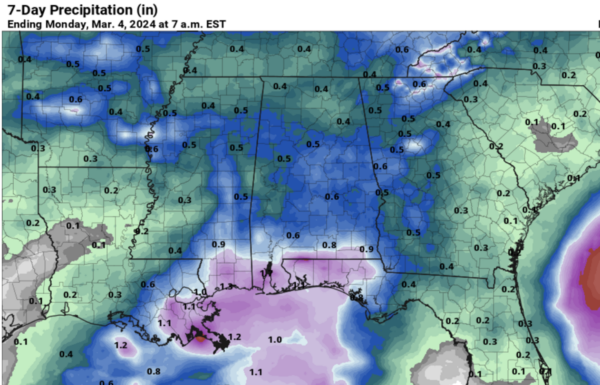
THE ALABAMA WEEKEND: The sky will be mostly cloudy, and scattered showers are possible both days. Nothing too heavy or widespread, and the weather turns warmer again with highs mostly in the upper 60s Saturday, followed by low 70s Sunday. Rainfall totals between now and Sunday will be in the 1/2 range for most of Alabama, while higher amounts are expected near the Gulf Coast.
NEXT WEEK: Some scattered showers remain possible Monday…showers and storms are more likely late Monday night into Tuesday ahead of another cold front. A few strong storms will be possible, but for now the risk of severe storms looks low with the best dynamic forcing to the north. Drier air returns Wednesday and Thursday with highs in the 60s.
BEACH FORECAST CENTER: Get the latest weather and rip current forecasts for the beaches from Fort Morgan to Panama City on our Beach Forecast Center page. There, you can select the forecast of the region that you are interested in visiting.
WORLD TEMPERATURE EXTREMES: Over the last 24 hours, the highest observation outside the U.S. was 113.0F at Telfer, Australia. The lowest observation was -75.6F at Dome A, Antarctica.
CONTIGUOUS TEMPERATURE EXTREMES: Over the last 24 hours, the highest observation was 96F at Rio Grande Village, TX. The lowest observation was -11F at Masardis, ME.
Category: Alabama's Weather, ALL POSTS
About the Author (Author Profile)
Macon, Georgia Television Chief Meteorologist, Birmingham native, and long time Contributor on AlabamaWX. Stormchaser. I did not choose Weather, it chose Me. College Football Fanatic. @Ryan_StinnetSubscribe
If you enjoyed this article, subscribe to receive more just like it.


