

Colder Air Continues To Roll Into Alabama
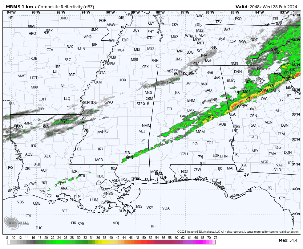
RADAR CHECK: The line of showers along the cold front at mid-afternoon runs from near Thomasville to Prattville to Lafayette. Behind the front, temperatures are in the 50s, while low 80s are reported across the southeast corner of Alabama. The front will continue to move southward this afternoon, and all of the Deep South will be in the colder air tonight. Lows will be mostly in the 30s early tomorrow morning.
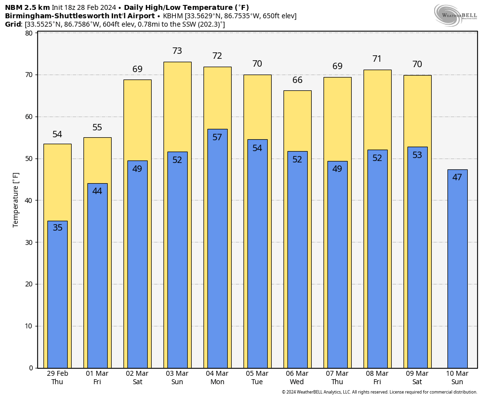
TOMORROW/FRIDAY: Tomorrow will be a cool, dry day with a partly sunny sky and a high in the 50s. Clouds return tomorrow night, and a disturbance will bring periods of rain on Friday. The weather stays cool with temperatures holding in the 50s during the day Friday.
THE ALABAMA WEEKEND: Expect a warming trend over the weekend… highs will be in the 67-72 degree range Saturday, and in the 70s statewide Sunday. It now looks like a decent part of the state will be dry Saturday with only isolated showers; the best chance of seeing some rain will be near the Gulf Coast. Then, on Sunday, we will mention a chance of scattered showers statewide, but nothing really heavy or widespread.
NEXT WEEK: Occasional showers and a thunderstorm or two are likely Monday with the approach of a cold front. The front will likely stall out somewhere across Alabama, keeping the chance of rain in the forecast basically on a daily basis through Friday. It certainly won’t rain all day every day, but the week looks fairly wet and unsettled. Highs through the week will be mostly in the upper 60s and low 70s… See the video briefing for maps, graphics, and more details.
ON THIS DATE IN 1962: Wilmington, North Carolina, reached a high temperature of 85 degrees. This is the warmest temperature on record during February.
ON THIS DATE IN 2007: A severe storm named Xynthia blows into France, Portugal, and Spain, smashing sea walls, destroying homes, polluting farmland with salt water, and devastating the Atlantic coast’s oyster farms. Winds reach about 125 mph on the summits of the Pyrenees and up to nearly 100 mph along the Atlantic Coast. Wind speeds of 106 mph are measured atop the Eiffel Tower in Paris.
ON THIS DATE IN 2011: Five short lived tornadoes touched down across Alabama, including an EF-1 near Tyson in Lowndes County, just west of I-65.
Look for the next video update here by 6:00 a.m. tomorrow…
Category: Alabama's Weather, ALL POSTS, Weather Xtreme Videos
About the Author (Author Profile)
James Spann is one of the most recognized and trusted television meteorologists in the industry. He holds the AMS CCM designation and television seals from the AMS and NWA. He is a past winner of the Broadcast Meteorologist of the Year from both professional organizations.Subscribe
If you enjoyed this article, subscribe to receive more just like it.


