Midday Nowcast: More Clouds than Sun and Wet at Times
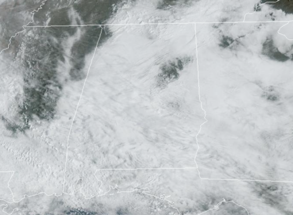
Multiple rounds of rain and storms highlight the forecast for the first full of week of March across Alabama. Today, is mainly dry for the state. We continue to see more clouds than sunshine, and though a few isolated showers are possible, these will not amount to much. Temperatures are above average with widespread 70s today. Tomorrow into tomorrow night, a disturbance will bring rain and thunderstorms back to Alabama. The rain could be heavy with rainfall totals near one inch, but we are not expecting any severe thunderstorms. Temperatures tomorrow will range from the upper 60s to lower 70s.
WEDNESDAY/THURSDAY: A few showers will remain possible these two days, but nothing widespread or heavy. We will continue to see more clouds than sun, despite the sun breaking out at times. Very mild temperatures will continue with afternoon highs in the mid 70s.
WET AND STORMY FRIDAY: A dynamic weather system will bring another organized batch of rain and thunderstorms into Alabama Friday, Friday night, and into at least part of the day Saturday. The SPC has defined a risk of severe thunderstorms for South Alabama Friday and Friday night for now.
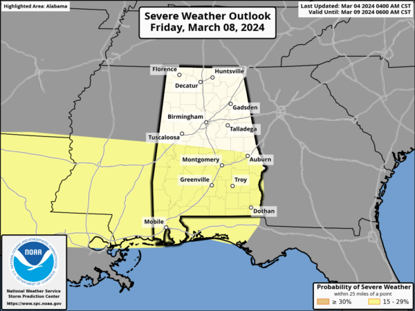
This area could be expanded in the coming days, but we note the severe weather threat is a conditional threat, meaning it may or may not happen. The reason for this, a large mass of rain could develop early in the day, keeping instability values down. Also, the main dynamic support for severe storms seems to be displaced to the north of here. We will keep an eye on this, and will update trends in future forecasts.
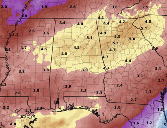
The main concern with this system will be the potential for flooding…With high precipitable water values in place, the rain will be heavy at times, and flooding is very possible. Rain amounts between now and Saturday night will be in the 3-6 inch range over the northern half of Alabama, with 2-4 inches likely for the southern counties.
DRY WEATHER RETURNS: Finally sunshine and a drier weather will return to Alabama Saturday nighttime. Sunday will be a mostly sunny, cooler day with a high in the upper 50s and low 60s. The drier pattern looks to persist into next week with highs in the 60s Monday and Tuesday, followed by 70s over the latter half of the week.
BEACH FORECAST CENTER: Get the latest weather and rip current forecasts for the beaches from Fort Morgan to Panama City on our Beach Forecast Center page. There, you can select the forecast of the region that you are interested in visiting.
WORLD TEMPERATURE EXTREMES: Over the last 24 hours, the highest observation outside the U.S. was 109.4F at Mariscal Estigarribia, Paraguay. The lowest observation was -78.3F at Concordia, Antarctica.
CONTIGUOUS TEMPERATURE EXTREMES: Over the last 24 hours, the highest observation was 90F at Rio Grande Village, TX. The lowest observation was -28F at Peter Sinks, UT.
Category: Alabama's Weather, ALL POSTS
About the Author (Author Profile)
Macon, Georgia Television Chief Meteorologist, Birmingham native, and long time Contributor on AlabamaWX. Stormchaser. I did not choose Weather, it chose Me. College Football Fanatic. @Ryan_StinnetSubscribe
If you enjoyed this article, subscribe to receive more just like it.


