Showers/Storms Likely Tomorrow; Heavy Rain Possible By Friday
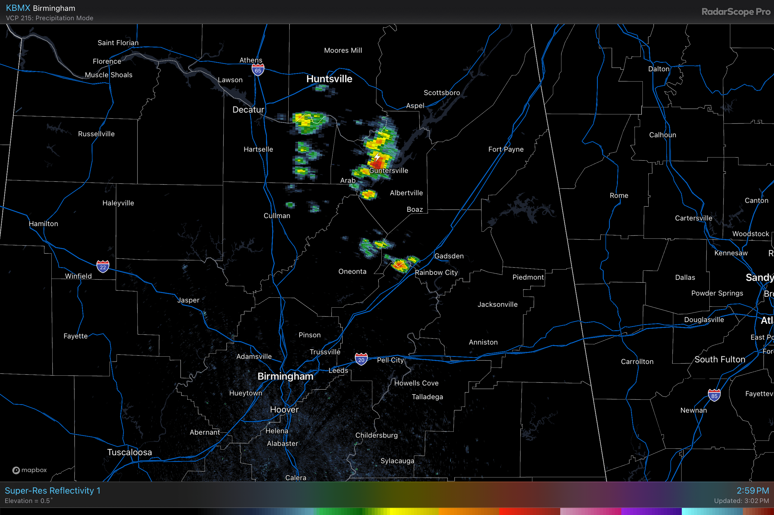
RADAR CHECK: We have a few widely scattered showers and thunderstorms over North Alabama at mid-afternoon, but much of the state is dry with a mix of sun and clouds with temperatures in the 70s. We will maintain the chance of a few isolated showers tonight; the low will be in the 59-64 degree range for most communities.
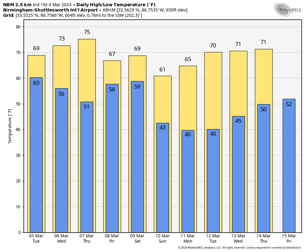
TOMORROW: A disturbance will bring rain and thunderstorms into Alabama tomorrow and tomorrow night. Not expecting any severe thunderstorms, and rain amounts should be around one inch for most of the state. There will be breaks in the rain, but the day looks pretty wet with a high in the 67-72 degree range.
WEDNESDAY/THURSDAY: We will mention some risk of isolated showers on these two days, but nothing widespread or heavy. The sun will break out at times, and afternoon highs will be mostly in the mid 70s.
FRIDAY/THE WEEKEND: A dynamic weather system will bring another organized batch of rain and thunderstorms into Alabama Friday, Friday night, and into Saturday morning. With high precipitable water values in place, the rain will be heavy at times, and some flooding is very possible. Rain amounts between now and Saturday night will be in the 3-6 inch range over the northern half of Alabama, with 2-4 inches likely for the southern counties.
We also note SPC has defined a risk of severe thunderstorms for South Alabama Friday and Friday night…
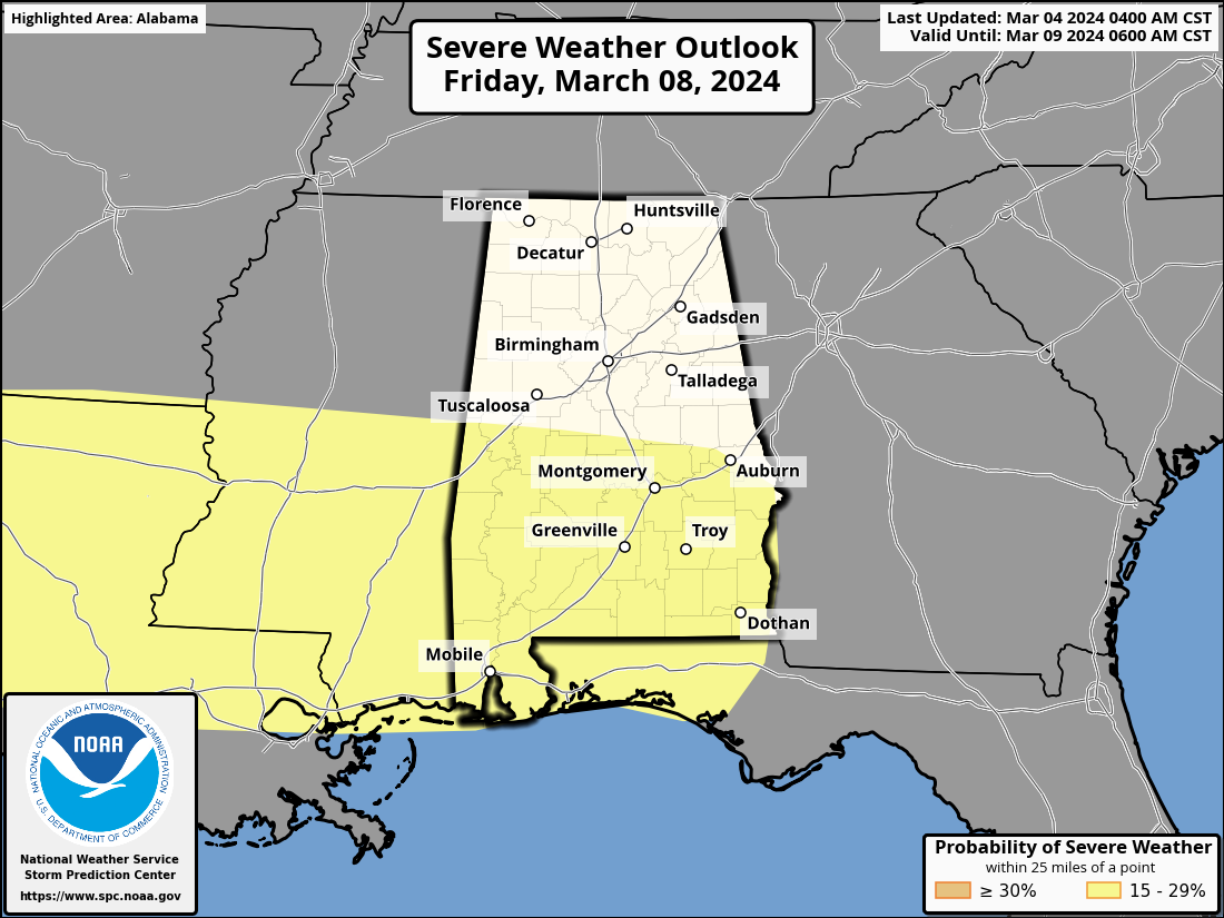
This is a conditional threat; a large mass of rain could evolve early in the day, keeping instability values down. Also, the main dynamic support for severe storms seems to be focused north of here. We will watch model trends over the next few days and the forecast will be adjusted as needed. But for now it looks like heavy rain/flooding will be the main concern.
Highs Friday and Saturday will be in the 67-73 degree range… rain will end from west to east Saturday morning as drier air begins to push into the state. Dry air takes over Saturday night, and Sunday will be a mostly sunny, cooler day with a high in the upper 50s and low 60s.
NEXT WEEK: For now much of next week looks dry. Highs in the 60s Monday and Tuesday, followed by 70s over the latter half of the week. See the video briefing for maps, graphics, and more details.
ON THIS DATE IN 1842: A tornado moved through the western part of Tuscaloosa, killing one person and injuring ten others.
ON THIS DATE IN 1983: Brownsville, Texas, recorded a high of 100 degrees, the earliest the city has ever hit the century mark.
Look for the next video briefing here by 6:00 a.m. tomorrow…
Category: Alabama's Weather, ALL POSTS, Weather Xtreme Videos
About the Author (Author Profile)
James Spann is one of the most recognized and trusted television meteorologists in the industry. He holds the AMS CCM designation and television seals from the AMS and NWA. He is a past winner of the Broadcast Meteorologist of the Year from both professional organizations.Subscribe
If you enjoyed this article, subscribe to receive more just like it.


