Warming Trend Continues; Rain By Thursday Night/Friday
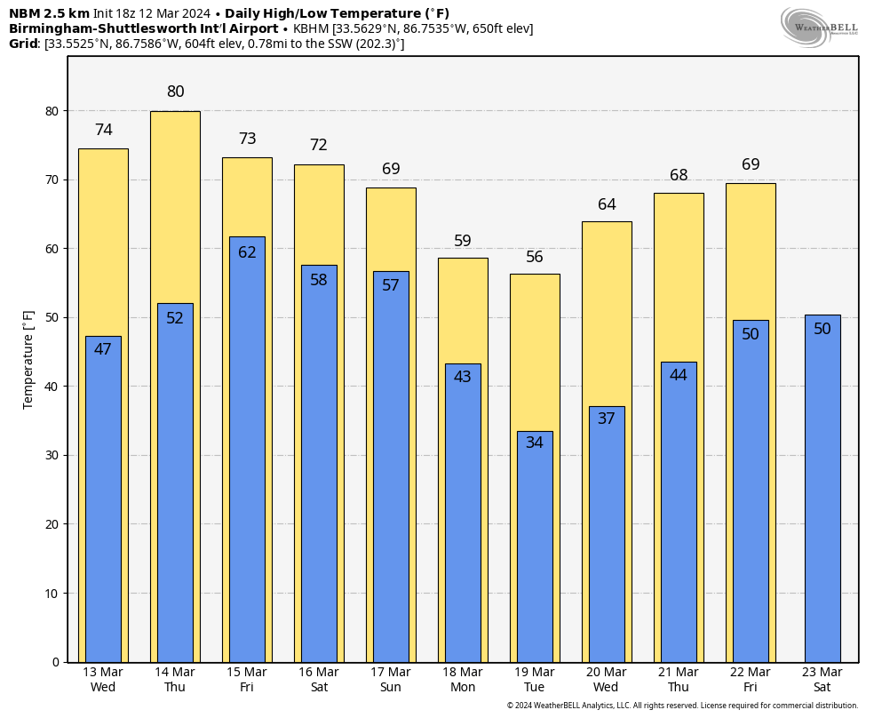
MARVELOUS MARCH AFTERNOON: After a chilly start, temperatures are close to 70 degrees across most of Alabama this afternoon with a good supply of sunshine. Tonight will be generally clear with a low in the 40s.
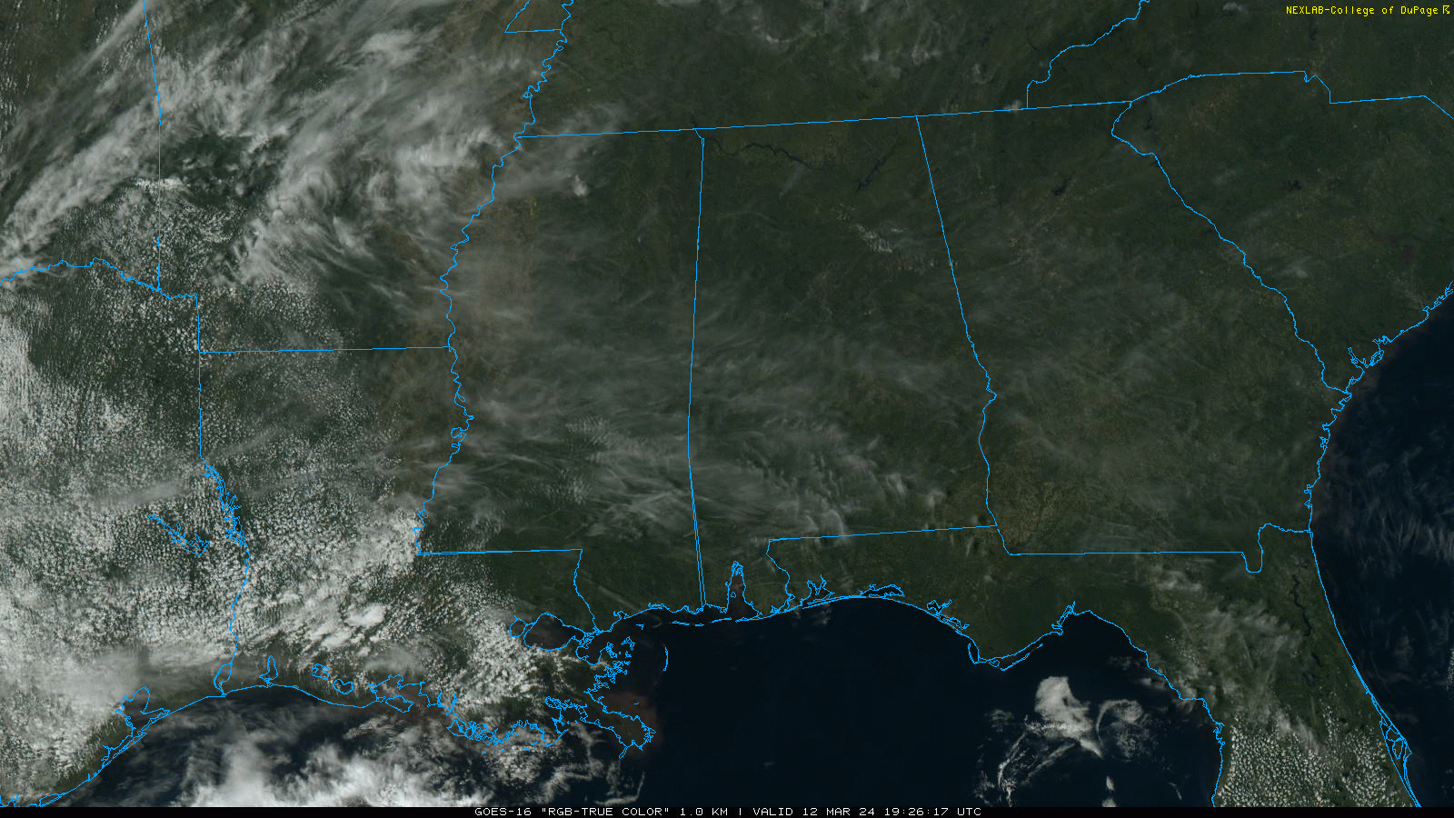
Tomorrow will feature a partly sunny sky with a high in the mid 70s. Then, by Thursday afternoon, 80 degree warmth is possible in a few spots as the warming trend continues. Clouds will increase Thursday, and a few showers are possible over the western half of the state during the day. Showers are more likely Thursday night as moisture levels continue to rise.
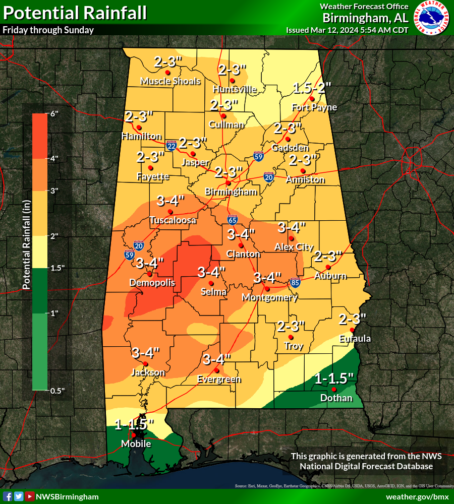
FRIDAY AND THE WEEKEND: Rain and thunderstorms are likely statewide Friday and Friday night. A few strong storms are possible, but the overall severe weather threat looks fairly low at this point with limited dynamic forcing. Wet weather continues over the weekend; we will deal with showers on Saturday, followed by a more widespread rain event Sunday. It certainly won’t rain all weekend, and the sun might peek out at times Saturday. Highest rain coverage will come on Friday and Sunday.
Rain totals Friday through Sunday night will be in the 2-3 inch range for most of Alabama, and some flooding issues are certainly possible. Highs will be in the 70s Friday and Saturday, followed by 60s Sunday.
NEXT WEEK: Lingering rain Monday morning will be most likely confined to far South Alabama, in the general area between Mobile and Dothan. Then, another shot of cold air will drop into the Deep South, and another late season freeze looks likely by Tuesday morning with lows in the 25-35 degree range over the northern half of the state. Rain will likely return late Thursday into Friday… See the video briefing for maps, graphics, and more details.
ON THIS DATE IN 1993: The generational “Blizzard of 93” was underway. All 67 Alabama counties had measurable snow; winds gusted to nearly hurricane force on ridges with white out conditions, snow amounts of 1 to 2 feet were common over the northern half of the state, with drifts to 4 feet. Some had no power for over a week. We forecast 6 to 16 inches of snow going into the event, but many didn’t listen since it was mid-March, the flowers were blooming, and the high on March 10, 1993 (two days before the blizzard) was 75.
Look for the next video briefing here by 6:00 a.m. tomorrow…
Category: Alabama's Weather, ALL POSTS, Weather Xtreme Videos
About the Author (Author Profile)
James Spann is one of the most recognized and trusted television meteorologists in the industry. He holds the AMS CCM designation and television seals from the AMS and NWA. He is a past winner of the Broadcast Meteorologist of the Year from both professional organizations.Subscribe
If you enjoyed this article, subscribe to receive more just like it.


