Occasional Rain Through Tonight; Drier Air Arrives Tomorrow
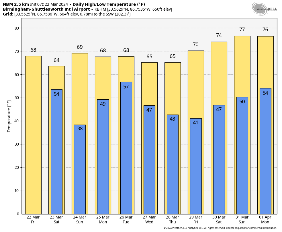
RADAR CHECK: Light rain continues to develop across Alabama early this morning, and we will forecast occasional rain through tonight as an upper trough approaches. The day will be cloudy and cool with highs in the mid 60s for most communities; rain amounts will be around 1/2 inch through late tonight.
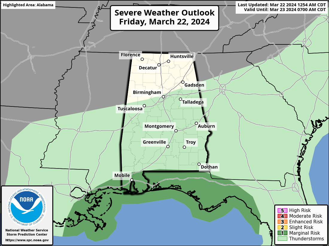
We do note SPC has defined a low end “marginal risk” (level 1/5) of severe thunderstorms for the Gulf Coast, a few storms there could produce gusty winds. But, for most of the Deep South, the air will be cool and stable and no thunder is expected.
THE ALABAMA WEEKEND: Any lingering showers will end tomorrow morning, and some clearing is possible by afternoon as dry air returns to the state. Temperatures will remain below average with highs in the mid 60s. Then, on Sunday, the sky will be sunny with a high not too far from 70 degrees. We need to mention there will be some risk of scattered frost early Sunday morning with temperatures dropping into the mid to upper 30s over the northern 2/3 of Alabama.
NEXT WEEK: The weather stays dry Monday, but showers and storms return to the state Tuesday ahead of a surface front. Instability will be very limited, and the main dynamic support will pass well to the north, so the risk of severe thunderstorms for now looks fairly low. Rain amounts of 1/2 to 1 inch are likely Tuesday, then drier air returns Wednesday with a partly sunny sky. The latest global model data suggests Thursday and Friday will be dry as well. Highs will be in the 65-72 degree range through the week… See the video briefing for maps, graphics, and more details.
ON THIS DATE IN 1893: The first tornado was recorded in Oklahoma City on this date. It destroyed 14 buildings and injured four people as it passed through the center of town. There was minor damage to the Weather Bureau office, which was located at Grand and Robinson in south Oklahoma City.
ON THIS DATE IN 2022: Nine tornadoes touched down across Alabama, including an EF-2 in Choctaw County that was down for over four miles.
Look for the next video briefing here by 3:00 this afternoon… enjoy the day!
Category: Alabama's Weather, ALL POSTS, Weather Xtreme Videos
About the Author (Author Profile)
James Spann is one of the most recognized and trusted television meteorologists in the industry. He holds the AMS CCM designation and television seals from the AMS and NWA. He is a past winner of the Broadcast Meteorologist of the Year from both professional organizations.Subscribe
If you enjoyed this article, subscribe to receive more just like it.


