Midday Nowcast: Rain at Times Today, Tonight, and into Tomorrow
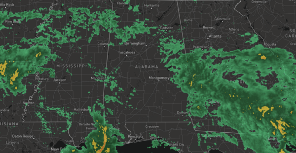
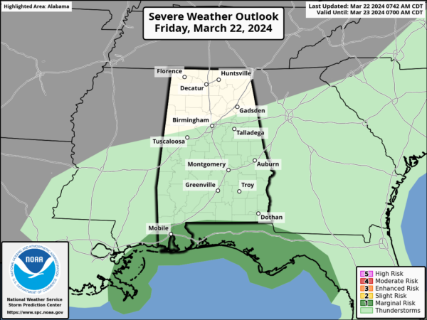
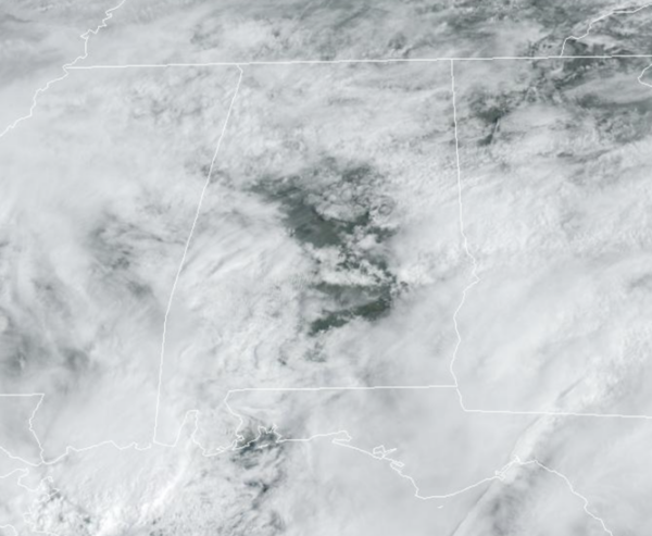
WET FRIDAY: Rain has returned to Alabama today as a low pressure tracks along the Gulf Coast. With the low to the south of us, there is no threat of severe weather and very little thunder is expected. If there are any stronger storms today, they will be confined to the immediate Gulf Coast.
Rain amounts should be in the 1/2 to 1 inch range. The rain today will come in waves, with some breaks in the rain for a couple of hours, then a couple of hours of rain. We are seeing a few peeks of sunshine today as well, but overall clouds will win the day. Highs today are in the low and mid 60s.
Occasional rain will continue through tonight and we will maintain the chance of lingering showers into the morning hours tomorrow. Most of tomorrow will likely be cloudy, but we are expecting to see some peeks of sunshine through the afternoon. Highs tomorrow will remain below average with low to mid 60s. Drier air flows into the state Saturday night and the sky will clear overnight. It will be a cold night with lows in the 30s and 40s.
SUNNY SUNDAY: Sunshine returns in full supply Sunday and it will be the better day of weather this weekend. Highs Sunday should return to seasonal values with low 70s expected.
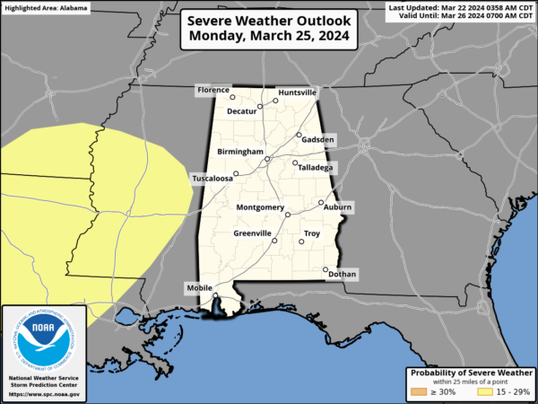
NEXT WEEK: Monday will be dry with a high in the low to mid 70s, then rain and storms return to the state Tuesday. Some strong storms are possible but for now, the severe weather threat looks low due to lack of surface based instability and the main dynamic support passing well to the north. We will keep an eye on trends in the coming days as the severe weather threat could increase, but for now it is very low. We note the SPC has most of Central Mississippi in a risk of severe weather on Monday, but no part of Alabama is included in this risk.
Rainfall amounts on Tuesday will be in the 1/2 to 1 inch range. Wednesday through Friday look dry, and highs next week will be in the 60s and 70s across Alabama.
BEACH FORECAST CENTER: Get the latest weather and rip current forecasts for the beaches from Fort Morgan to Panama City on our Beach Forecast Center page. There, you can select the forecast of the region that you are interested in visiting.
WORLD TEMPERATURE EXTREMES: Over the last 24 hours, the highest observation outside the U.S. was 117.1F at Nalnut, Libya. The lowest observation was -86.6F at Concordia, Antarctica.
CONTIGUOUS TEMPERATURE EXTREMES: Over the last 24 hours, the highest observation was 88F at Death Valley, CA. The lowest observation was -8F at Forest Center, MN.
Category: Alabama's Weather, ALL POSTS
About the Author (Author Profile)
Macon, Georgia Television Chief Meteorologist, Birmingham native, and long time Contributor on AlabamaWX. Stormchaser. I did not choose Weather, it chose Me. College Football Fanatic. @Ryan_StinnetSubscribe
If you enjoyed this article, subscribe to receive more just like it.


