130pm CDT Update: Flash Flooding Likely through this evening for the Western Florida Peninsula
The Weather Prediction Center has produced an outlook showing the most likely area of flash flooding over the next few hours. This will be focused in on the western Florida peninsula.
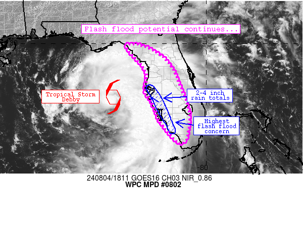
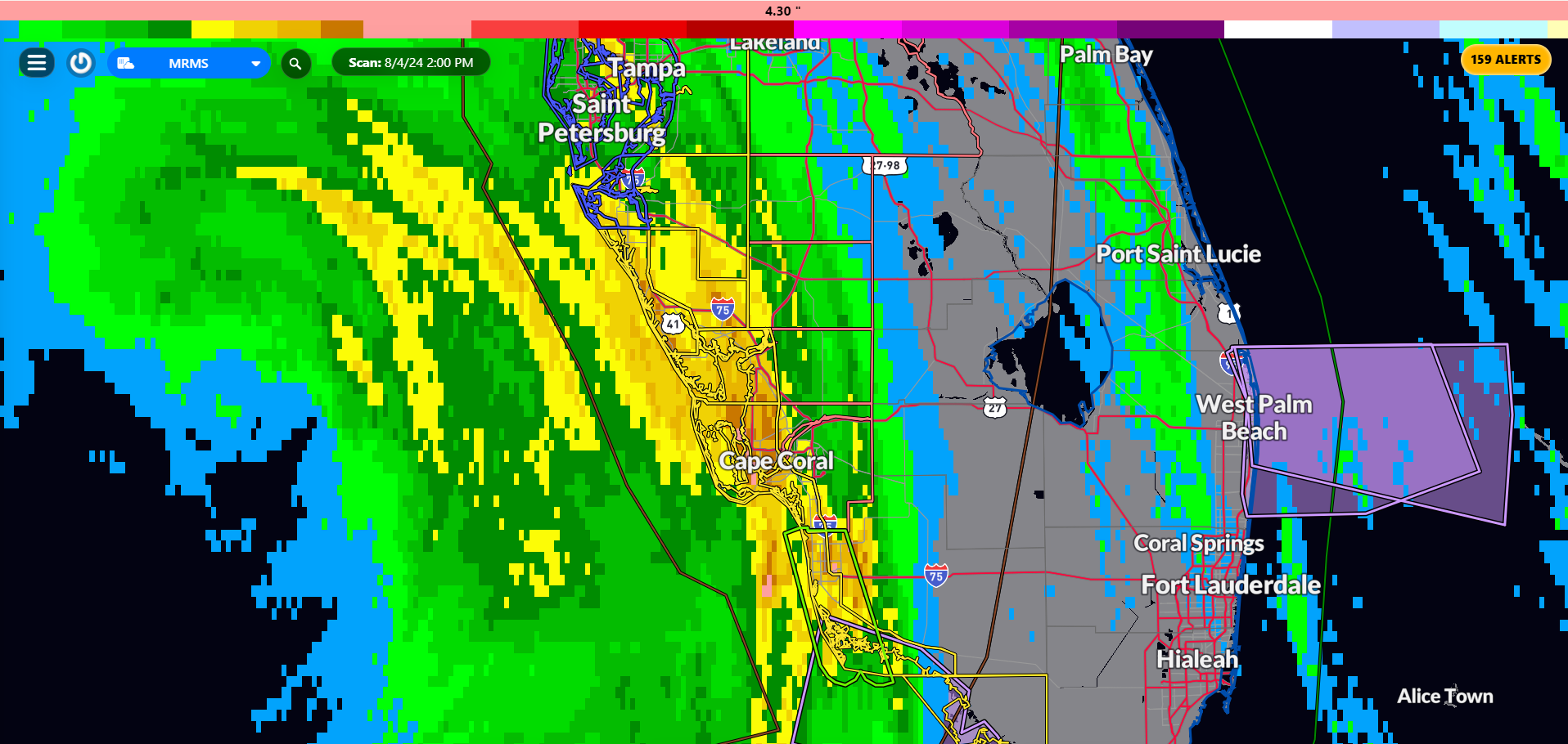
Huge surge of moisture continues to pull into from Gainesville through Tampa down to Fort Myers and into portions of the Keys. There are been reports of 2-4 inches of rain already from places like Fort Myers and Punta Gorda. Areas of 1-2 inches of rain PER HOUR are expected to continue through this evening. Below is a snapshot from RadarOmega of the 6 hour precip accumulation as of 130pm CDT.
About the Author (Author Profile)
Owner of Tornado Talk. Radio broadcast meteorologist with The Storm Report. WeatherBrains Panelist. B.S. Meteorology from Penn State University.Subscribe
If you enjoyed this article, subscribe to receive more just like it.


