Dry Days For Alabama; Debby Stays To The East
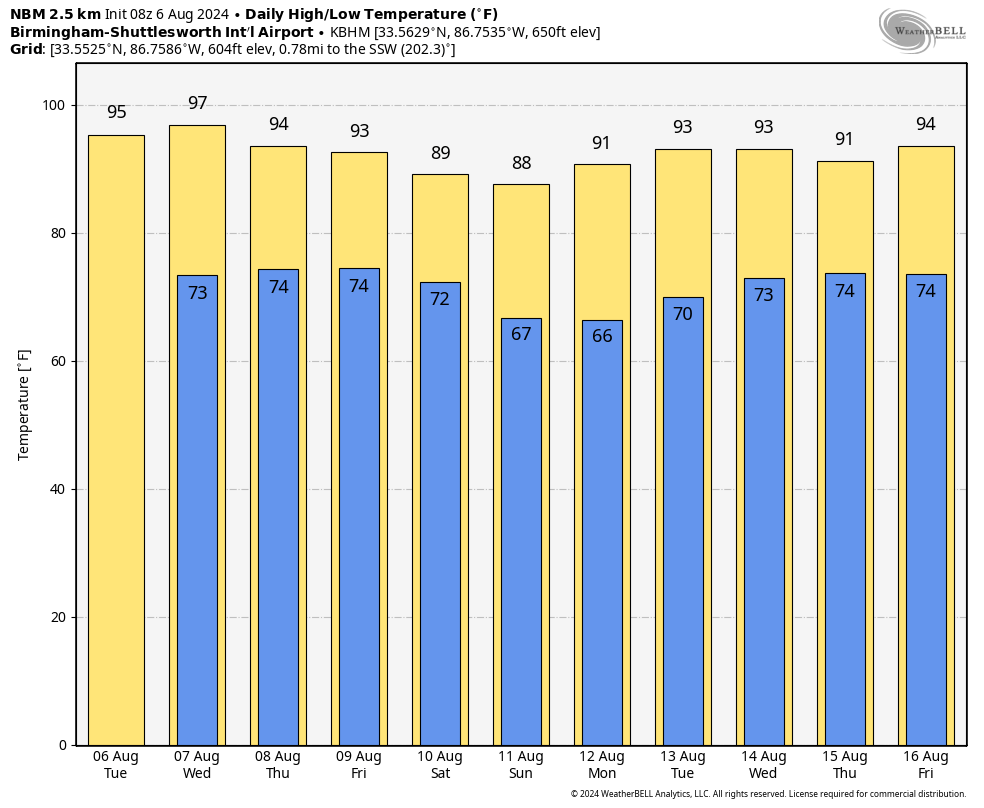
DRY PATTERN: Dry weather will continue across Alabama through the rest of the week with sunny hot afternoons and fair nights. Highs will be in the mid to upper 90s through Thursday, followed by low to mid 90s Friday. Then, over the weekend, we will enjoy an airmass change as relatively cooler and drier air drops into the state from the north. Highs drop into the upper 80s over the northern half of the state, and lows will be in the 60s early Sunday morning. Some of the cooler spots over North Alabama might even see upper 50s. Humidity levels will be lower making for comfortable conditions for mid-August.
NEXT WEEK: Dry weather will likely continue Monday and Tuesday; then we will bring in some chance of widely scattered, mostly afternoon and evening showers and thunderstorms over the latter half of the week. Highs will be generally in the 91-95 degree range… See the video briefing for maps, graphics, and more details.
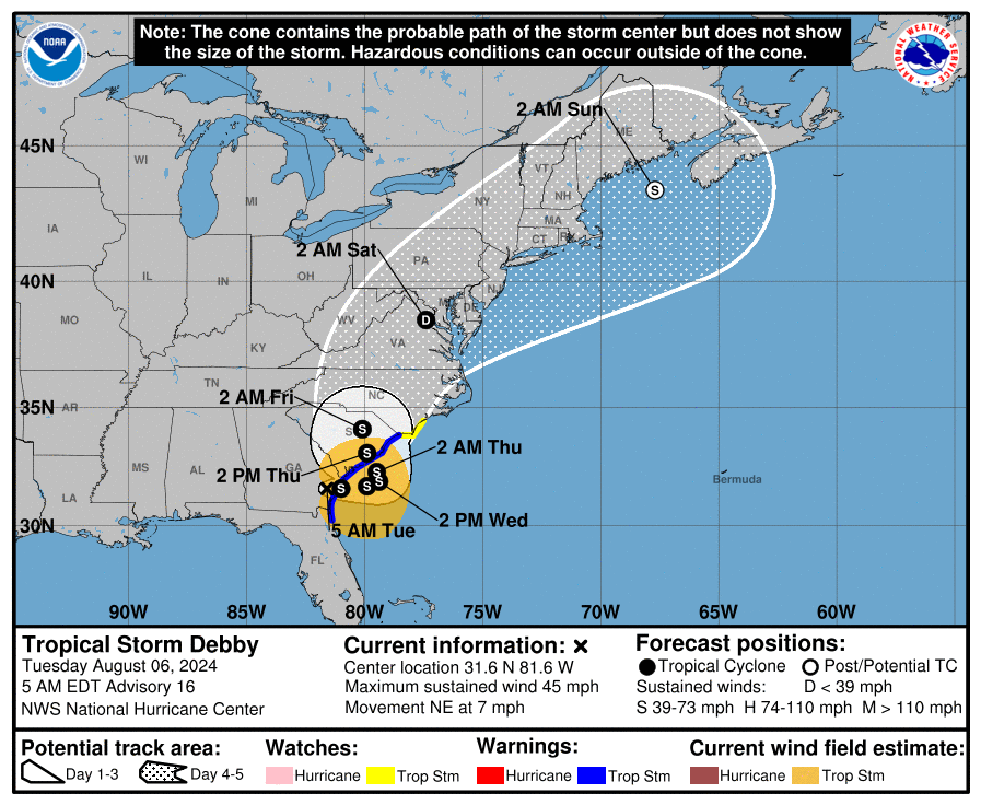
DEBBY: Tropical Storm Debby this morning has winds of 45 mph, and is centered about 50 miles southwest of Savannah. The system is moving northeast at 7 mph, and continues to bring torrential tropical rain to much of South Carolina.
Potentially historic heavy rainfall across southeast Georgia and eastern South Carolina through Friday will likely result in areas of catastrophic flooding. Heavy rainfall will likely result in flooding impacts from northern North Carolina through portions of Mid-Atlantic States and southern New England through Sunday morning.
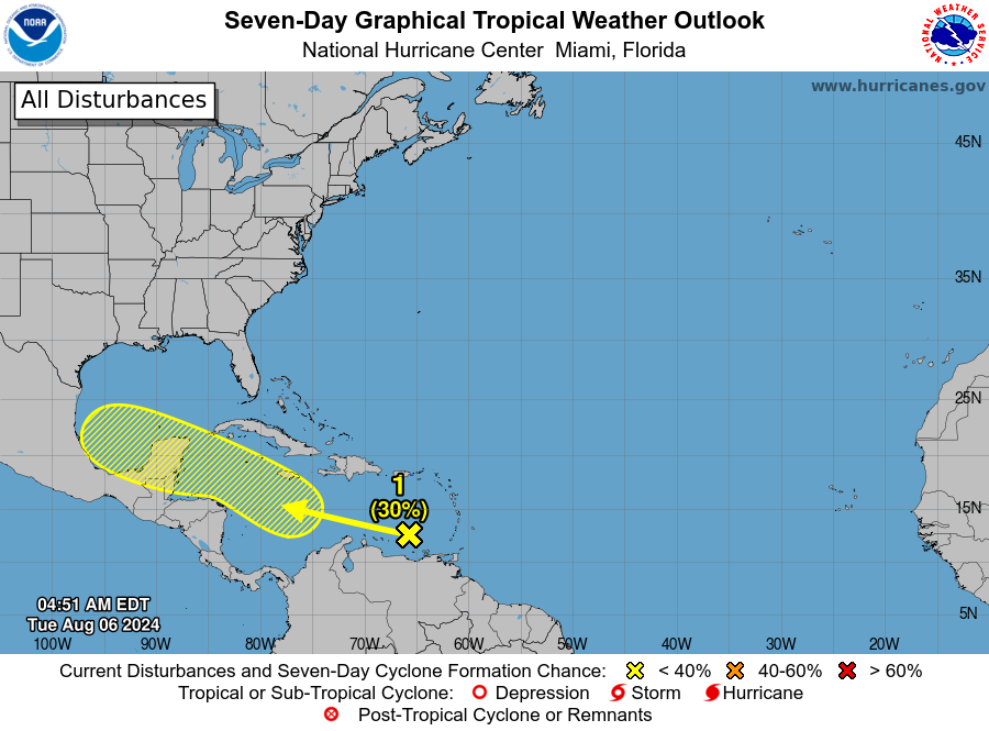
Elsewhere, showers and thunderstorms associated with a tropical wave located over the eastern Caribbean Sea remain disorganized. Any development of this system should be slow to occur during the next couple of days while it moves westward over the eastern and central Caribbean Sea. Environmental conditions are expected to become more conducive for development later this week as the system moves across the western Caribbean Sea or the southern Gulf of Mexico. NHC gives this system a 30 percent chance of development for now.
ON THIS DATE IN 1959: Hurricane Dot crossed Kauai in the Hawaiian Islands producing sustained winds of 105 mph with gusts to 125 mph. Over 6 inches of rain fell with over 9 inches on the big island of Hawaii.
ON THIS DATE IN 1993: Virginia experienced its worst tornado outbreak ever as 18 tornadoes ripped through the state in 5 hours. The most devastating tornado caused severe damage in the historic part of Petersburg. The storm then moved on to Pocahontas Island and into Colonial Heights. There, the storm ripped apart a WalMart store, killing three people and injuring nearly 200. The F4 twister was the first known violent tornado in Virginia history. It killed a total of 4 people and injured 246 along its 12-mile path.
Look for the next video briefing here by 3:00 this afternoon… enjoy the day!
Category: Alabama's Weather, ALL POSTS, Weather Xtreme Videos
About the Author (Author Profile)
James Spann is one of the most recognized and trusted television meteorologists in the industry. He holds the AMS CCM designation and television seals from the AMS and NWA. He is a past winner of the Broadcast Meteorologist of the Year from both professional organizations.Subscribe
If you enjoyed this article, subscribe to receive more just like it.


