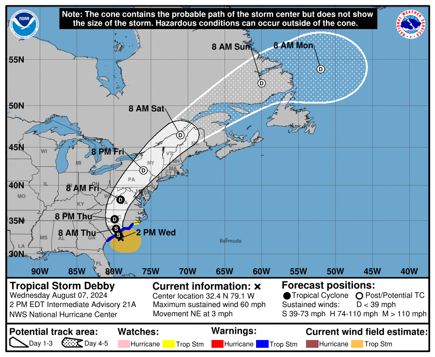
Afternoon Debby Update: Stronger Winds Found; Another Landfall by Thursday AM
Quick look at Debby this afternoon. Currently, the storm continues the slow movement at 3 mph to the northeast. Weak steering currents continue promote the crawl. The combination of a ridge east of Debby and a trough near the Great Lakes will help bring in a northward movement and an eventual acceleration. A second landfall along the South Carolina coast is expected sometime Thursday morning.
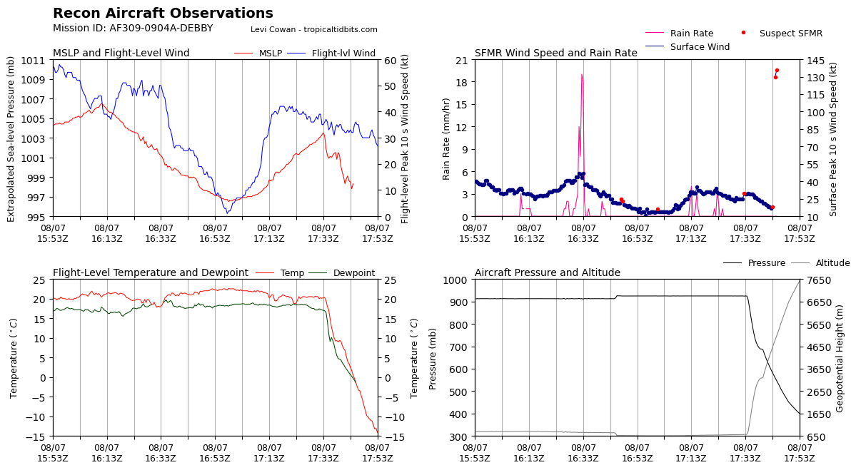
The hurricane hunters have been flying in and out of Debby and found surface winds of around 60 mph will the southeast of the center (100 n mi). There is limited convection near the center of Debby. It is all found northeast and southeast. Due to the aircraft data, the intensity has been set at 60 mph.
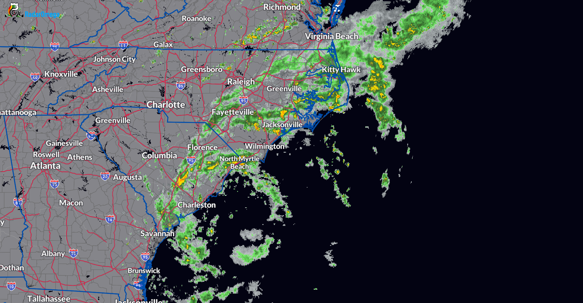
Several rain bands continue to pivot around the broad circulation of Debby. Any of these that set up could produce very heavy rain that could lead to more flooding. Heavy rain has occurred early this afternoon in the Myrtle Beach area.
Debby’s most impressive band yet is really putting on a show along Ocean Blvd in Myrtle Beach. #SCwx @wmbfnews pic.twitter.com/45RqVBPThY
— Jamie Arnold WMBF (@jamiearnoldWMBF) August 7, 2024
Radar as of 1pm CDT:
About the Author (Author Profile)
Owner of Tornado Talk. Radio broadcast meteorologist with The Storm Report. WeatherBrains Panelist. B.S. Meteorology from Penn State University.Subscribe
If you enjoyed this article, subscribe to receive more just like it.


