(Expired) Severe Thunderstorm Warning for Northwestern Jackson County until 445pm CDT
Update as of 445pm CDT: Warning was allowed to expire. Still watching the radar closely.
HUN expires Severe Thunderstorm Warning for Jackson [AL] https://t.co/nPMldPbJPs pic.twitter.com/h9gEciIKbL
— IEMBot HUN (@iembot_hun) August 16, 2024
——————–
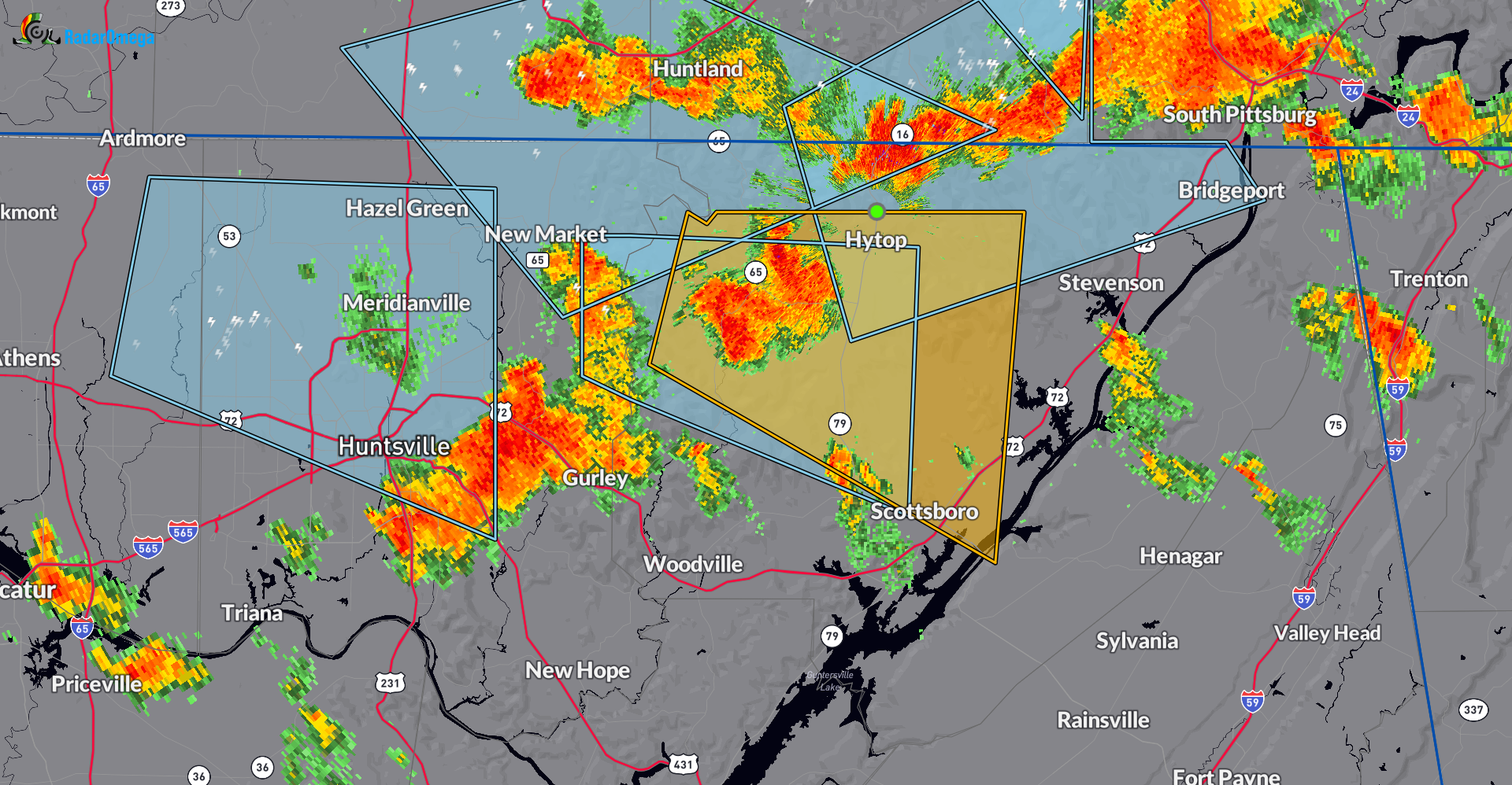
Very active this Friday afternoon with several clusters of storms across parts of northern and central Alabama. Please be careful as you are wrapping up work and trying to ease out to plans this Friday evening. Some of these storms have the capability of producing winds 50-60mph. Some large hail as well and due to the slow movement, very heavy rain could lead to ponding on the roads. Here is the radar snapshot of the latest warning. The yellow polygon is the severe thunderstorm warning.
The National Weather Service in Huntsville Alabama has issued a
* Severe Thunderstorm Warning for…
Northwestern Jackson County in northeastern Alabama…
* Until 445 PM CDT.
* At 402 PM CDT, a severe thunderstorm was located 7 miles west of
Skyline, or 15 miles east of Moores Mill, moving east at 15 mph.
HAZARD…60 mph wind gusts and quarter size hail.
SOURCE…Radar indicated.
IMPACT…Hail damage to vehicles is expected. Expect wind damage
to roofs, siding, and trees.
* Locations impacted include…
Scottsboro, Hollywood, Skyline, Hytop, Princeton, Estillfork, Hollytree, and Larkin.
Category: Alabama's Weather, ALL POSTS, Severe Weather
About the Author (Author Profile)
Owner of Tornado Talk. Radio broadcast meteorologist with The Storm Report. WeatherBrains Panelist. B.S. Meteorology from Penn State University.Subscribe
If you enjoyed this article, subscribe to receive more just like it.


