Midday Nowcast: Some Strong Storms This Evening; Alabama is Now Drought Free
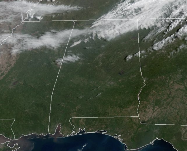
SOME STORMS RETURN: It is another gorgeous day across Alabama with tons of sunshine and very mild afternoon temperatures; upper 70s and low 80s. A cold front will bring widely, scattered showers and thunderstorms to the state this evening and into the overnight hours. This will not be a widespread event, many locations will not see any rain, but some locations will see heavy rainfall and perhaps a severe storm.
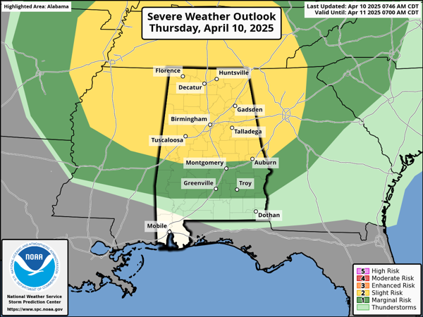
The Storm Prediction Center (SPC) maintains a level 2 of 5 “slight risk” of severe thunderstorms for the northern two-thirds of Alabama, areas along and north of U.S. 80 from Demopolis to Selma to Montgomery, with a level 1 of 5 “marginal risk” south of there. However, this is a low end threat as wind fields will not be particularly strong, but we will have to watch as some storms could produce large hail and gusty winds. Tornado threat is very low, but not zero. Rain amounts will be around one-quarter inch. As the storms push south through the state late tonight, they will be weakening.
BIRMINGHAM ALMANAC: For April 10th, the average high for Birmingham is 74° and the average low is 51°. The record high is 88° set in 1995, while the record low is 29° set in 1996. We average 0.18” of precipitation on this date and the record value is 1.74” set in 2015.
ELSEWHERE IN THE USA: Mixed rain/wet snow from the Great Lakes to interior New England Thursday will be followed by cold soaking rain showers across the Mid-Atlantic Friday into early Saturday. Well above normal and near-record warmth builds across the West and into the Plains through the weekend. Turning cooler and unsettled across the Pacific Northwest.
TOMORROW AND THE WEEKEND: Cooler air moves into the state tomorrow behind the front. The day will feature a gradually clearing sky with highs in the 60s. The weekend will be cool and dry across the Deep South; lows will be mostly in the 40s, with highs in the 60s Saturday and 70s Sunday.
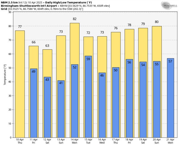
NEXT WEEK: Monday will be warm with highs in the 80s and plenty of sunshine. A cold front arrives Tuesday, it will bring a few showers, and it will bring cooler temperatures. Expect highs in the 60s and 70s, with lows in the 40s. The rest of the week looks dry for now.
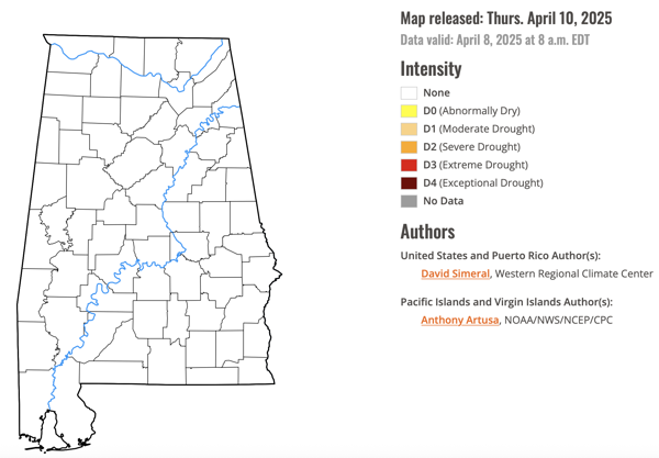
DROUGHT MONITOR: The latest drought monitor released this morning, shows the rains of the last week were a big help. All of Alabama is drought free, and no part of Alabama is abnormally dry. This is the first time is a long time we can say that for Alabama, great news!!!
WORLD TEMPERATURE EXTREMES: Over the last 24 hours, the highest observation outside the U.S. was 111.7F at Barmer, India. The lowest observation was -104.1F at Concordia, Antarctica.
CONTIGUOUS TEMPERATURE EXTREMES: Over the last 24 hours, the highest observation was 101F at Death Valley, CA. The lowest observation was 3F at Mount Washington, NH.
Category: Alabama's Weather, ALL POSTS, Social Media
About the Author (Author Profile)
Macon, Georgia Television Chief Meteorologist, Birmingham native, and long time Contributor on AlabamaWX. Stormchaser. I did not choose Weather, it chose Me. College Football Fanatic. @Ryan_StinnetSubscribe
If you enjoyed this article, subscribe to receive more just like it.


