Scattered Showers/Storms Through Tomorrow; Drier Thursday/Friday
RADAR CHECK: Large areas of rain and a few thunderstorms continue to move across the northern 2/3 of Alabama this afternoon. Some communities are seeing heavy rain, and we have small hail in a few spots. South Alabama is generally dry with only isolated showers.
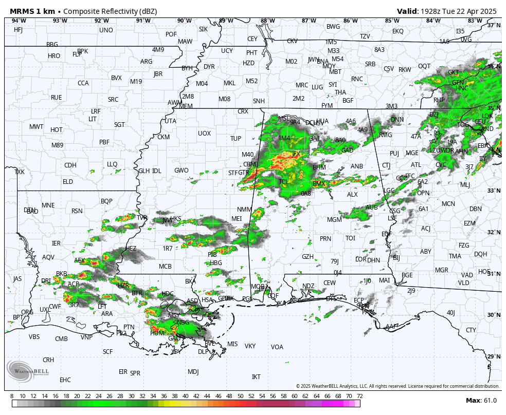
We will maintain the chain of scattered showers and storms through tomorrow, mainly over the northern and central counties, as a stalled front hangs around just to the north. The high tomorrow will be in the 78-84 degree range.
Then, showers become fewer in number Thursday as the front lifts northward and dissipates. By the time we get to Friday and the weekend most of Alabama will be simply warm and dry with only isolated afternoon showers over the northern third of the state. Temperatures will stay above average with highs in the 80s… lows will be in the 60s.
NEXT WEEK: The weather looks warm and mostly dry Monday through Wednesday; global models suggest we will have rain with a cold front Thursday, followed by cooler air at the end of next week. See the video briefing for maps, graphics, and more details.
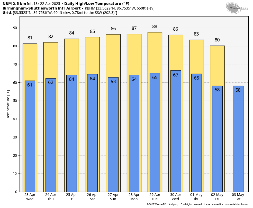
RACE WEEKEND: The weather will be warm and mostly dry at Talladega Friday through Sunday. The chance of an afternoon shower is small (20 percent or less), and highs will be in the 80s.
ON THIS DATE IN 2004: Oklahoma City residents are accustomed to walking outside to find a blanket of white covering the ground. But not in late April on a day which started out with temperatures in the upper 70s. The layer of white was not snow, but rather hail, which fell in prodigious amounts as massive supercell thunderstorms pounded the Oklahoma City metro area. Traffic was snarled on area highways, including I-44, as cars could not drive on roads slick with the ice.
Look for the next video briefing here by 6:00 a.m. tomorrow…
Category: Alabama's Weather, ALL POSTS, Weather Xtreme Videos
About the Author (Author Profile)
James Spann is one of the most recognized and trusted television meteorologists in the industry. He holds the AMS CCM designation and television seals from the AMS and NWA. He is a past winner of the Broadcast Meteorologist of the Year from both professional organizations.Subscribe
If you enjoyed this article, subscribe to receive more just like it.


