Midday Nowcast: More Heavy Rainfall and Strong Storms Today
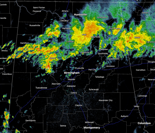
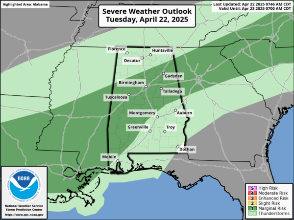
NEW DAY, SAME FORECAST: With a stalled front in place, we continue see showers and thunderstorms today across Alabama, with the highest coverage across the northern half of the state. Like yesterday, the SPC has a “marginal risk” of severe storms across portions of Alabama as some storms this afternoon and evening could produce hail and strong, gusty winds.
An isolated severe warning or two is not out of the question. All storms will be producing very heavy rainfall and frequent lightning, and some localized flash flooding is certainly possible. Highs today are in the 70s.
BIRMINGHAM ALMANAC: For April 22nd, the average high for Birmingham is 77° and the average low is 54°. The record high is 90° set in 1987, while the record low is 31° set in 1993. We average 0.16” of precipitation on this date and the record value is 1.97” set in 1909.
PERSISTENT FORECAST: The front begins to lift northward tomorrow, showers and storms become fewer in number and more isolated in nature. Most of these will occur during the afternoon and evening hours, peak heating of the day, and the chance of any spot seeing rain is around 20 percent. The northern third of the state, has the best chance of seeing these showers and storms. It will remain warm with temperatures staying above average with highs well into the 80s, and lows will be in those soothing 60s. The overall pattern doesn’t change as we roll into the weekend.
RACE WEEKEND: The weather will be warm and mostly dry at Talladega Friday through Sunday. The chance of an afternoon shower is small (20 percent or less), and highs will be in the 80s. Great weather for all the race weekend actives.
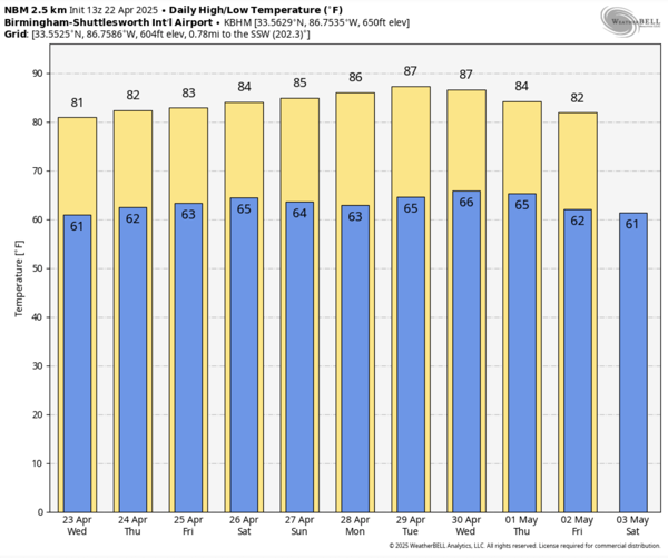
NEXT WEEK: An upper ridge will build in across the Deep South and it will keep Alabama mostly dry and very warm to almost hot. Highs will be above average by ten degrees or so, and that means many locations could see some 90s on the maps by the time we end the month of April and get ready to roll into May.
WORLD TEMPERATURE EXTREMES: Over the last 24 hours, the highest observation outside the U.S. was 115.2F at Jharsuguda, India. The lowest observation was -92.4F at Vostok, Antarctica.
CONTIGUOUS TEMPERATURE EXTREMES: Over the last 24 hours, the highest observation was 99F at Faith Ranch, TX. The lowest observation was 8F at Peter Sinks, UT.
Category: Alabama's Weather, ALL POSTS, Social Media
About the Author (Author Profile)
Macon, Georgia Television Chief Meteorologist, Birmingham native, and long time Contributor on AlabamaWX. Stormchaser. I did not choose Weather, it chose Me. College Football Fanatic. @Ryan_StinnetSubscribe
If you enjoyed this article, subscribe to receive more just like it.


