Midday Nowcast: Quiet Radar for Now; Rain and Storms Remain in the Forecast
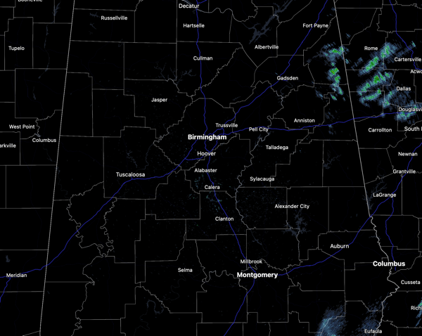
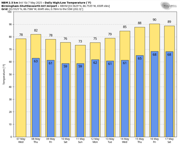
Widespread rain returned to Alabama overnight, but the majority of it today has pushed east into Georgia. For the rest of today, we are going to continue to see scattered showers and the occasional thunderstorm across Alabama. Highs today are in the upper 70s and lower 80s as we continue to see more clouds than sun. Tonight, showers will linger across Alabama as lows hold in the 60s.
BIRMINGHAM ALMANAC: For May 7th, the average high for Birmingham is 80° and the average low is 58°. The record high is 91° set in 1962, while the record low is 37° set in 1944. We average 0.15” of precipitation on this date and the record value is 5.71” set in 2003.
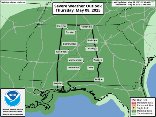
KEEP THE RAIN GEAR HANDY: An upper-level low will slowly inch eastward through the Deep South the next several days, and our weather will stay unsettled with rain and storms at times. Though a few strong storms are possible, the air will be relatively stable, and widespread severe storms are not expected, however, we note the SPC all of Alabama under a “marginal risk” (level 1 of 5) of severe storms tomorrow.
A few stronger storms tomorrow could produce gusty winds and small hail. Highs tomorrow should be in the low 80s, while we see a few more peeks of sunshine, and rain and storms will be more scattered. Friday will feature an increase in rain and storms again, it won’t rain all the time, but expect rain to be a possibility anytime. Highs Friday will be in hold in the 70s.
THE ALABAMA WEEKEND: The upper low will remain the main player in our weather, and we will keep occasional rain and storms in the forecast both days as the low moves ever so slightly eastward. Again, a few strong storms are possible, but the severe weather threat is very low. Highs will remain in the mid to upper 70s. Rain amounts through Sunday will be in the 1-3 inch range for most of Alabama, but heavier amounts are possible mainly over the southern part of the state, where some spots could see 3-5 inches.
NEXT WEEK: The week looks to start off with continued showers in the forecast at least for Monday and Tuesday. Then the weather will trend drier and warmer over the latter half of next week as an upper ridge builds; it looks like many locations by the end of the week will see highs approaching the lower 90s.
WORLD TEMPERATURE EXTREMES: Over the last 24 hours, the highest observation outside the U.S. was 115.7F at Suwaiq, Oman. The lowest observation was -88.2F at Concordia, Antarctica.
CONTIGUOUS TEMPERATURE EXTREMES: Over the last 24 hours, the highest observation was 102F at Faith Ranch, TX. The lowest observation was 18F at Red Lodge, MT.
Category: Alabama's Weather, ALL POSTS, Social Media
About the Author (Author Profile)
Macon, Georgia Television Chief Meteorologist, Birmingham native, and long time Contributor on AlabamaWX. Stormchaser. I did not choose Weather, it chose Me. College Football Fanatic. @Ryan_StinnetSubscribe
If you enjoyed this article, subscribe to receive more just like it.


