Rain At Times Across Alabama Through Early Next Week
UNSETTLED PATTERN: Again this morning we have some fog issues; a dense fog advisory is in effect for the northern quarter of the state. The fog will dissipate later this morning… otherwise we expect a mix of sun and clouds today with a few scattered showers and storms around this afternoon and tonight. Highest coverage will be over South Alabama, and a few strong storms could develop there. SPC has a low end “marginal risk” (level 1/5) of severe thunderstorms defined for the southern counties due to the potential of small hail and strong, gusty winds.
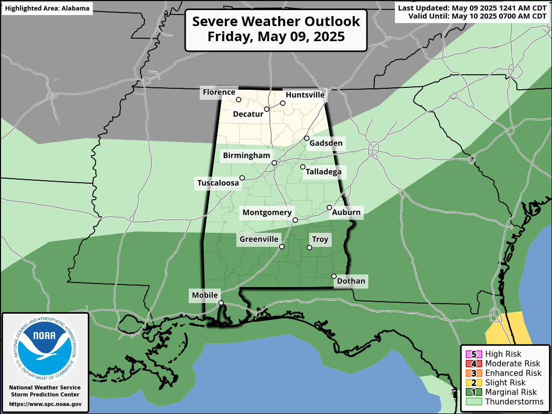
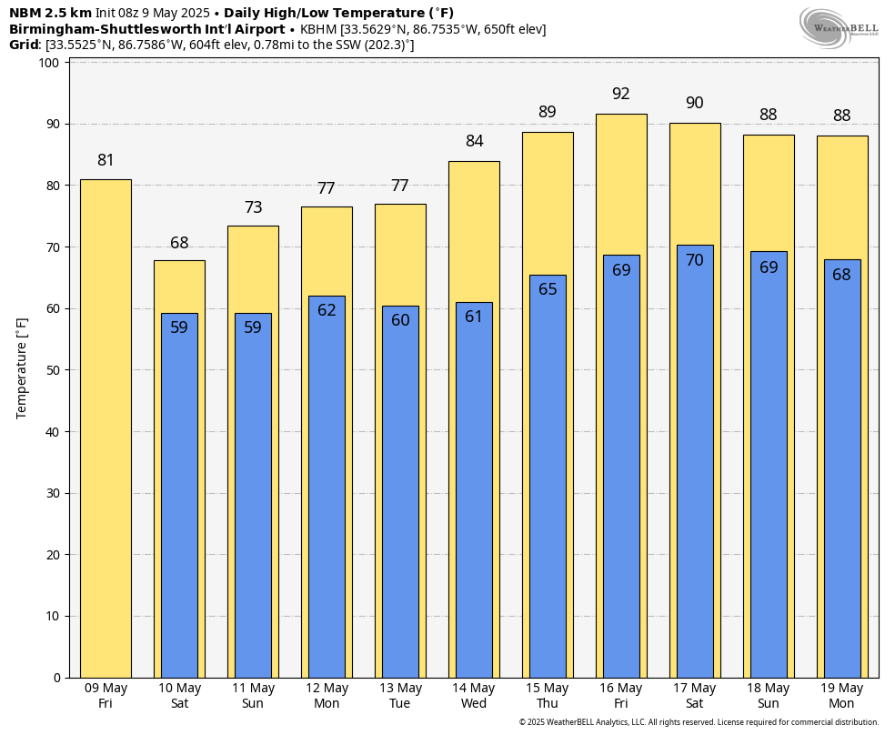
An upper trough will remain positioned west of Alabama over the weekend, and we will forecast periods of rain tomorrow, Sunday, and Monday. Understand the weekend won’t be a total wash-out, and the sun will peek out at times. But if you have something planned outdoors just understand it will rain at times. Some thunder is possible, and SPC has parts of South and West Alabama in a “marginal risk” Sunday afternoon for the potential of small hail and gusty winds. Highs tomorrow will be in the 67-74 degree range, and in the 70s on Sunday.
Rain amounts between now and Monday will be in the 2-3 inch range for much of the state; amounts will be bit lower over the Tennessee Valley with 1-2 inches there.
REST OF NEXT WEEK: We will maintain some risk of showers on Tuesday, especially over the northern half of Alabama. Then, an upper ridge develops over the region which will bring dry and much warmer weather over the latter half of the week. Most places will reach the low 90s by Friday for a good preview of summer… See the video briefing for maps, graphics, and more details.
ON THIS DATE IN 1933: An estimated F4 tornado moved through Monroe, Cumberland, and Russell Counties in Kentucky along a 60-mile path. The town of Tompkinsville, KY was the hardest hit with 18 people killed. Overall, 36 people lost their lives.
ON THIS DATE IN 1995: An F3 tornado produced $10 million in damages along its 40-mile path across central Illinois. The tornado caused significant damage in Cantrall where three homes were destroyed, 10 had significant damage, and 11 had minor damage. The roof and interior of a grade school suffered extensive damage. The tornado passed about 2 miles southeast of the new NWS Office in Lincoln, Illinois.
Look for the next video briefing here by 3:00 this afternoon… enjoy the day!
Category: Alabama's Weather, ALL POSTS, Weather Xtreme Videos
About the Author (Author Profile)
James Spann is one of the most recognized and trusted television meteorologists in the industry. He holds the AMS CCM designation and television seals from the AMS and NWA. He is a past winner of the Broadcast Meteorologist of the Year from both professional organizations.Subscribe
If you enjoyed this article, subscribe to receive more just like it.


