Midday Nowcast: Wet at Times Through the Weekend
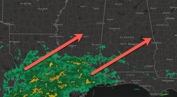
WET AT TIMES: The upper trough continues to remain a player in our weather, along with a surface low moving onshore along the Northwestern Gulf Coast. Widespread rain and storms are spreading northward from the Coast and clouds and rain will become widespread later this evening, overnight, and into tomorrow.
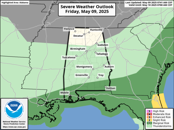
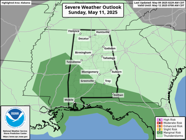
A few strong storms are possible, but the severe weather threat is very low. Any strong storms will produce gusty winds and hail and a few isolated severe storms are possible any day.
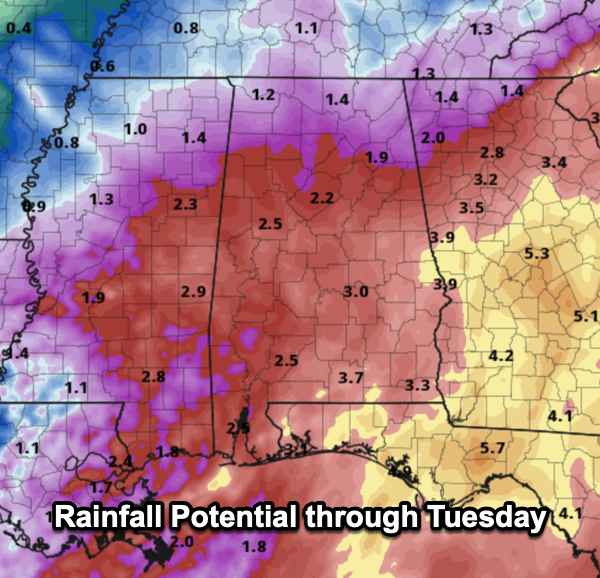
Highs will hold in the 60s and 70s due to the clouds and rain. Additional rain amounts through Monday will be in the 1-2 inch range for northern portions of Alabama, but heavier amounts are possible mainly over the southern part of the state, where some spots could see 2-4 inches.
BIRMINGHAM ALMANAC: For May 9th, the average high for Birmingham is 80° and the average low is 59°. The record high is 94° set in 1962, while the record low is 40° set in 1984. We average 0.16” of precipitation on this date and the record value is 2.00” set in 1998.
NEXT WEEK: The week looks to start off with continued showers in the forecast at least for Monday and Tuesday. Then the weather will trend drier and warmer over the latter half of next week as an upper ridge builds; it looks like many locations by the end of the week will see highs approaching the lower 90s and it will be humid, so it will be a summer preview for sure across Alabama.
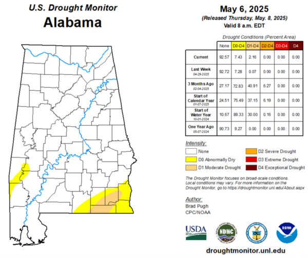
DROUGHT MONITOR: The latest drought monitor released yesterday. Some changes in drought conditions in Alabama. Abnormally Dry conditions have slightly increased to 7.43% of state, up from 7.28% last week. This includes areas of Southwest Alabama including portions of Choctaw, Washington, Clarke, and Marengo Counties. In Southeast Alabama, the Wiregrass Region, portions of Covington, Geneva, Coffee, Dale, Henry, and Houston counties are experiencing these conditions. Moderate drought has increased to 2.16% of the state, up from 0.07% last week. These conditions are affecting portions of Geneva, Covington, Dale, Coffee, Houston, Henry counties.
WORLD TEMPERATURE EXTREMES: Over the last 24 hours, the highest observation outside the U.S. was 112.6F at Chauk, Myanmar. The lowest observation was -92.4F at Concordia, Antarctica.
CONTIGUOUS TEMPERATURE EXTREMES: Over the last 24 hours, the highest observation was 103F at Death Valley, CA. The lowest observation was 16F at Peter Sinks, UT.
Category: Alabama's Weather, ALL POSTS, Social Media
About the Author (Author Profile)
Macon, Georgia Television Chief Meteorologist, Birmingham native, and long time Contributor on AlabamaWX. Stormchaser. I did not choose Weather, it chose Me. College Football Fanatic. @Ryan_StinnetSubscribe
If you enjoyed this article, subscribe to receive more just like it.


