Midday Nowcast: Still Hazy Today; Rain Chances Begin to Increase Tomorrow
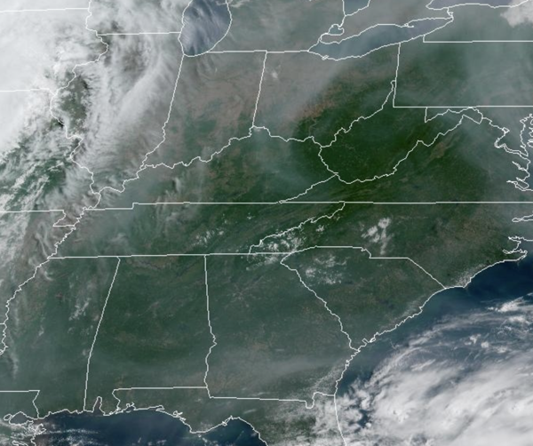
HAZY AND DRY: Today is generally dry, very warm, and hazy again due to the Canadian wildfires. Highs are in the upper 80s and lower 90s this afternoon across the state. Moisture levels begin to increase tomorrow, and we are will begin to mention the chance for some scattered afternoon and evening showers and storms. The higher rain chances will be the farther south you are in the state as tropical moisture surges north from the Gulf of Mexico as well as moves in from the southeast off the Atlantic. Highs tomorrow will be in the mid to upper 80s.
BIRMINGHAM ALMANAC: For June 3rd, the average high for Birmingham is 87° and the average low is 64°. The record high is 99° set in 1985, while the record low is 47° set in 1956. We average 0.15” of precipitation on this date and the record value is 1.46” set in 1909.
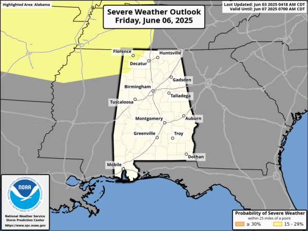
THURSDAY/FRIDAY: We are forecasting a mix of sun and clouds, with scattered, mainly afternoon and evening showers and storms expected with highs in the mid to upper 80s. Rain chances will be in the 40-50% range both days. We note late Friday, severe weather is expected north and west of Alabama, and some of those storms could make it into the Northwest corner of the state where the SPC has a risk of severe storms.
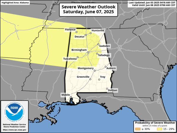
WET WEEKEND WEATHER: The weekend is looking rather wet and unsettled as a surface front approaches from the north. The proximity of the front and the high moisture levels means scattered to numerous showers and thunderstorms are in the forecast both Saturday and Sunday. Not a total wash-out, and the sun will peek out at times, but you will definitely want to keep the rain gear close. Highs over the weekend will be in the 80s. We also note the Storm Prediction Center has defined a risk of severe storms for Alabama due to the potential of hail and strong, gusty winds.
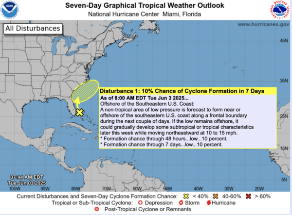
IN THE TROPICS: Offshore of the Southeastern U.S. Coast, a non-tropical area of low pressure is forecast to form near or offshore of the southeastern U.S. coast along a frontal boundary during the next couple of days. If the low remains offshore, it could gradually develop some subtropical or tropical characteristics later this week while moving northeastward at 10 to 15 mph. Formation chance through 48 hours…low…10 percent. Formation chance through 7 days…low…10 percent.
WORLD TEMPERATURE EXTREMES: Over the last 24 hours, the highest observation outside the U.S. was 118.4F at Sibi, Pakistan. The lowest observation was -104.1F at Vostok, Antarctica.
CONTIGUOUS TEMPERATURE EXTREMES: Over the last 24 hours, the highest observation was 109F at Death Valley, CA. The lowest observation was 19F at White Sulphur Springs, MT.
Category: Alabama's Weather, ALL POSTS, Social Media
About the Author (Author Profile)
Macon, Georgia Television Chief Meteorologist, Birmingham native, and long time Contributor on AlabamaWX. Stormchaser. I did not choose Weather, it chose Me. College Football Fanatic. @Ryan_StinnetSubscribe
If you enjoyed this article, subscribe to receive more just like it.


