Isolated Showers Tomorrow/Friday; A Few Strong Storms Over The Weekend
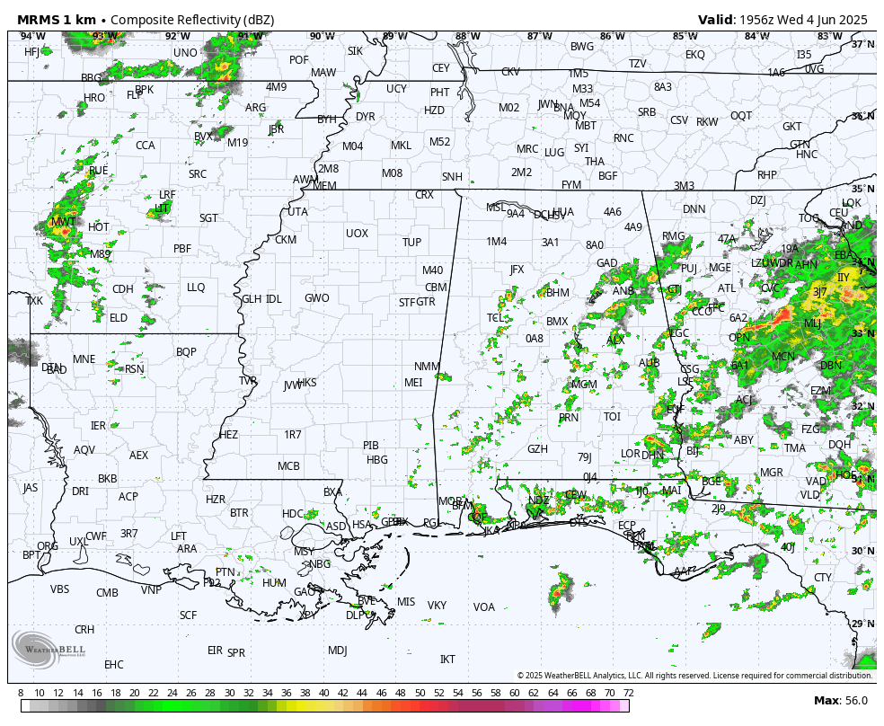
RADAR CHECK: We have a classic case of scattered, random scattered showers and thunderstorms across Alabama this afternoon. Showers are a little more numerous over the eastern half of the state, and they are moving westward on top of an upper low over the Northeast Gulf. Showers will fade after sunset; the low tonight will be in the 65-72 degree range.
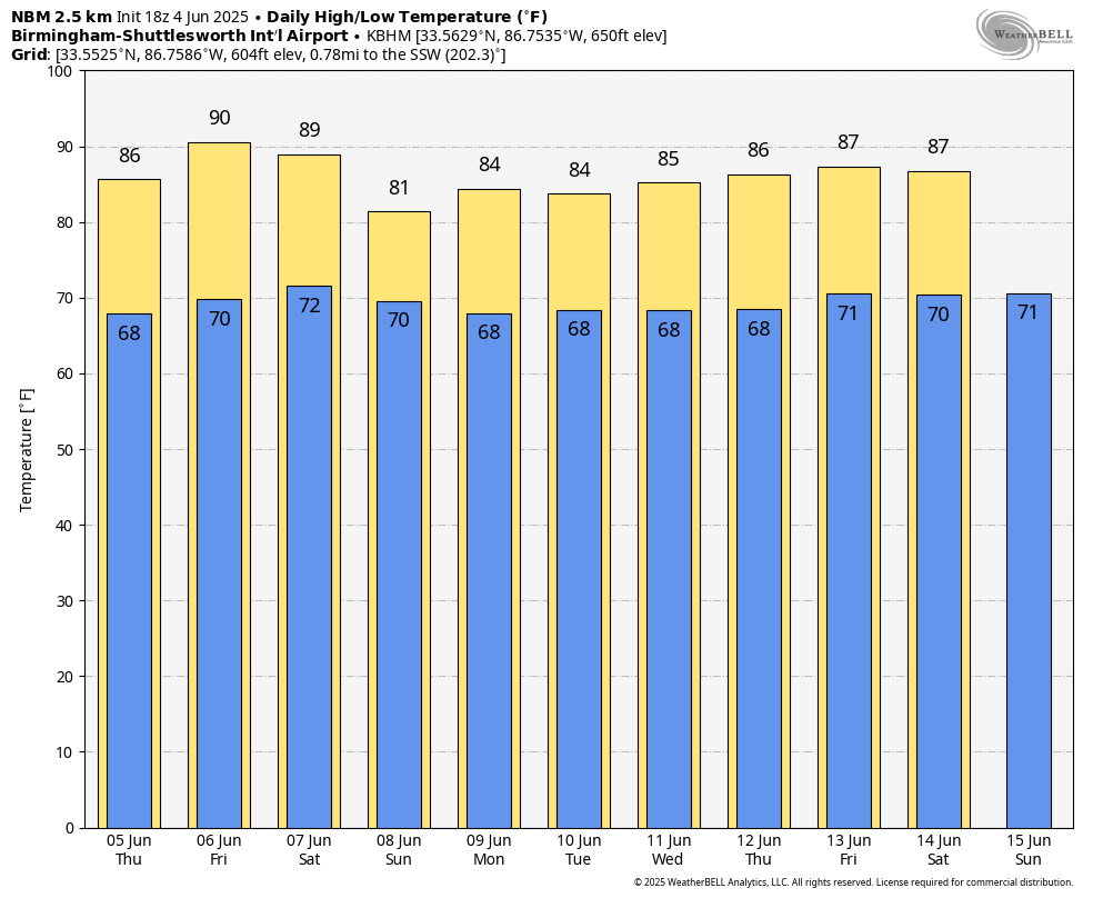
TOMORROW/FRIDAY: A very routine June pattern will continue tomorrow and Friday across the Deep South. Partly sunny days, highs in the mid to upper 80s, and the risk of a passing afternoon shower or storm in a few spots. The chance of any one specific spot seeing a shower or storm will be in the 20-30 percent range daily, mainly between 2:00 and 10:00 p.m.
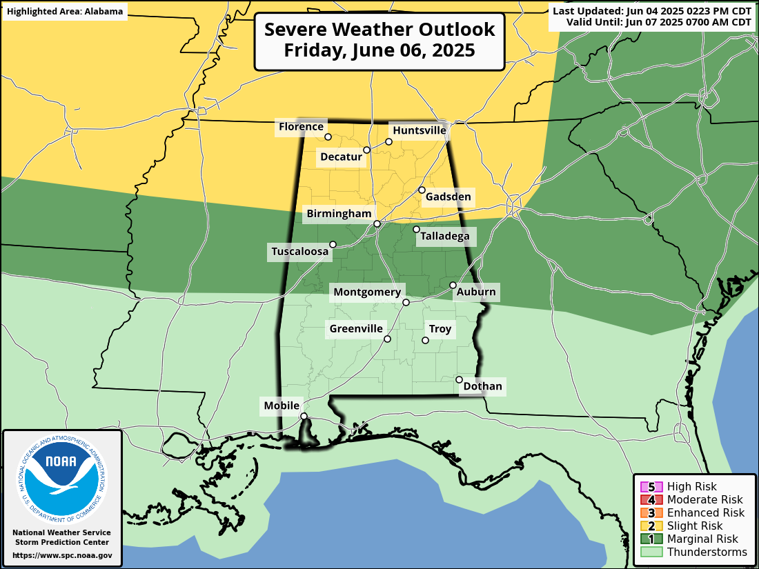
We note SPC has North Alabama in a severe weather risk on Friday; a surface front will be positioned just to the north, and storms that form could produce strong, gusty winds. Thankfully we are out of tornado season, and wind profiles don’t favor any tornado risk here. Showers and storms will be fewer in number over the southern counties of the state.
THE ALABAMA WEEKEND: The front will stay parked just to the north, and we will maintain the chance of scattered showers and thunderstorms Saturday and Sunday. The weekend won’t be a wash-out, and the sun will be out at times. Just expect a passing shower or storm from time to time, and like Friday, where the storms form they could be heavy with potential for strong, gusty winds. Highest coverage of showers will be over the northern half of the state, and highs will be in the 80s.
NEXT WEEK: The weather will be pretty much what we expect in June in Alabama. Partly sunny, warm, humid days with the chance of “scattered, mostly afternoon and evening showers and thunderstorms” through the week. Highs remain in the 80s. See the video briefing for maps, graphics, and more details.
TROPICS: All is quiet and tropical storm formation is not expected across the Atlantic basin over the next seven days.
ON THIS DATE IN 1995: Category one Hurricane Allison made landfall in the Big Bend area of Florida before tracking northward as an extratropical system. Several tornadoes touched down in Georgia; the most significant of the tornadoes touched down in the town of St. Marys. An elementary school was destroyed and significant damage was also reported to several buildings at the Kings Bay Naval Submarine Base.
Look for the next video briefing here by 6:00 a.m. tomorrow…
Category: Alabama's Weather, ALL POSTS, Weather Xtreme Videos
About the Author (Author Profile)
James Spann is one of the most recognized and trusted television meteorologists in the industry. He holds the AMS CCM designation and television seals from the AMS and NWA. He is a past winner of the Broadcast Meteorologist of the Year from both professional organizations.Subscribe
If you enjoyed this article, subscribe to receive more just like it.


