Major Heat Wave Ahead: Hot Temperatures & High Humidity Grip Alabama
CRANKING UP THE HEAT & HUMIDITY THIS WEEKEND
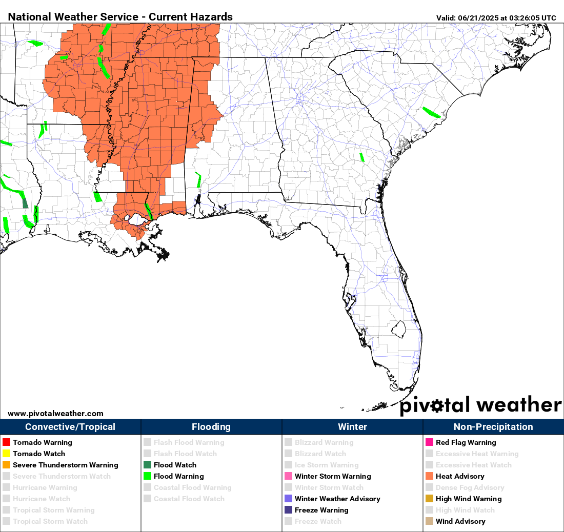
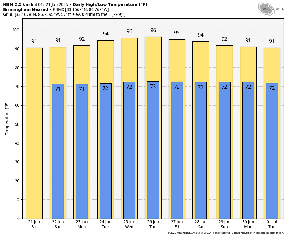
Today brings the start of a very hot and humid pattern across Alabama. With highs in the 90s and dewpoints in the low to mid 70s, it’s going to feel more like 100–107° in some spots. A Heat Advisory is in effect from noon to 7 PM for parts of the area, especially across western counties. A few isolated storms may pop up in the afternoon, but coverage will be low. Overnight lows won’t provide much relief, only dropping into the low to mid 70s. Highs will range from the upper 80s to mid 90s.
Sunday’s forecast looks very similar, with intense heat and limited storm activity. Afternoon highs will climb into the lower to mid 90s, and it will feel closer to 105° in some locations. Another Heat Advisory may be needed if conditions remain on track. Afternoon storms will be few and far between, and overnight lows will again stay muggy in the 70s. Highs will reach the lower to mid 90s.
SCORCHING, STICKY SUMMER SURGE
Monday brings even more heat. High pressure remains firmly in control, locking in a tropical airmass with high humidity and very little cloud cover. The heat index will once again push 105° in many areas, and the air will feel heavy and uncomfortable throughout the day. Isolated storms are possible, but like recent days, most locations will stay dry. Highs will hold in the lower to mid 90s.
Tuesday kicks off the peak of this upcoming heat wave. Forecast models show strong upper-level ridging strengthening over the Southeast, pushing high temperatures and heat indices well into dangerous territory. We’re looking at highs in the mid 90s, with heat index values topping 105° in many areas — possibly higher. This type of heat can be dangerous if precautions aren’t taken. Highs will be in the lower to mid 90s.
Wednesday will likely be one of the hottest days of the year so far. That ridge overhead may reach near-record strength, suppressing any real chance for widespread showers and allowing heat to build unchecked. Urban areas may hit the Extreme heat risk category, with heat indices exceeding 105–110° in places. Highs will soar into the mid to upper 90s.
Thursday doesn’t bring much relief. The heat dome remains in place, and storm chances stay very low under strong subsidence aloft. Dewpoints in the 70s combined with mid to upper 90s temperatures will once again create heat index values over 105°. It’s critical to practice heat safety during stretches like this. Highs will be in the mid to upper 90s.
Friday may bring a slight step back from peak heat, but don’t expect much change. High pressure is still in control, and humidity will still be high. Heat index values should still exceed 100° in many areas, especially west. Some models hint at a few more isolated storms, but the overall trend remains hot and dry. Highs will range from the lower to mid 90s.
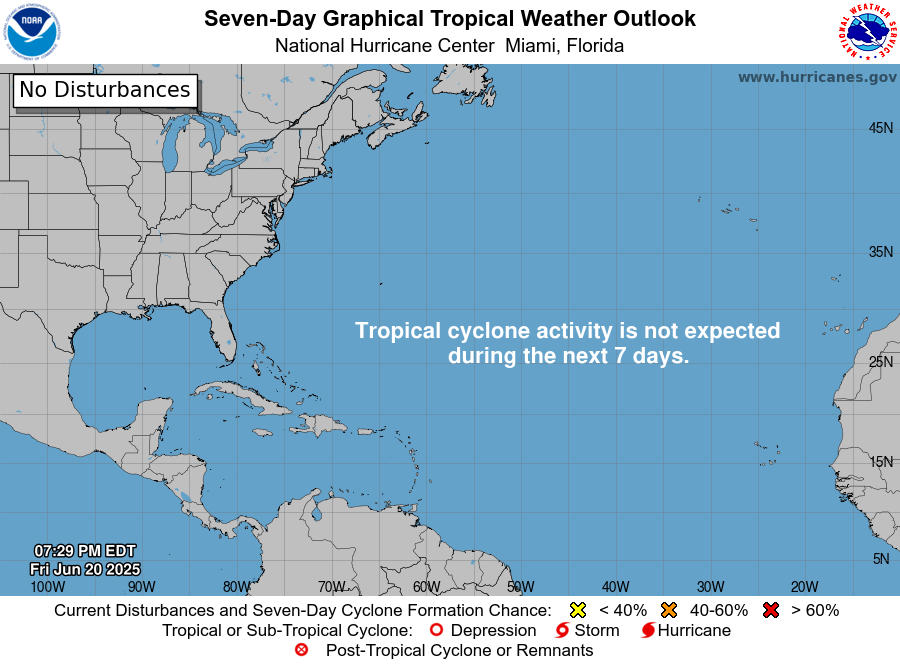
THE TROPICS
For the North Atlantic, Caribbean Sea, and the Gulf of Mexico: Tropical cyclone formation is not expected during the next 7 days.
Category: Alabama's Weather, ALL POSTS, Social Media, Tropical, Weather Xtreme Videos
About the Author (Author Profile)
Scott Martin is an operational meteorologist, professional graphic artist, musician, husband, and father. Not only is Scott a member of the National Weather Association, but he is also the Central Alabama Chapter of the NWA president. Scott is also the co-founder of Racecast Weather, which provides forecasts for many racing series across the USA. He also supplies forecasts for the BassMaster Elite Series events including the BassMaster Classic.Subscribe
If you enjoyed this article, subscribe to receive more just like it.


