Midday Nowcast: Greetings from a Refreshing Boise; Heat, Humidity, Daily Storms Back in Alabama
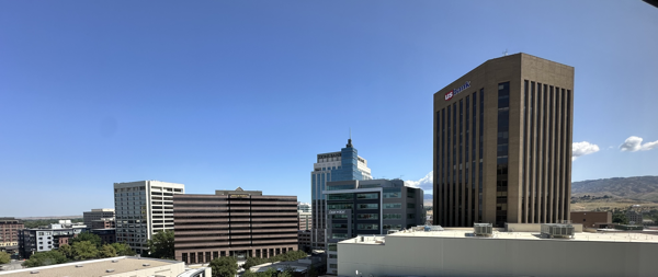
Greetings from Boise, Idaho!!! I am here attending the 52nd Conference on Broadcast and Digital Meteorology and the 21st Conference on Mesoscale Processes. It is our big annual meeting where we learn more about the wonderful world of meteorology. The weather here is amazing today…morning low of 48° and the dew point is in the 30s. It feels amazing and I am enjoying it. It will be October or November before I feel temps like this again in the Deep South.
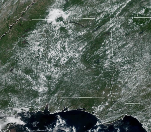
Now back in Alabama, it is heat, humidity, and daily storms during the afternoon and evening hours. Each day this week will feature a mix of sun and clouds, expect highs in the mid 90s for many locations, while those heat index values will be in the low 100s. These will reach the danger range of 105° in some spots and a heat advisory has been issued for portions for Alabama today, and will likely be expanded through out the week. Storms will be few and far between the next few days, but they will be out there, mainly during the peak heating of the day, 2PM-10PM.
BIRMINGHAM ALMANAC: For June 23rd, the average high for Birmingham is 89° and the average low is 70°. The record high is 100° set in 1897, while the record low is 48° set in 1972. We average 0.16” of precipitation on this date and the record value is 4.11” set in 1900.
ACROSS THE USA: Extreme Heat Risk impacts will expand from the Midwest into the Mid-Atlantic and Northeast today. This level of Heat Risk is known for being rare and/or long duration with little to no overnight relief, and affects anyone without effective cooling and/or adequate hydration. Severe weather potential continues from the Great Lakes to the Central Plains today. Heavy rainfall for Southwest on Tuesday.
FRIDAY AND THE WEEKEND: The strong upper ridge will weaken. This opens for door for an increase in the number of afternoon/evening showers and thunderstorms, and lower heat levels. Highs drop into the upper 80s and lower 90s with a mix of sun and clouds daily. Chance of any one location seeing rain each day rises to the 40-50% range.
NEXT WEEK: Temperatures could be a little below average next week with highs in the upper 80s in many areas, otherwise pretty routine summer weather is the story with partly sunny days along with afternoon and evening showers and thunderstorms.
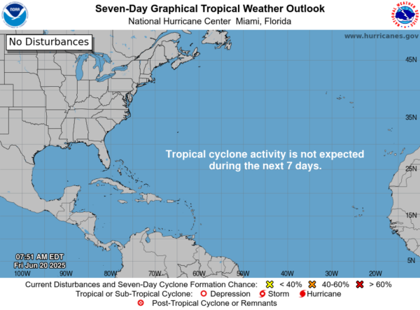
IN THE TROPICS: Central Subtropical Atlantic (AL90): Satellite images indicate that disorganized showers and thunderstorms are displaced to the east of an area of low pressure located about 600 miles east of Bermuda. Environmental conditions are still marginally favorable for further development, and an increase in thunderstorm activity could result in the formation of a short-lived tropical depression today. By Tuesday, this system is expected to encounter less favorable environmental conditions, ending its opportunity for development. The system is forecast to move northeastward around 10 mph, remaining over the open central Atlantic. Formation chance through 48 hours…high…70 percent. The rest of the Atlantic is quiet.
WORLD TEMPERATURE EXTREMES: Over the last 24 hours, the highest observation outside the U.S. was 118.0F at Adam Airport, Oman. The lowest observation was -94.0F at Vostok, Antarctica.
CONTIGUOUS TEMPERATURE EXTREMES: Over the last 24 hours, the highest observation was 104F at St. Francis, KS. The lowest observation was 19F at Peter Sinks, UT.
Category: Alabama's Weather, ALL POSTS, Social Media
About the Author (Author Profile)
Macon, Georgia Television Chief Meteorologist, Birmingham native, and long time Contributor on AlabamaWX. Stormchaser. I did not choose Weather, it chose Me. College Football Fanatic. @Ryan_StinnetSubscribe
If you enjoyed this article, subscribe to receive more just like it.


