Hot, Humid Summer Weather With A Few Afternoon Storms
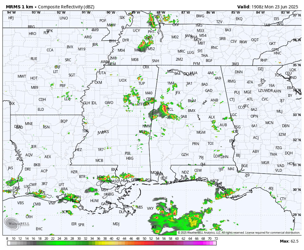
RADAR CHECK: We have your classic case of random, scattered showers and thunderstorms across Alabama this afternoon; they are moving westward and will dissipate after dark. Away from the showers, temperatures are mostly in the 90-94 degree range.
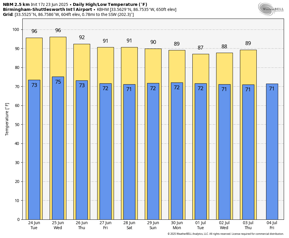
Hot, humid summer weather continue through mid-week. Partly to mostly sunny days, fair nights, and the usual risk of a pop-up afternoon thunderstorm in a few spots. Most of the storms will come from 2:00 until 9:00 p.m… and the chance of any one spot getting wet remains in the 20/30 percent range tomorrow and Wednesday, then 30/40 percent Thursday. Afternoon temperatures stay into the low to mid 90s.
FRIDAY AND THE WEEKEND: The strong upper ridge will weaken. This opens for door for an increase in the number of afternoon/evening showers and thunderstorms, and lower heat levels. Highs drop into the 88-93 degree range with a mix of sun and clouds daily. Chance of any one location seeing rain each day rises to 40/50 percent.
NEXT WEEK: Temperatures could be a little below average next week with highs in the upper 80s in many areas, otherwise pretty routine summer weather is the story with partly sunny days along with afternoon and evening showers and thunderstorms. See the video briefing for maps, graphics, and more details.
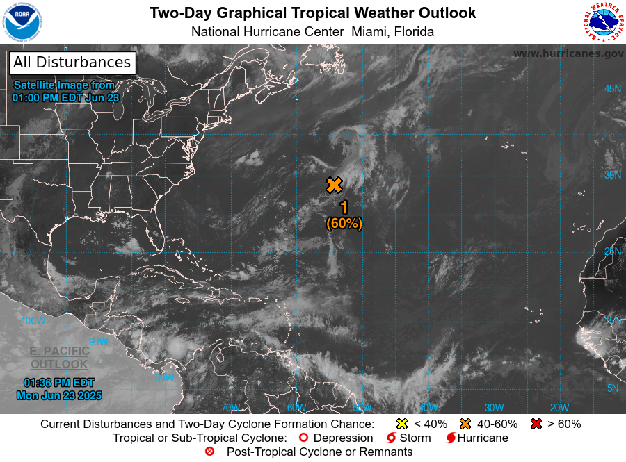
TROPICS: Recent satellite data indicates that the low pressure system located more than 600 miles east-northeast of Bermuda is producing gale-force winds. However, the shower and thunderstorm activity remains disorganized. Environmental conditions are still marginally favorable for further development, and an increase in thunderstorm activity could result in the formation of a short-lived tropical depression or tropical storm today or tonight.
By tomorrow, this system is expected to encounter unfavorable environmental conditions, ending its opportunity for development. The system is forecast to move northeastward around 10 to 15 mph, remaining over the open central Atlantic. NHC gives it a 60 percent chance of becoming a brief depression or storm tonight. This will remain over open water far from land, and the rest of the Atlantic basin is very calm.
ON THIS DATE IN 1944: An outbreak of violent tornadoes across eastern Ohio, northern West Virginia, and western Pennsylvania. Thirty people were killed in Shinnston WV, which was leveled. A total of 154 people were killed and 966 were injured. The tornadoes defied previous meteorological thought by crossing mountainous terrain. A family of tornadoes killed thirty people along an 85-mile path from near Wellsburg, WV to near Uniontown, Maryland. As many as four violent tornadoes were on the ground simultaneously during the evening hours. The most devastating tornado of the evening was an F4 monster that carved a sixty-mile path from near Pine Grove to near Alpena. One hundred people died in this tornado, including thirty at Shinnston.
Look for the next video briefing here by 6:00 a.m. tomorrow…
Category: Alabama's Weather, ALL POSTS, Weather Xtreme Videos
About the Author (Author Profile)
James Spann is one of the most recognized and trusted television meteorologists in the industry. He holds the AMS CCM designation and television seals from the AMS and NWA. He is a past winner of the Broadcast Meteorologist of the Year from both professional organizations.Subscribe
If you enjoyed this article, subscribe to receive more just like it.


