A Few Storms Tonight; Typical Summer Weather For The Weekend
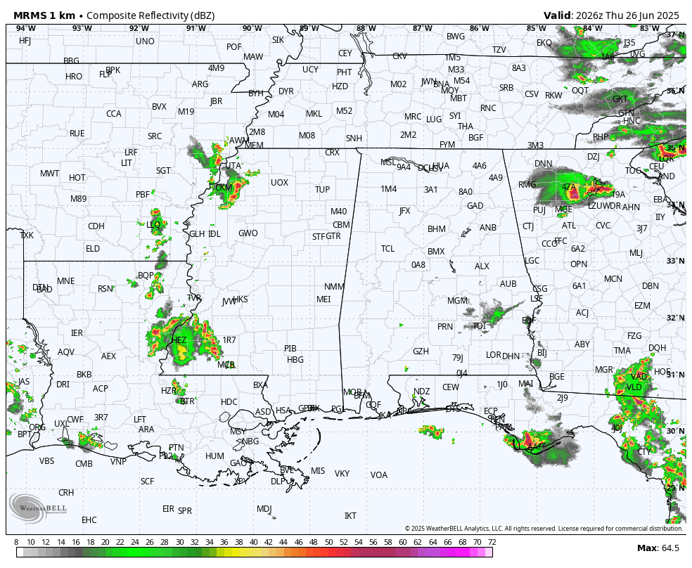
RADAR CHECK: Showers are almost impossible to find across Alabama this afternoon; the rain overnight last night and early this morning helped to stabilize the atmosphere. Heat levels are also down; many communities are only in the mid to upper 80s with a partly to mostly sunny sky. We are watching stronger storms over North Georgia; some of those will likely move into Alabama this evening.
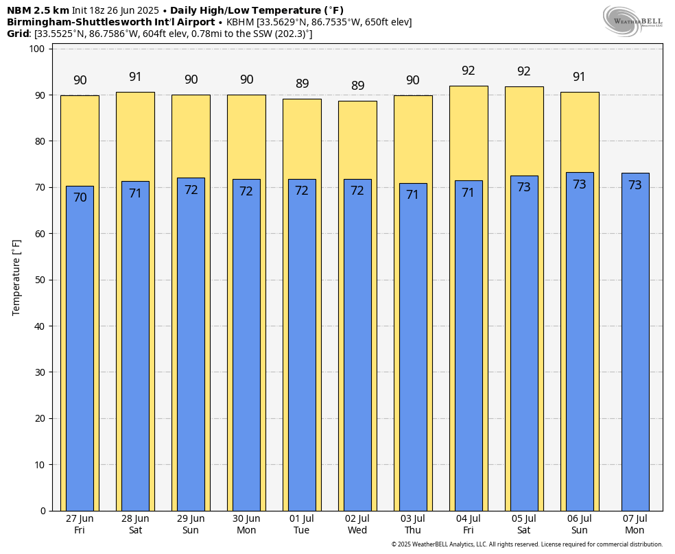
TOMORROW AND THE WEEKEND: The summer mix of sun and storms will continue. Best chance of a passing shower or storm will come during the afternoon and evening hours, and the chance of any one spot getting wet each day is 55-65 percent. Afternoon highs will be in the 88-92 degree range, which is just what we expect in late June in Alabama.
NEXT WEEK: The summer pattern will stay in place through the week and into the Fourth of July weekend. Each day we will have a mix of sun and clouds with scattered showers and thunderstorms, mainly in the 1:00-10:00 p.m. time frame. Highs will remain in the upper 80s and low 90s for most communities… See the video briefing for maps, graphics, and more details.
TROPICS: The Atlantic basin remains very calm. Tropical storm/hurricane formation is not expected for at least the next seven days.
ON THIS DATE IN 1986: Hurricane Bonnie made landfall on the upper Texas coast. A wind gust to 98 mph occurred at Sea Rim State Park. Ace, Texas recorded a total of 13 inches of rain.
Look for the next video briefing here by 6:00 a.m. tomorrow…
Category: Alabama's Weather, ALL POSTS, Weather Xtreme Videos
About the Author (Author Profile)
James Spann is one of the most recognized and trusted television meteorologists in the industry. He holds the AMS CCM designation and television seals from the AMS and NWA. He is a past winner of the Broadcast Meteorologist of the Year from both professional organizations.Subscribe
If you enjoyed this article, subscribe to receive more just like it.


