Showers/Storms Likely Later Today; Drier Air Begins To Arrive Tomorrow
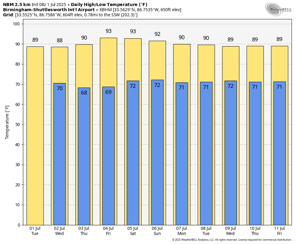
RADAR CHECK: Showers are isolated across Alabama early this morning, but a number of showers and thunderstorms will form across the state later today and tonight ahead of a surface front. SPC maintains a “marginal risk” of severe storms for most of the state today; heavier storms will be capable of producing strong wind gusts, heavy rain, lots of lightning, and possibly some small hail. The high today will be in the 86-90 degree range for most communities.
Drier air begins to push into the Deep South late tonight, and tomorrow showers will be confined to the southern third of the state. And, even there they should be widely scattered. With a partly sunny sky the high will be close to 90 degrees.
THURSDAY THROUGH THE WEEKEND: Global models continue to suggest an unusually dry airmass for summer will settle in here, meaning mostly sunny days, fair nights, slowly rising heat levels, and lower humidity levels for the Fourth of July holiday weekend. Highs rise into the low 90s, and showers will be very hard to find statewide. A few showers could pop up Sunday afternoon as moisture levels begin to rise again, but they should be widely spaced.
NEXT WEEK: Moisture levels will continue to slowly rise, and the week will feature very routine summer weather. Partly sunny days with “scattered, mostly afternoon and evening showers and thunderstorms”. Highs will be close to 90 degrees… See the video briefing for maps, graphics, and more details.
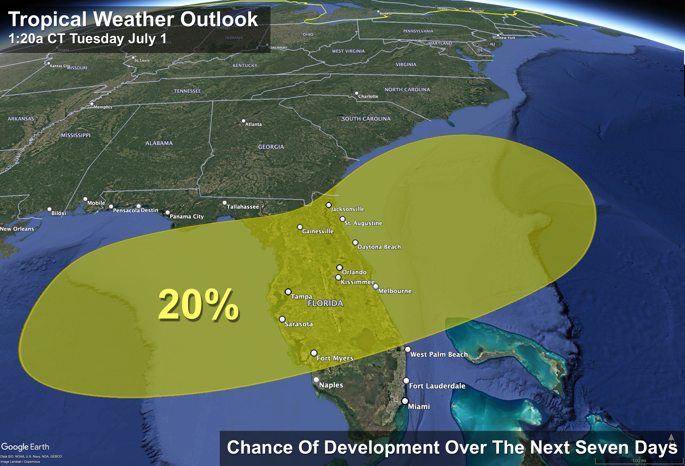
TROPICS: A frontal boundary is expected to stall and weaken off the southeast U.S. coast late this week. An area of low pressure could develop from the weakening front by the weekend over the Atlantic waters off the southeast U.S., over Florida, or over the eastern Gulf. Some gradual tropical or subtropical development could occur thereafter as the low moves little.
Global models are not bullish on development, and NHC gives it only a 20 percent chance of becoming a depression or storm. Don’t let this impact a planned trip to the Gulf Coast; it is just something to watch for now.
The rest of the Atlantic basin remains very, very quiet.
ON THIS DATE IN 2002: San Antonio, Texas recorded 9.52 inches of rain on this day to set a new record for its greatest rainfall for the entire month of July.
ON THIS DATE IN 2024: Hurricane Beryl reached category five strength over the Caribbean with sustained winds of 160 mph; this was after making landfall on the island of Carriacou, Grenada, as a high-end Category 4 hurricane, causing total devastation.
Look for the next video briefing here by 3:00 this afternoon… enjoy the day!
Category: Alabama's Weather, ALL POSTS, Weather Xtreme Videos
About the Author (Author Profile)
James Spann is one of the most recognized and trusted television meteorologists in the industry. He holds the AMS CCM designation and television seals from the AMS and NWA. He is a past winner of the Broadcast Meteorologist of the Year from both professional organizations.Subscribe
If you enjoyed this article, subscribe to receive more just like it.


