Dry Air Settles Into Alabama And The Deep South
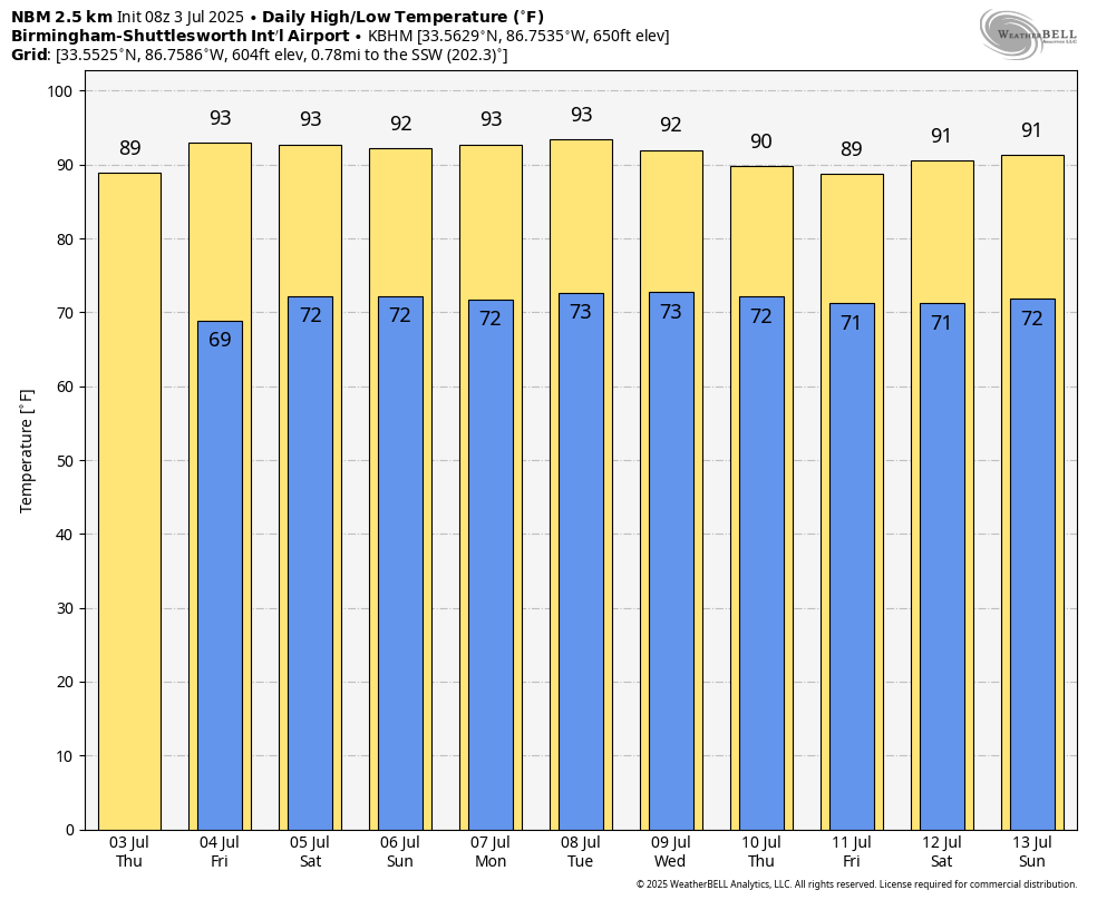
DRY PATTERN: An unusually dry airmass has dropped into the Deep South this morning. No rain across Alabama at daybreak, and we expect no rain through tonight. It is very hard to find a July day around here without at least a few afternoon and evening showers and thunderstorms. Today’s high will be close to 90, and with lower dewpoints the humidity levels will drop this afternoon.
TOMORROW AND THE WEEKEND: Expect partly to mostly sunny days, fair nights, and highs in the 90-95 degree range. While a small shower or two can’t be totally ruled out during the afternoon and evening evening hours, the chance of any one spot getting wet is only 10 percent tomorrow and Saturday, and 15-20 percent Sunday. You couldn’t ask for better weather for the Fourth of July holiday weekend.
NEXT WEEK: Showers will remain rather hard to find over the first half of the week, but we expect an increase in the number of showers and thunderstorms by Thursday and Friday as moisture levels rise and the air becomes unstable. Highs will be in the low 90s through Wednesday, followed by upper 80s Thursday and Friday. See the video briefing for maps, graphics, and more details.
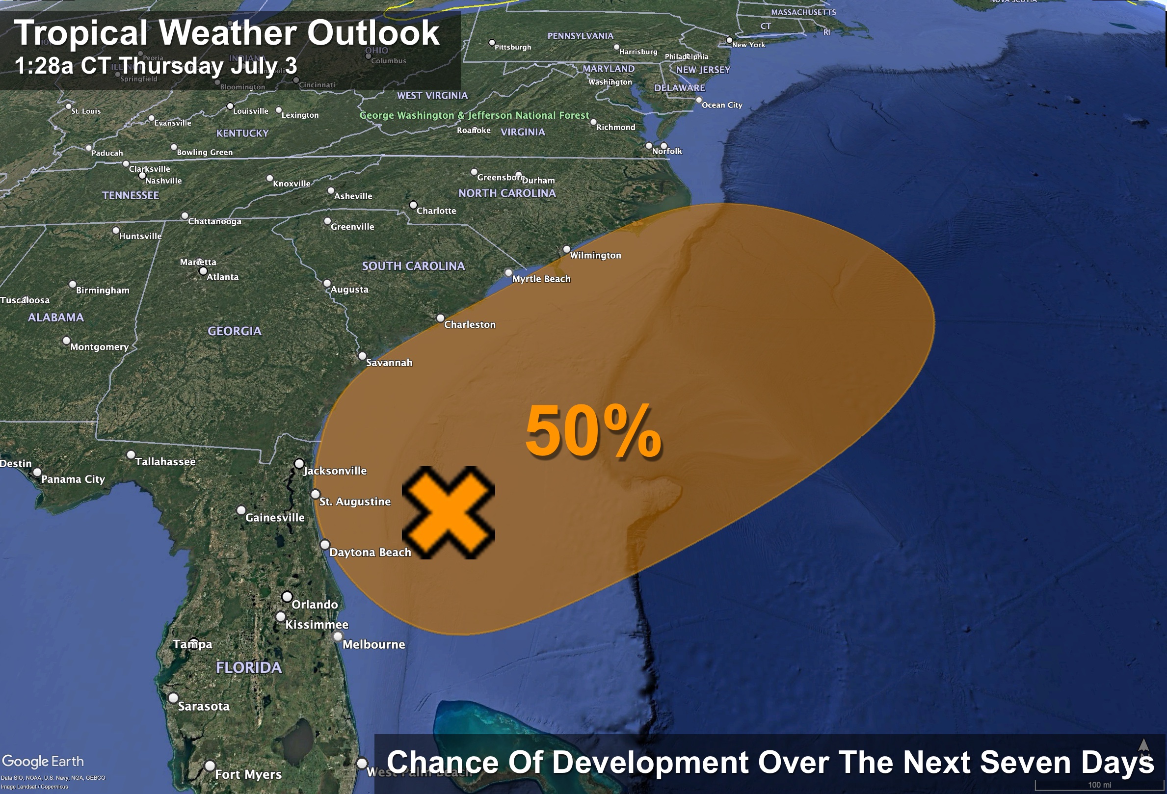
TROPICS: An area of low pressure is forecast to develop along a weakening frontal boundary near Florida or the Atlantic coast of the southeastern United States by early this weekend. Environmental conditions appear only marginally conducive for some slow development, but a tropical or subtropical depression could form in this region over the weekend or early next week while the system drifts northward or northeastward.
Regardless of development, heavy rainfall is possible across portions of the southeast U.S., particularly across the west-central Florida coast. NHC gives it a 50 percent chance of development in the Atlantic off the coast of FL/GA/SC.
This feature will not impact the Central Gulf Coast (Gulf Shores to Panama City Beach), where the weather looks very favorable for the holiday weekend. And, the rest of the Atlantic basin remains very quiet.
ON THIS DATE IN 1975: Up to 3 inches of rain caused flash flooding throughout Las Vegas, NV. The main damage occurred to vehicles at Caesars Palace with approximately 700 damaged or destroyed with several cars found miles away. North Las Vegas was hardest hit with $3.5 million in damage. Two people drowned in the flood waters.
Look for the next video briefing here by 3:00 this afternoon… enjoy the day!
Category: Alabama's Weather, ALL POSTS, Weather Xtreme Videos
About the Author (Author Profile)
James Spann is one of the most recognized and trusted television meteorologists in the industry. He holds the AMS CCM designation and television seals from the AMS and NWA. He is a past winner of the Broadcast Meteorologist of the Year from both professional organizations.Subscribe
If you enjoyed this article, subscribe to receive more just like it.


