Hot Humid Summer Weather; Isolated Storms This Afternoon
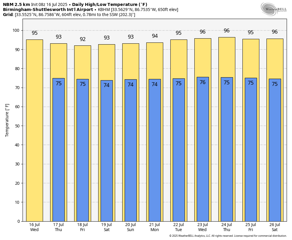
HOT: Temperatures will rise into the mid 90s across much of Alabama this afternoon with just a few isolated showers and storms around. Afternoon storms will be a little greater in number tomorrow and Friday as a broad tropical low moves into Louisiana, highest coverage will be over the southern counties. And, even there, it won’t rain everywhere.
THE ALABAMA WEEKEND: Pretty routine summer weather is the story for Saturday and Sunday. Hot, humid days with the risk of a passing afternoon shower or storm both days. Highest coverage of showers will likely be over the western half of the state; highs will be in the 91 to 94 degree range. We aren’t expecting much change through next week. Highs in the mid 90s on most days with a few spotty, random showers and storms around during the afternoon and evening hours. See the video briefing for maps, graphics, and more details.
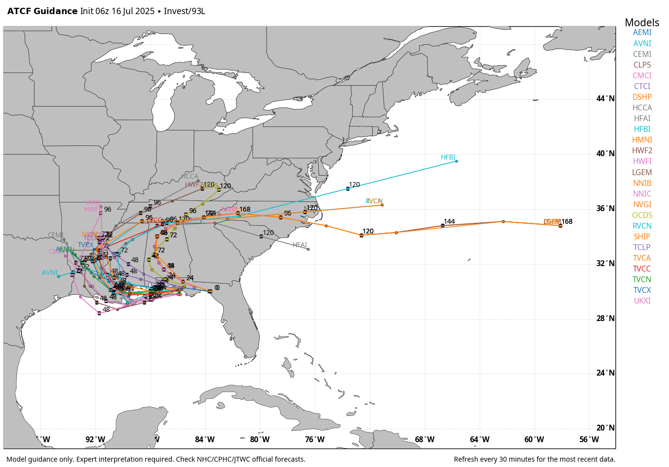
TROPICS: Surface observations indicate that a broad area of low pressure near Tallahassee is continuing to move westward across the Florida Panhandle. It is producing disorganized shower and thunderstorm activity mainly south of its center. This system is forecast to continue moving westward, and could emerge or redevelop over the far northeastern to north-central portion of the Gulf, reaching the coast of Louisiana tomorrow.
If this system moves far enough offshore, environmental conditions over the Gulf appear generally favorable for additional development, and a tropical depression could still form over the next couple of days before the system moves fully inland by the end of the week. NHC gives it a 40 percent of development.
For the central Gulf Coast (Gulf Shores to Panama City Beach), scattered storms could be a little more numerous today and tomorrow due to this feature, but you will still see good intervals of sunshine. The weather on the coast will be very routine by Friday and the weekend (sun + a few scattered storms). The main issue is a high danger of rip currents tomorrow and Friday.
The rest of the Atlantic basin remains very quiet.
ON THIS DATE IN 1979: The most damaging tornado in Wyoming history touched down 3 miles west-northwest of the Cheyenne airport. This strong tornado moved east or east-southeast across the northern part of Cheyenne, causing $22 million in damage and one fatality. 140 houses and 17 trailers were destroyed. 325 other homes were damaged. Four C-130 aircraft and National Guard equipment sustained $12 million damage. Municipal hangars and buildings suffered $10 million in losses.
ON THIS DATE IN 1980: Birmingham’s high was 105 degrees, the seventh consecutive day of triple digit heat as the generational heat of 1980 continued.
Look for the next video briefing here by 3:00 this afternoon… enjoy the day!
Category: Alabama's Weather, ALL POSTS, Weather Xtreme Videos
About the Author (Author Profile)
James Spann is one of the most recognized and trusted television meteorologists in the industry. He holds the AMS CCM designation and television seals from the AMS and NWA. He is a past winner of the Broadcast Meteorologist of the Year from both professional organizations.Subscribe
If you enjoyed this article, subscribe to receive more just like it.


