Humid Days, Hot Afternoons, A Few Showers/Storms
RADAR CHECK: Scattered to numerous showers and thunderstorms are moving northward across Alabama this afternoon… stronger storms are producing heavy rain and lots of lightning. Away from the showers we have a mix of sun and clouds with temperatures generally in the 88-92 degree range. Showers will end tonight after sunset.
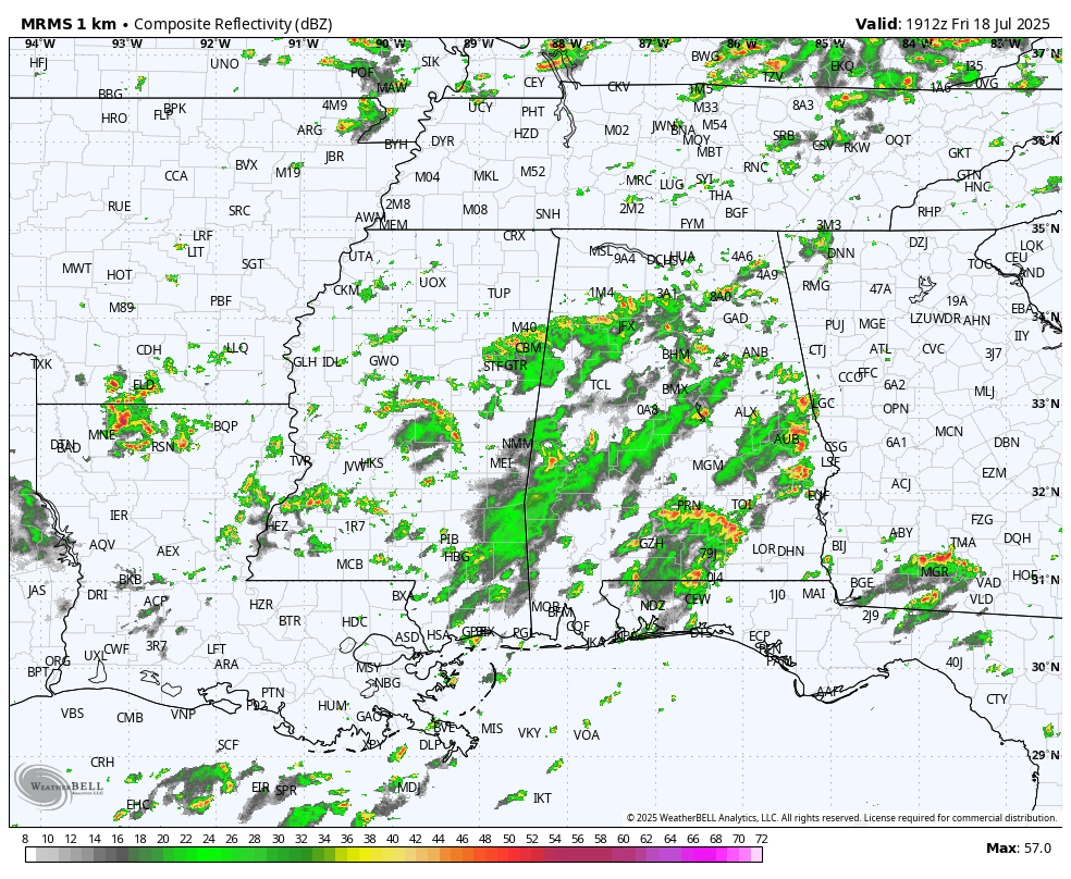
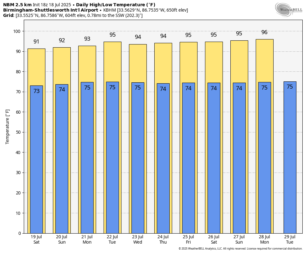
DOG DAYS: Our weather will be hot and humid for the foreseeable future with the usual risk of a pop up, splash and dash afternoon shower or thunderstorm in a few spots. Best chance of getting a cooling shower will come from around 1:00 until 10:00 p.m… odds for one given spot are 30-40 percent over the weekend.
Highs over the weekend will be generally in the low 90s. The upper ridge across the southern U.S. will strengthen a bit next week, which should help to push afternoon highs into the mid 90s. Afternoon showers and storms next week will be isolated… See the video briefing for maps, graphics, and more details.
TROPICS: The Atlantic basin remains very quiet, and tropical storm formation is not expected for at least the next seven days.
ON THIS DATE IN 1966: A storm system in north central and northeast Illinois led to widespread flooding. Aurora reported 16.94 inches of rain, establishing a state record for the most rain in a single day. Other heavy totals included 13.60 inches at Joliet, 9.24 inches in Wheaton, 8.09 inches in DeKalb, and 7.82 inches at Elgin. This event is often called “the second most damaging weather disaster in Illinois History.”
Look for my next video briefing here by 6:00 a.m. Monday… enjoy the weekend!
Category: Alabama's Weather, ALL POSTS, Weather Xtreme Videos
About the Author (Author Profile)
James Spann is one of the most recognized and trusted television meteorologists in the industry. He holds the AMS CCM designation and television seals from the AMS and NWA. He is a past winner of the Broadcast Meteorologist of the Year from both professional organizations.Subscribe
If you enjoyed this article, subscribe to receive more just like it.


