

Strong Storms across West-Central Alabama
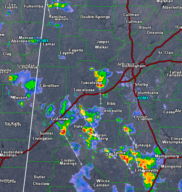
As we have headed through this afternoon, some intense thunderstorms have developed in scattered areas across western portions of the state.
These storms are not currently severe, but like we have seen over the past few days, torrential rain, gusty winds, hail and tremendous amounts of lightning are occurring with these storms. These storms could pulse up in intensity and reach severe limits at anytime with the greatest threat coming from damaging winds. Don’t forget that these storms pose a serious flash flooding threat as well.
Currently, the most intense storms are affecting portions of northeast Tuscaloosa County, near Burchfield, Kellerman, Abernant, Brookwood and Vance. These storms are moving to south-southeast this afternoon and will be impacting Interstate 20/59 and highways 11 & 5. They will be moving into Bibb County. If they hold together they will impact areas in Brent and Centreville.
Additional storms are to the south of these storms across portions of Greene, Hale, Perry, Dallas and Lowndes Counties.
Category: Alabama's Weather
About the Author (Author Profile)
Macon, Georgia Television Chief Meteorologist, Birmingham native, and long time Contributor on AlabamaWX. Stormchaser. I did not choose Weather, it chose Me. College Football Fanatic. @Ryan_StinnetSubscribe
If you enjoyed this article, subscribe to receive more just like it.


