

Clouds Slowly Increasing
An all new edition of the ABC 33/40 Weather Xtreme video is available in the player on the right sidebar of the blog. You can subscribe to the Weather Xtreme video on iTunes by clicking here.
THIS AFTERNOON: A veil of high, thin cirrus clouds is over Alabama this afternoon; temperatures are approaching the 50 degree mark in most spots.
Clouds will slowly thicken across Alabama during the next 24 hours, and a wave in the southern branch of the jet stream will bring rain to the southern quarter of the state tomorrow and tomorrow night. Best chance of rain will be south of U.S. 80… or south of a line from Demopolis to Selma to Montgomery to Opelika.
Up this way, the high tomorrow will be in the mid to upper 50s with some sun through the clouds at times.
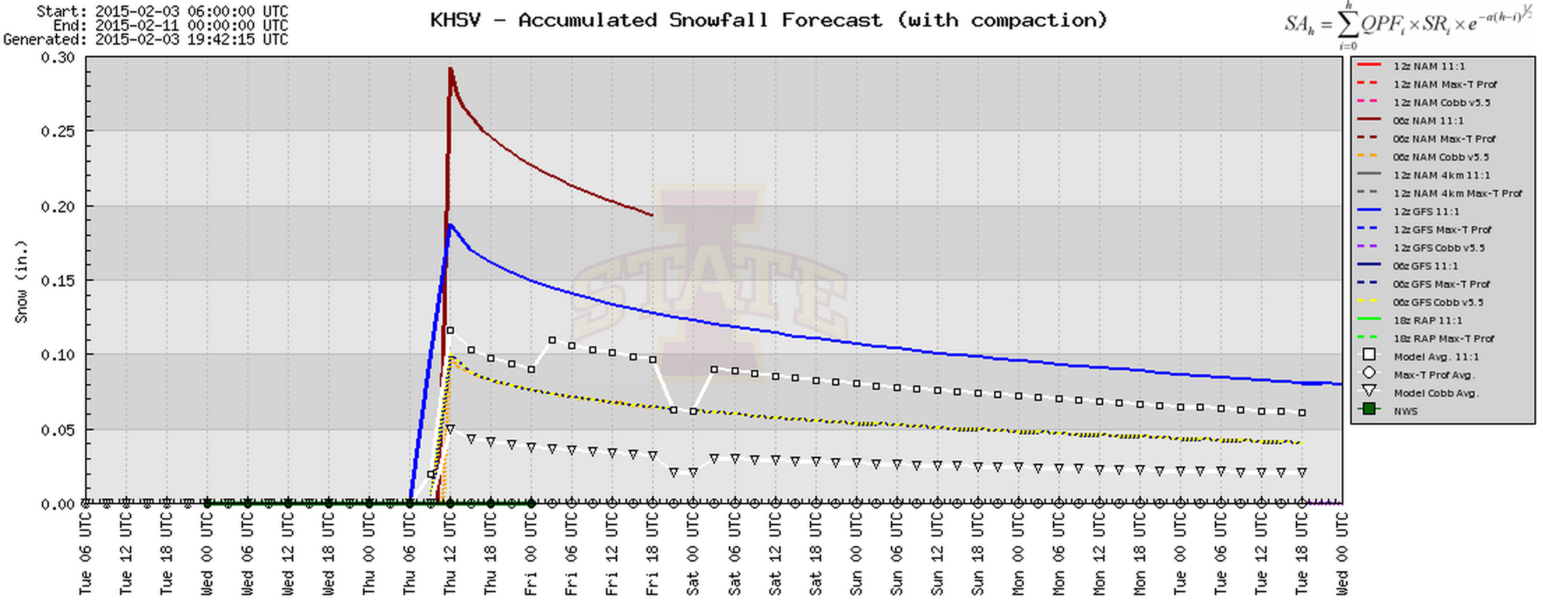
TOMORROW NIGHT/THURSDAY MORNING: A wave in the northern branch of the jet will bring some light snow to the Tennessee Valley of far North Alabama, with the window coming from about 2:00 a.m. until 8:00 a.m. Thursday. Some model guidance is now suggesting the potential of a little light accumulation in grassy areas across around the U.S. 72 corridor (Florence to Athens to Huntsville to Scottsboro), but major impacts are not expected for now. A slick spot on a bridge or two is not totally out of the question up that way with temperatures close to freezing by daybreak Thursday.
For Birmingham, Tuscaloosa, Anniston, and Gadsden, a few light snow flurries are possible early Thursday morning, but no impact. We expect gradual clearing during the day Thursday, and it will be colder with a high in the low 40s along with a chilly north wind.
FRIDAY/SATURDAY: These two days will feature a good supply of sunshine with a warming trend. After a low down in the mid 20s early Friday, we rise into the mid 50s Friday afternoon, and the high Saturday will be in the low 60s.
SUNDAY/MONDAY: A clipper will drag a surface front into Alabama Sunday afternoon; this might squeeze out a shower in a few spots, but moisture is very limited, and any rain should be light and spotty. The 12Z GFS keeps the front nearly stationary across Central Alabama Monday, and hints we might need to hang on to a small risk of a shower on Monday. Temperatures will be very pleasant with a high in the low 60s both days.
The rest of the week is looking dry and pleasant; see the Weather Xtreme video for maps, graphics, and more details.
WEATHER BRAINS: Don’t forget you can listen to our weekly 90 minute netcast anytime on the web, or on iTunes. This is the show all about weather featuring many familiar voices, including our meteorologists here at ABC 33/40.
CONNECT: You can find me on all of the major social networks…
Facebook
Twitter
Google Plus
Instagram
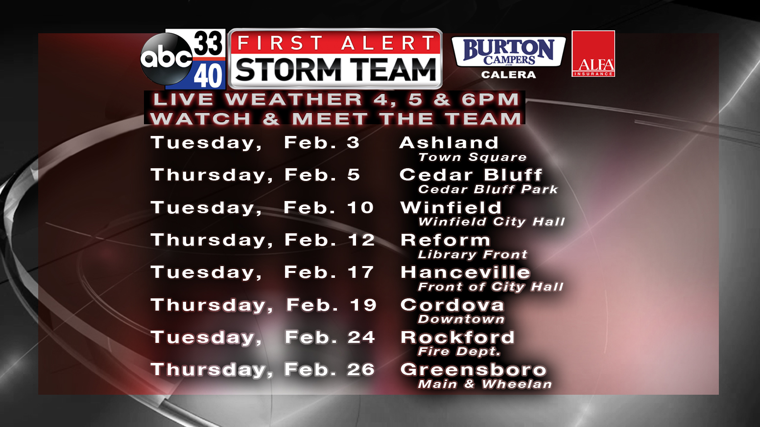
I enjoyed seeing the kids at Appalachain School in Blount County this morning… and don’t forget we will be in downtown Ashland this evening for the first stop on the First Alert Storm Team weather tour.
Look for the next Weather Xtreme video here by 7:00 a.m. tomorrow…
Category: Alabama's Weather
About the Author (Author Profile)
James Spann is one of the most recognized and trusted television meteorologists in the industry. He holds the AMS CCM designation and television seals from the AMS and NWA. He is a past winner of the Broadcast Meteorologist of the Year from both professional organizations.Subscribe
If you enjoyed this article, subscribe to receive more just like it.


