Unsettled Weather Continues Through Mid-Week
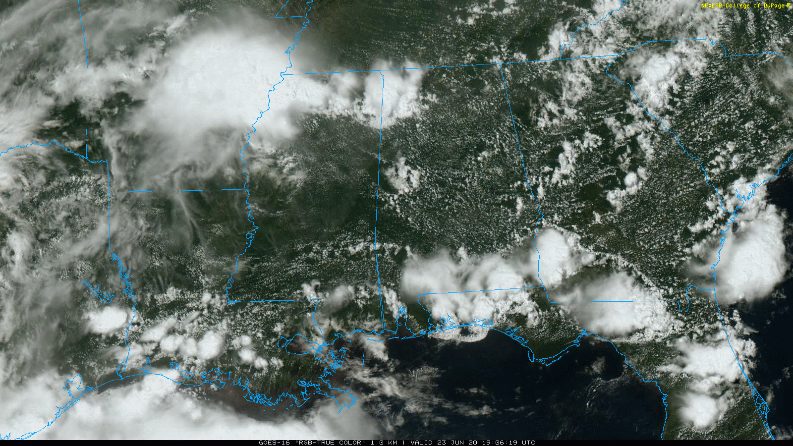
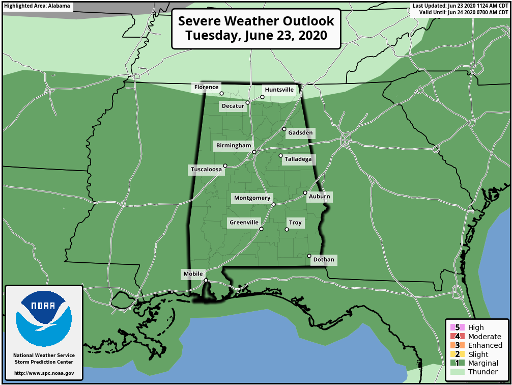
RADAR CHECK: A band of showers and strong thunderstorms is moving across Northwest Alabama at mid-afternoon, producing gusty winds, heavy rain, and frequent lightning. So far, they have been under severe limits, but SPC maintains a “marginal risk” (level 1/5) of severe thunderstorms for most of Alabama through tonight.
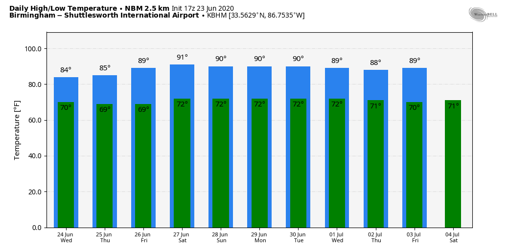
REST OF THE WEEK: Unsettled weather continues tomorrow and Thursday; the sky will be occasionally cloudy with scattered to numerous showers and thunderstorms. A few strong storms are likely, and highs will be in the low to mid 80s. Showers on Friday should become more scattered in nature with a high in the mid to upper 80s.
THE ALABAMA WEEKEND: We are foresting pretty routine summer weather Saturday and Sunday; partly sunny days with random, scattered, mostly afternoon and evening showers and thunderstorms, generally between 1:00 and 9:00 p.m. Highs will be in the 85-90 degree range both days.
NEXT WEEK: For now we are not expecting many changes; standard summer weather continues with highs mostly in the mid to upper 80s with the risk of “scattered, mostly afternoon and evening showers and thunderstorms” on a daily basis. See the Weather Xtreme video for maps, graphics, and more details.
HELLO DOLLY: We now have a very short lived tropical storm in the Atlantic, well east of the U.S coast. Dolly is packing sustained winds of 45 mph, and will become post-tropical tomorrow. No threat to land. The rest of the Atlantic basin is quiet.
AFRICAN DUST: The Saharan Air Layer (SAL) continues to move through the Caribbean, and the dry, dusty air should reach the southern U.S. by Thursday or Friday. Remember, this is not unusual, and helps to mitigate tropical storm formation. It also brings potential for vivid sunrise and sunset scenes due to the scattering of sunlight. There can be some reduction in air quality, but it won’t impact most people.
ON THIS DATE IN 1944: The deadliest and strongest tornado in the state of West Virginia occurred on this day. The Shinnston Tornado that ravaged a path of destruction from Shinnston to Cheat Mountain, then on to Maryland and ending in Pennsylvania in the Allegheny Mountains, is the only twister to produce F4 damage in West Virginia. This tornado killed 103 people.
BEACH FORECAST: Click here to see the AlabamaWx Beach Forecast Center page.
WEATHER BRAINS: Don’t forget you can listen to our weekly 90 minute show anytime on your favorite podcast app. This is the show all about weather featuring many familiar voices, including our meteorologists here at ABC 33/40.
CONNECT: You can find me on all of the major social networks…
Facebook
Twitter
Instagram
Pinterest
Snapchat: spannwx
Look for the next Weather Xtreme video here by 7:00 a.m. tomorrow…
Category: Alabama's Weather, ALL POSTS, Weather Xtreme Videos
About the Author (Author Profile)
James Spann is one of the most recognized and trusted television meteorologists in the industry. He holds the AMS CCM designation and television seals from the AMS and NWA. He is a past winner of the Broadcast Meteorologist of the Year from both professional organizations.Subscribe
If you enjoyed this article, subscribe to receive more just like it.


