Much Colder Air For The Weekend; Severe Storms Possible Next Thursday
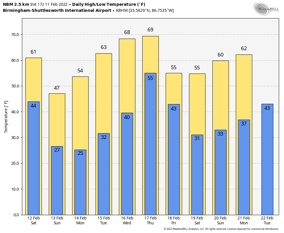
SPRING-LIKE DAY: Temperatures across Alabama this afternoon are generally in the 66-72 degree range, well above the average high of 58 for February 11. The sky will remain mostly fair tonight with a low in the 40s for most places.
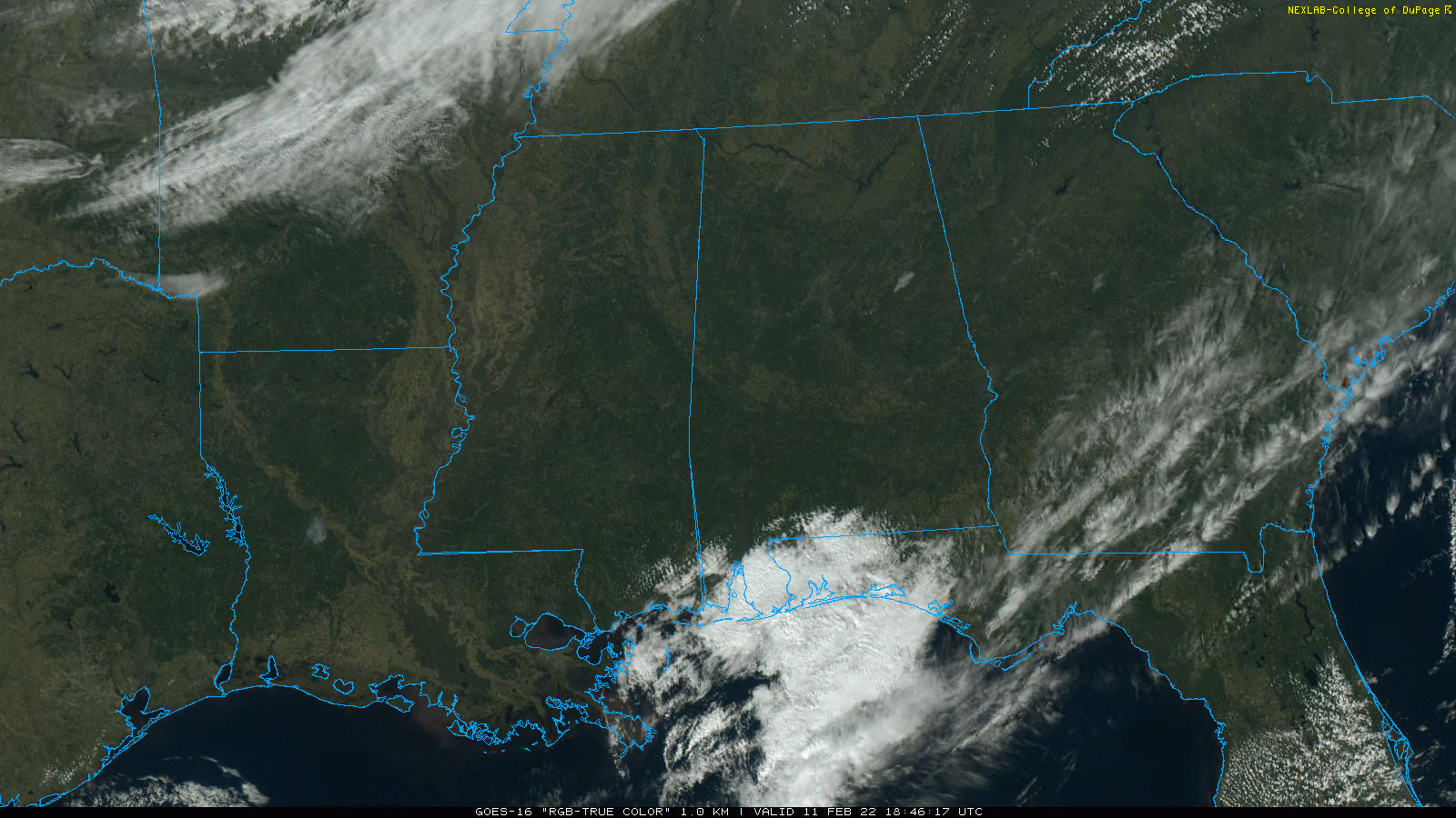
COLD CHANGE: Clouds will move into Alabama tomorrow as a cold front passes through in dry fashion. Over the northern half of the state, temperatures will fall into the 40s by mid to late afternoon with a chilly north breeze. South Alabama will see highs in the 60s again tomorrow, but they will feel the colder air tomorrow night.
By daybreak Sunday, we project lows in the 20-26 degree range. Then, during the day Sunday, temperatures will struggle to get past the mid 40s despite a partly to mostly sunny sky.
NEXT WEEK: The weather will be dry with mostly sunny days during the first half of the week along with a warming trend. The high Monday will be in the low 50s, followed by low 60s Tuesday, and upper 60s Wednesday. Then, a dynamic weather system will bring rain and thunderstorms to the state Thursday and Thursday night. Based on the projected wind profiles and instability values, severe thunderstorms will be possible across Alabama and the Deep South. It is too early to know the magnitude of the threat, but it looks like all modes of severe weather will be possible, including tornadoes. Plan on being very weather aware Thursday of next week… drier air returns Friday. See the Weather Xtreme video for maps, graphics, and more details.
ON THIS DATE IN 1962: A powerful F3 tornado struck Holstebro in Denmark, causing devastating damage. More than 100 houses were severely damaged or destroyed, making this event the most devastating tornado in Denmark’s history. The tornado could have been a low-end F4.
ON THIS DATE IN 1965: An F3 tornado moved through Aliceville, in West Alabama. Twelve homes were demolished and another 42 homes suffered varying degrees of damage. A church, motel, cotton mill, and several commercial buildings were heavily damaged. One farm suffered extensive damage. Several injuries occurred in and near Aliceville, but no fatalities were reported.
ON THIS DATE IN 2014: A winter storm brought snow to the northern third of Alabama… some communities north of Birmingham received over 5 inches. The system would evolve into a major nor’easter, and would bring 15 inches of snow to Washington DC and Baltimore.
BEACH FORECAST: Click here to see the AlabamaWx Beach Forecast Center page.
WEATHER BRAINS: Don’t forget you can listen to our weekly 90 minute show anytime on your favorite podcast app. This is the show all about weather featuring many familiar voices, including our meteorologists here at ABC 33/40.
CONNECT: You can find me on all of the major social networks…
Look for my next Weather Xtreme video here by 6:00 a.m. Monday… enjoy the weekend!
Category: Alabama's Weather, ALL POSTS, Weather Xtreme Videos
About the Author (Author Profile)
James Spann is one of the most recognized and trusted television meteorologists in the industry. He holds the AMS CCM designation and television seals from the AMS and NWA. He is a past winner of the Broadcast Meteorologist of the Year from both professional organizations.Subscribe
If you enjoyed this article, subscribe to receive more just like it.


