Strong Winds Later Today; Severe Storms Arrive Tonight
VERY ACTIVE WEATHER AHEAD: Alabamians will need to be very “weather aware” over the next 24 hours as a dynamic storm system approaches the state. While most of the day today will be dry, strong winds will develop this afternoon, and a line of severe storms will sweep through tonight. While thermodynamics (instability) aren’t especially impressive for late March, the dynamics are very strong, and this could be a high impact event for the Deep South.
SPC has defined a “moderate risk” (level 4/5) of severe thunderstorms for areas west of a line from Muscle Shoals to Birmingham to Montgomery to Enterprise… the rest of the state (East Alabama) is in an “enhanced risk” (level 3/5).
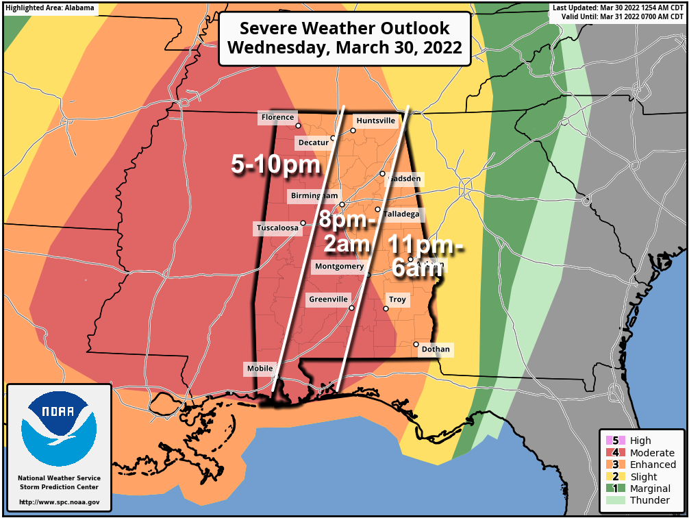
TIMING: A line of severe storms will push into the northwest corner of the state around 6:00 this evening, then moving quickly eastward. The line should be around I-59 (Tuscaloosa/Birmingham/Gadsden) by 10:00 p.m… and then into East Alabama after midnight.
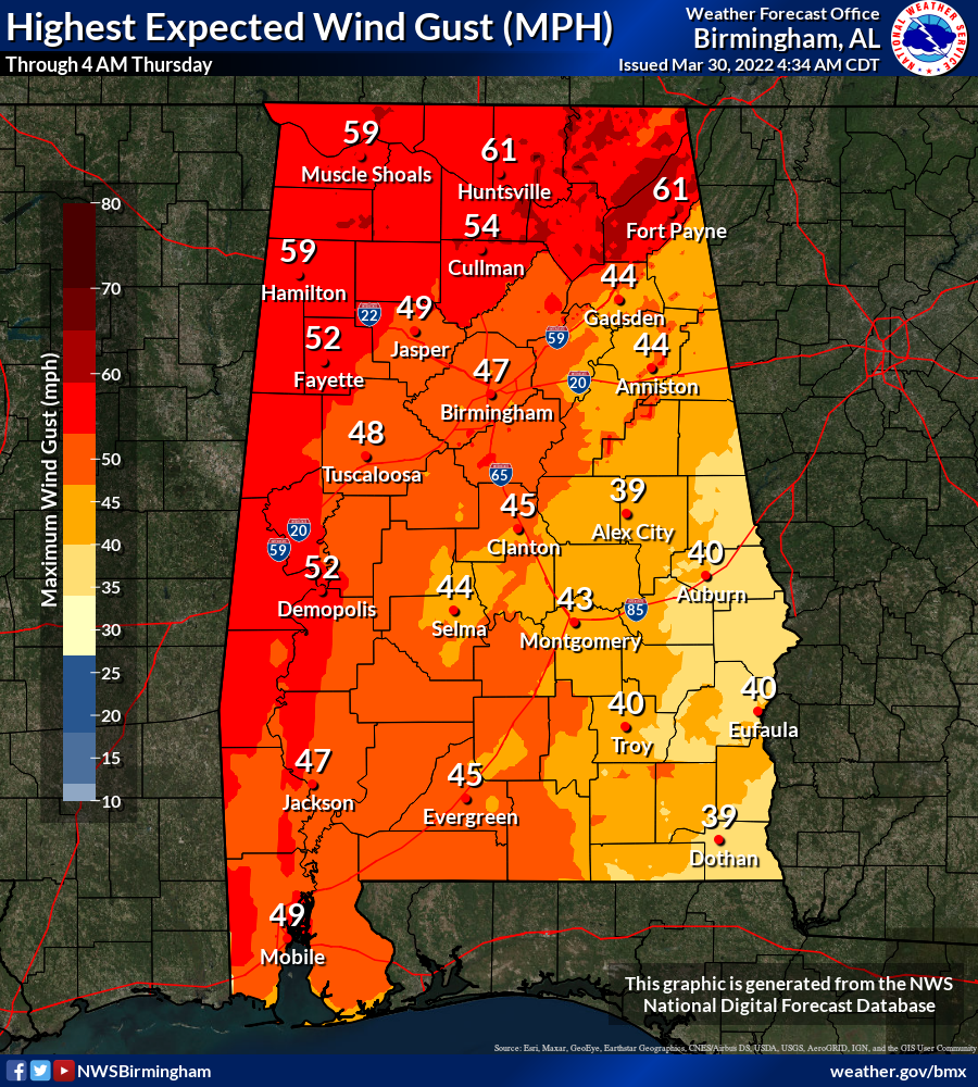
THREATS: The main concern tonight will come from damaging straight line winds. Stronger storms in the line will be capable of producing wind gusts in the 60-80 mph range, and this could bring down many trees. Also, a few tornadoes are possible… a strong tornado (EF-2 or higher) can’t be ruled out. The higher tornado probabilities are over the southern half of the state. Some hail is possible as well.
GRADIENT WINDS: Ahead of the storms, a tight pressure gradient will bring strong winds to the state this afternoon. Winds could gust to 40/50 mph in spots, and this could also bring some tree and power line damage. A high wind warning has been issued for Lauderdale, Colbert, Franklin, Lawrence, Marion, Lamar, Fayette, and Pickens counties, where gusts could reach 60 mph this afternoon and early tonight before the storms arrive.
RAIN: Rain amounts will be in the 1-2 inch range with the storms tonight. Some flooding issues are possible, but the line of storms will be moving at a pretty rapid clip which should prevent major, widespread flooding.
IMPORTANT NOTES: It will be important to pay attention to severe thunderstorm warnings tonight, since much of the damage will be caused by straight line winds. If you live in a mobile home, treat a severe thunderstorm warning like a tornado warning. Take some time this morning and secure loose objects on your property that might fly away in high winds. Prepare for power outages; this could be a fairly widespread wind event tonight and some could be without power for hours, if not longer.
Have two reliable ways of learning severe weather warnings (never a siren!)… NOAA Weather Radio and your phone. Be sure emergency alerts are enabled, and install the free ABC 33/40 Weather app. In your safe place have helmets for everyone. If you live in a mobile home, know the nearest shelter and how to get there quickly.
These kind of events are not unusual for Alabama in March and April. Don’t be anxious or scared, simply be ready and we will get through the night fine together.
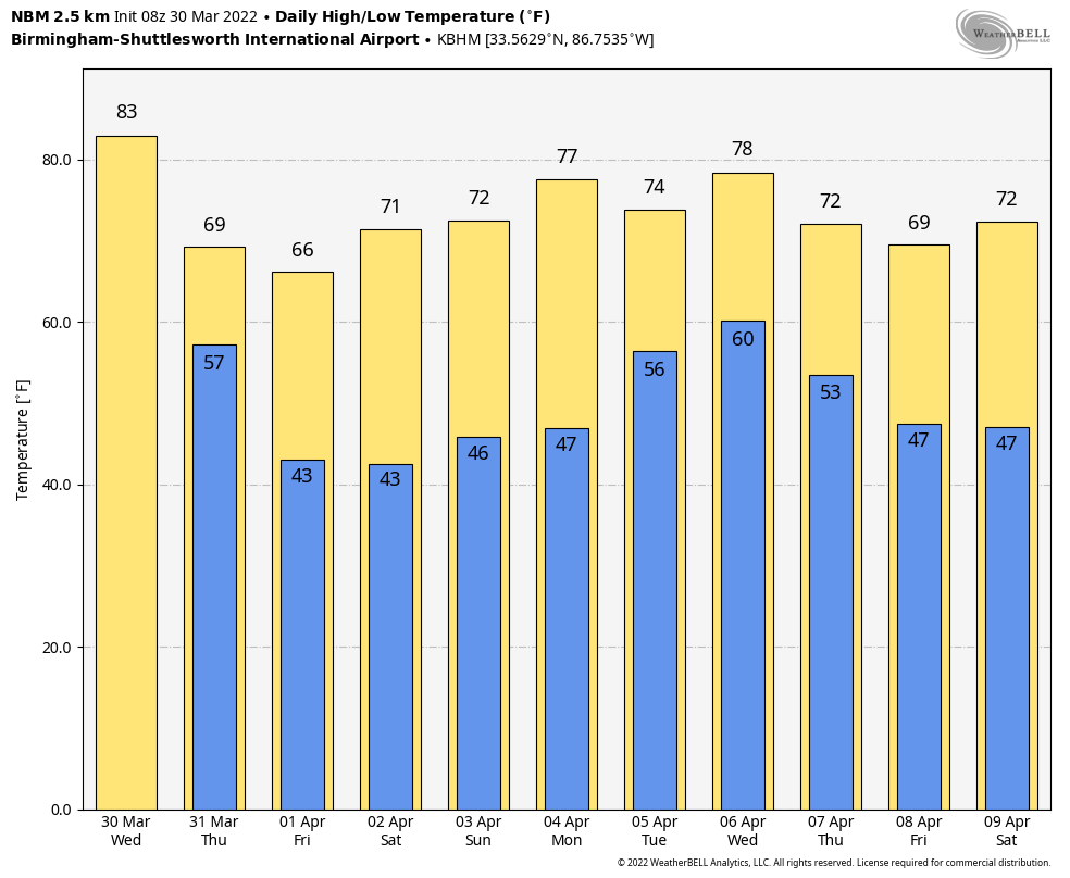
REST OF THE WEEK AND THE WEEKEND: Look for a clearing sky Thursday with a high between 67 and 70 degrees. Then, we will be rain-free Friday through Sunday with a high in the mid 60s Friday, and close to 70 over the weekend. The possible exception is the immediate Gulf Coast, where a few showers are possible Saturday.
NEXT WEEK: The weather stays dry Monday, but the next weather system will bring rain and storms back to the state Tuesday, and possibly into Wednesday. There will be a decent amount of instability available with this feature, and strong to severe storms could very well be possible, but it is too early to be specific. Dry air returns over the latter half of the week… See the Weather Xtreme video for maps, graphics, and more details.
ON THIS DATE IN 1805: New York’s City’s Battery Park was strewn with 24-inch snow rollers, from a ferocious storm between the March 26th and March 28th. Snow rollers are natural snowballs that are formed when winds blow over a snow-covered surface.
BEACH FORECAST: Click here to see the AlabamaWx Beach Forecast Center page.
WEATHER BRAINS: Don’t forget you can listen to our weekly 90 minute show anytime on your favorite podcast app. This is the show all about weather featuring many familiar voices, including our meteorologists here at ABC 33/40.
CONNECT: You can find me on all of the major social networks…
Look for the next Weather Xtreme video here by 3:00 this afternoon… enjoy the day!
Category: Alabama's Weather, ALL POSTS, Weather Xtreme Videos
About the Author (Author Profile)
James Spann is one of the most recognized and trusted television meteorologists in the industry. He holds the AMS CCM designation and television seals from the AMS and NWA. He is a past winner of the Broadcast Meteorologist of the Year from both professional organizations.Subscribe
If you enjoyed this article, subscribe to receive more just like it.


