Hot Weekend Ahead; Mostly Dry
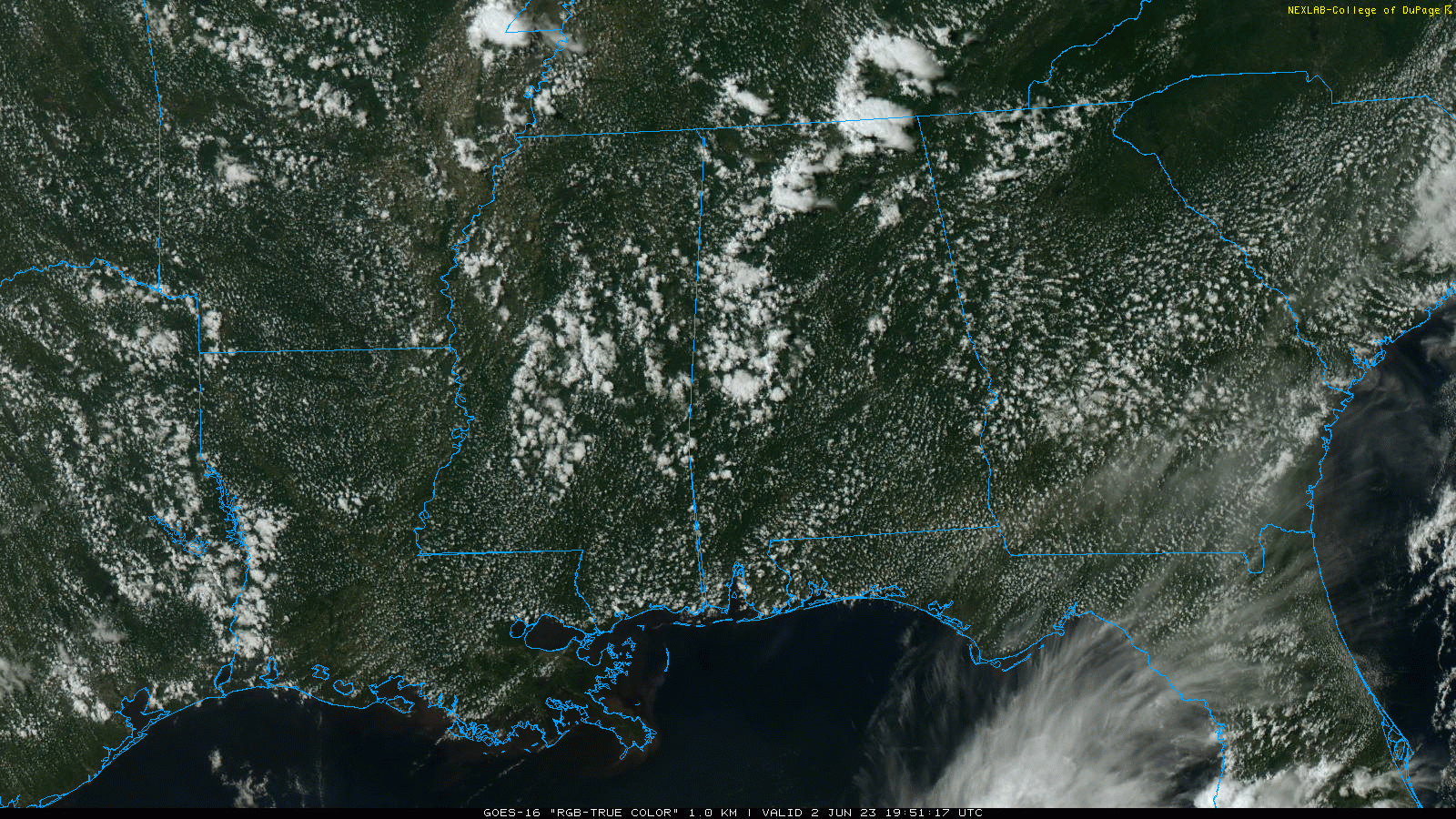
RADAR CHECK: We have a few widely scattered showers and storms this afternoon over parts of North and West Alabama, otherwise the sky is partly to mostly sunny with temperatures mostly in the 85-90 degree range. Showers will end this evening, and tonight will be mostly fair with a low in the 60s.
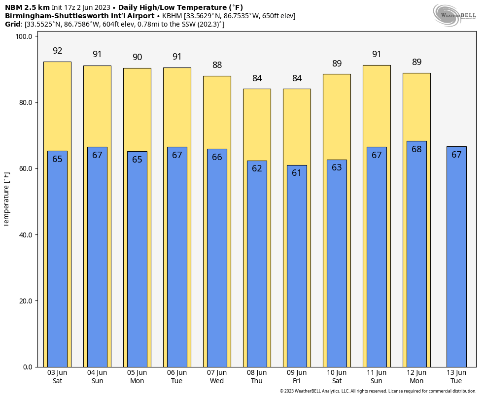
THE WEEKEND: We project afternoon highs in the 87-92 degree range through the weekend with partly sunny days and fair nights. The chance of any one spot seeing a pop-up shower tomorrow is 10 percent, and 20-25 percent Sunday. Most of the showers and storms that form will come from 2 until 9 p.m… but most of the weekend will be dry.
NEXT WEEK: The benign pattern continues Monday and Tuesday with just a few isolated/widely scattered showers or storms around. We are seeing evidence scattered showers and storms could be a bit more numerous over the latter half of the week as an upper low forms over the region… heat levels should fall then as well. See the video briefing for maps, graphics, and more details.
TROPICS: Tropical Storm Two was upgraded to Tropical Storm Arlene early this afternoon, but the system is weak and disorganized with winds of 40 mph. The circulation center is about 265 miles west of Fort Myers, Florida. We still expect Arlene to weaken soon due to increasing wind shear and dry air, and no change has been made to the forecast. It will dissipate by tomorrow night over the southern Gulf of Mexico.
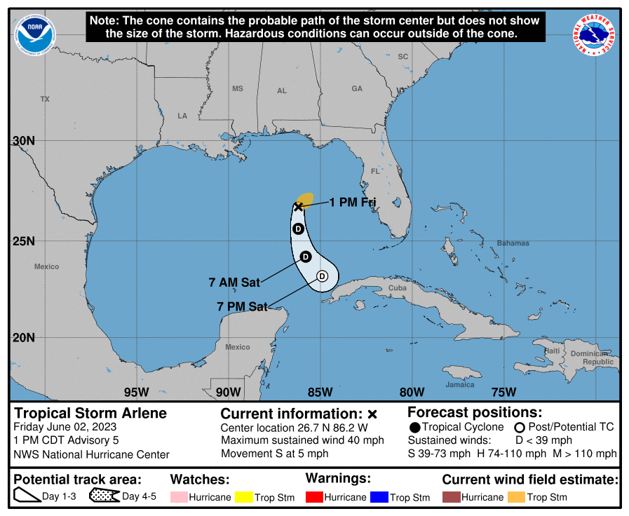
This system will have no impact on the Central Gulf Coast (Gulf Shores to Panama City Beach)… we expect mostly sunny days and fair nights there for the next five days with just a few random pop-up storms around. The rest of the Atlantic basin is very quiet.
ON THIS DATE IN 1889: The same storm that caused the historic dam failure in Johnstown, PA, also affected Washington, D.C. The streets and reservations in the center of the city and all the wharves and streets along the riverfront were under water. Pennsylvania Avenue was flooded from 2nd to 10th Streets. The Potomac River crested at the Aqueduct Bridge at 19.5 feet on June 2.
ON THIS DATE IN 1998: This was the first tornado to “officially” be rated an “F4” in the State of Maryland. The storm entered Garrett County, Maryland striking the town of Finzel. It then moved up and over Big Savage Mountain in Allegany County and ripped through the northern portion of Frostburg. It reached its peak strength as it crossed the ridge. Winds were estimated between 210 and 250 mph; there were no deaths.
Look for my next video briefing here by 6:00 a.m. Monday… enjoy the weekend!
Category: Alabama's Weather, ALL POSTS, Weather Xtreme Videos
About the Author (Author Profile)
James Spann is one of the most recognized and trusted television meteorologists in the industry. He holds the AMS CCM designation and television seals from the AMS and NWA. He is a past winner of the Broadcast Meteorologist of the Year from both professional organizations.Subscribe
If you enjoyed this article, subscribe to receive more just like it.


