Scattered To Numerous Showers/Storms Through The Weekend
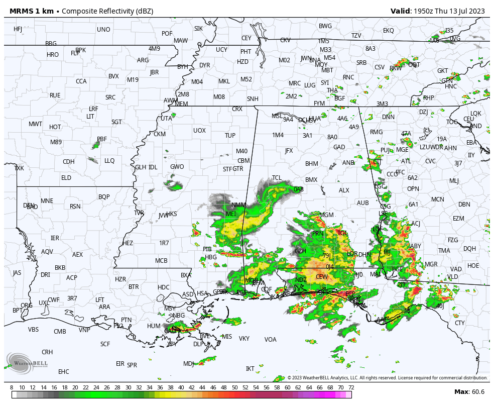
RADAR CHECK: You can see the MCV (Mesoscale Convective Vortex) spinning on radar south of Eutaw at mid-afternoon; this feature contributed to excessive rain across parts of West Alabama and East Mississippi this morning. Based on radar estimates, rain amounts across Sumter County are in the 5-8 inch range since the pre-dawn hours. Serious flooding developed in places like York. Thankfully the rain is mostly over in Sumter County for now, and the heavier storms are across the southern counties as of 3p CT.
Showers and storms remain possible statewide this evening; the activity will fade during the late night hours.
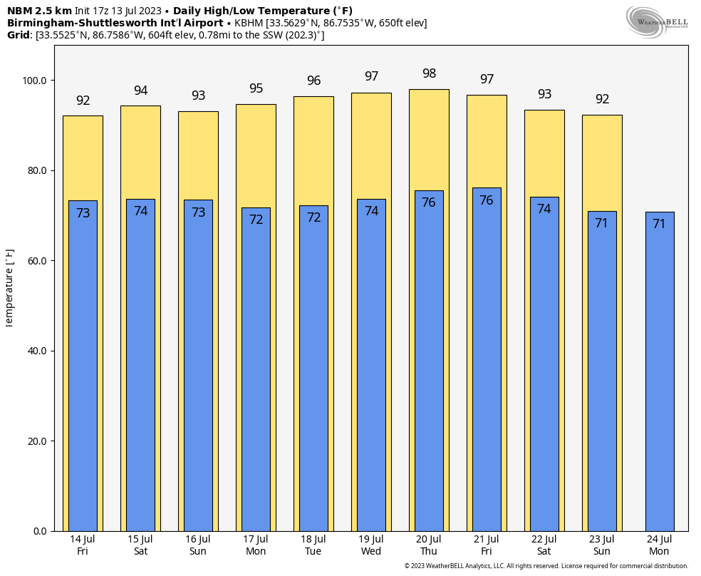
The weather won’t change much tomorrow through the weekend as the ocean of humidity stays in place across the Deep South. We will have a mix of sun and thunderstorms each day… most of the storms (but necessarily all) will come from noon to midnight and highs will be close to 90 degrees. With summer storms there is no way of forecasting the placement and timing in advance… if you have something planned outdoors you simply have to watch radar trends. And, of course, “when thunder roars, go indoors”.
NEXT WEEK: The intense heat bubble/upper high to the west will try and nose in here, meaning fewer showers and storms and higher heat levels through the week. Highs will reach the mid 90s, possibly upper 90s in spots. Heat advisories will likely be needed for much of the state as the heat index will exceed 100 most days. See the video briefing for maps, graphics, and more details.
TROPICS: An area of low pressure located about 900 miles east of Bermuda is producing gale-force winds and disorganized showers and thunderstorms. However, recent satellite imagery indicates that the system does not have a well-defined low-level center. Environmental conditions are forecast to be somewhat conducive for this system to become a subtropical storm during the next day or so, as it meanders over the central Atlantic. By the weekend, the low should turn northward bringing the system over cooler waters, potentially limiting additional development. NHC gives it a 60 percent chance of development… it is a junk system far from land.
The rest of the Atlantic basin, including the Gulf of Mexico, remains very quiet.
ON THIS DATE IN 1951: Rivers across eastern Kansas crest well above flood stage, causing the most significant destruction from flooding in the Midwestern United States at that time. Five-hundred-thousand people were left homeless, and 24 people died in the disaster.
ON THIS DATE IN 2019: Barry made landfall as a minimal category 1 hurricane with maximum sustained winds of 75 mph and a minimal central pressure of 993 millibars (29.32 inches) about 12 miles east-southeast of Pecan Island, Louisiana. Barry brought heavy rain to South Alabama… 8.36″ was measured near Fairhope in Baldwin County with numerous reports of 5+” across Mobile County.
Look for the next video briefing here by 6:00 a.m. tomorrow…
Category: Alabama's Weather, ALL POSTS, Weather Xtreme Videos
About the Author (Author Profile)
James Spann is one of the most recognized and trusted television meteorologists in the industry. He holds the AMS CCM designation and television seals from the AMS and NWA. He is a past winner of the Broadcast Meteorologist of the Year from both professional organizations.Subscribe
If you enjoyed this article, subscribe to receive more just like it.


