Strong Storms Possible Later Today
RADAR CHECK: Just before sunrise we have a few showers across the Tennessee Valley of far North Alabama, otherwise it is a dry, muggy morning with temperatures in the 70s. The day ahead will be hot and humid with highs in the 90s.
SPC has defined a “slight risk” (level 2/5) of severe thunderstorms for that part of Alabama north of a line from Russellville to Gardendale to Ranburne, and a “marginal risk” (level 1/5) as far south as Eutaw, Montgomery, and Phenix City.
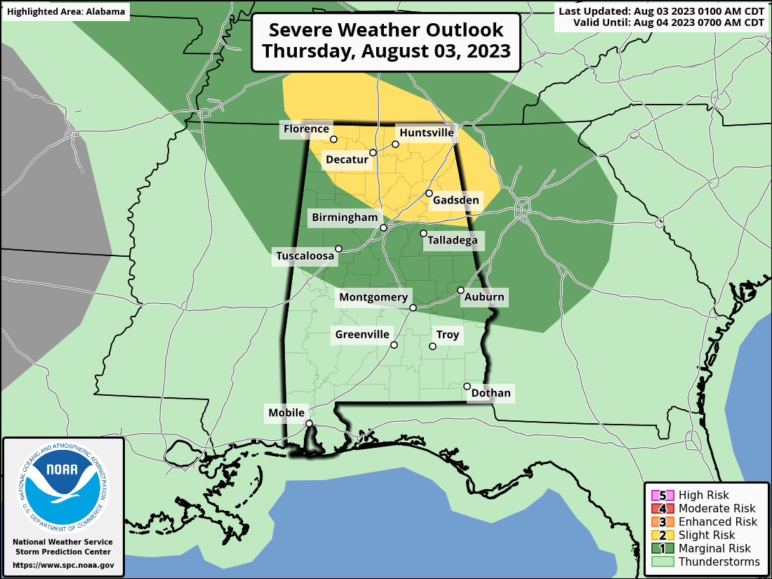
An organized mass of storms is expected to form over Tennessee later today; this MCS (Mesoscale Convective System) will move into North Alabama with potential for strong winds and heavy rain. We also note there is a flash flood watch in effect for areas north of a line from Russellville to Birmingham to Heflin through tomorrow afternoon.
A few showers/storms are also possible over South Alabama later today, but they will be widely spaced.
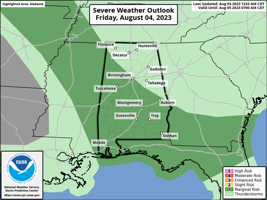
TOMORROW AND THE WEEKEND: There is potential for another mass of storms to move through Alabama tomorrow; there is a “marginal risk” (level 1/5) of severe thunderstorms for roughly the southern 2/3 of the state.
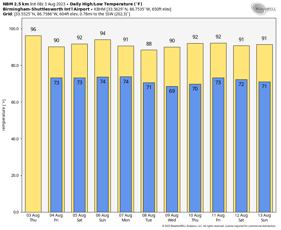
Understand it won’t rain all day tomorrow, and the sun will be out at times. The high tomorrow will be in the 87-92 degree range for most communities.
Concerning the weekend, for now it looks like a decent part of the day Saturday will be dry with just a few widely scattered showers and storms along with a high in the low 90s. Showers and storms will increase a bit on Sunday with highs holding in the 89-93 degree range.
NEXT WEEK: Forecasting summer convection is always a challenge; we are seeing evidence a drier airmass could temporarily dip into the northern half of Alabama Tuesday and Wednesday, otherwise the week will feature a mix of sun and clouds with scattered showers and storms around daily, especially during the afternoon and evening hours. Highs will be mostly in the low 90s; right at seasonal averages. See the video briefing for maps, graphics, and more details.
TROPICS: All is amazingly quiet for early August across the Atlantic basin, and tropical storm formation is not expected at least for the next seven days.
ON THIS DATE IN 1970: Hurricane Celia made landfall near Aransas Pass as a major Category 4 hurricane on the Saffir-Simpson scale with sustained winds of 140 mph. Hurricane Celia was the third major hurricane to impact the Middle Texas coast in a 9-year period (Carla in 1961 and Beulah in 1967). Hurricane Celia caused 15 fatalities in South Texas and 466 injuries. It was the costliest tropical cyclone in Texas history until Hurricane Alicia in 1983.
ON THIS DATE IN 2020: Hurricane Isaias made landfall at Ocean Isle Beach, NC as a category one hurricane during the evening of August 3, 2020 with maximum sustained winds near 85 mph. The storm’s rapid movement limited rainfall amounts, however significant storm surge flooding and multiple tornado touchdowns occurred across portions of coastal South and North Carolina.
Look for the next video briefing here by 3:00 this afternoon… enjoy the day!
Category: Alabama's Weather, ALL POSTS, Weather Xtreme Videos
About the Author (Author Profile)
James Spann is one of the most recognized and trusted television meteorologists in the industry. He holds the AMS CCM designation and television seals from the AMS and NWA. He is a past winner of the Broadcast Meteorologist of the Year from both professional organizations.Subscribe
If you enjoyed this article, subscribe to receive more just like it.


