Rain Returns Tomorrow, Mainly Along And South Of I-20
CLOUDS THICKEN TONIGHT: We have a layer of high, thin clouds over Alabama this afternoon ahead of a warm front and developing surface low over the northern Gulf of Mexico. Clouds will thicken tonight, the low will be in the 55-65 degree range for most communities.
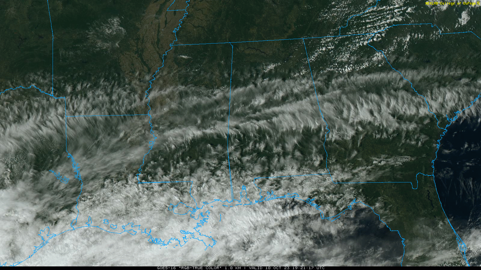
RAIN RETURNS: Rain is likely over much of the state tomorrow; the heaviest rain will be over the southern counties, where some spots could see 2-3 inches. The amount of rain for North Alabama is still debatable; models are not in good agreement concerning the northern extent of the rain. New model guidance suggests the northern extent of the rain will be close to I-59, where light amounts are likely (mostly 1/4″ or less). Odds of meaningful rain for the Tennessee Valley continue to drop.
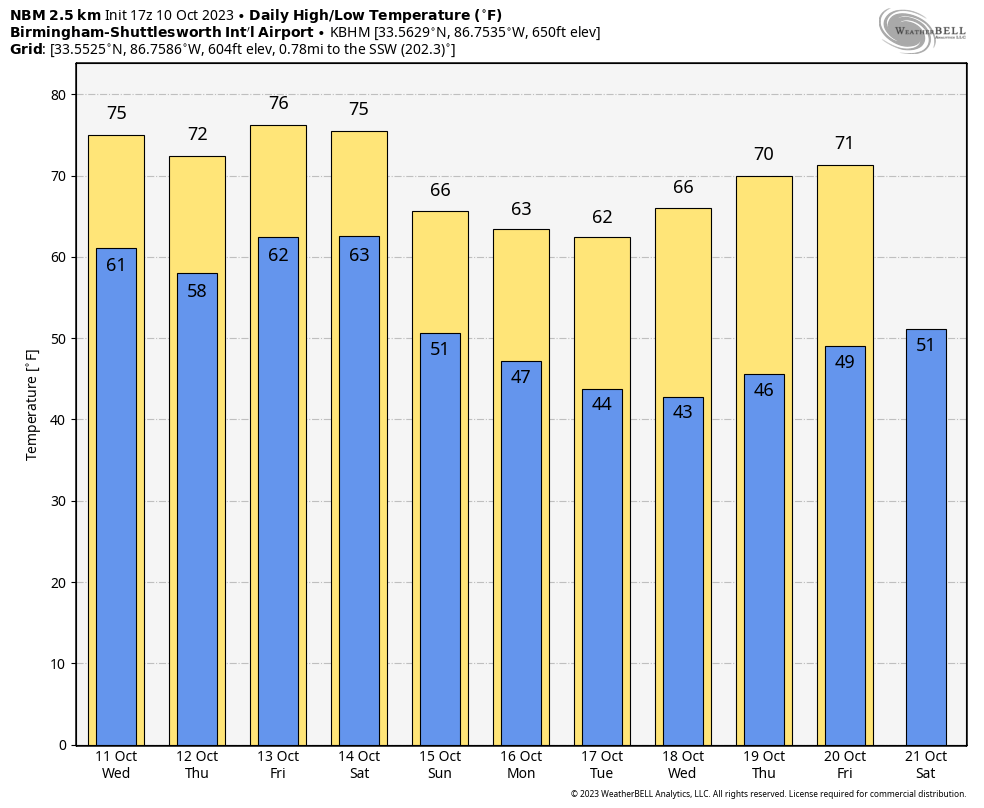
For now Thursday looks like a dry day; the sky becomes partly sunny. Highs will be in the 70s both tomorrow and Thursday. Clouds return late Thursday, and we will mention a chance of showers Thursday night and Friday morning over much of the state with a disturbance in the southern branch of the jet stream. Rain amounts will be light.
The, a cold front will approach the state Friday night, and a few spotty showers are possible, but moisture will be very limited and widespread rain isn’t likely. On Saturday the sky will become mostly sunny by afternoon, and Sunday will be a sunny day as dry air continues to settle into the state. The high Saturday will be in the 70s, then falling into the 60s Sunday with a cool north breeze.
NEXT WEEK: At this point the week looks cool and dry with highs in the 60s through Wednesday, followed by 70s Thursday and Friday. Lows will be mostly in the 40s. See the video briefing for maps, graphics, and more details.
FOOTBALL WEATHER: Jacksonville State will host Liberty tonight (6:30p CT kickoff)… the sky will be mostly fair with temperatures falling from near 75 at kickoff, into the 60s by the second half. No risk of rain.
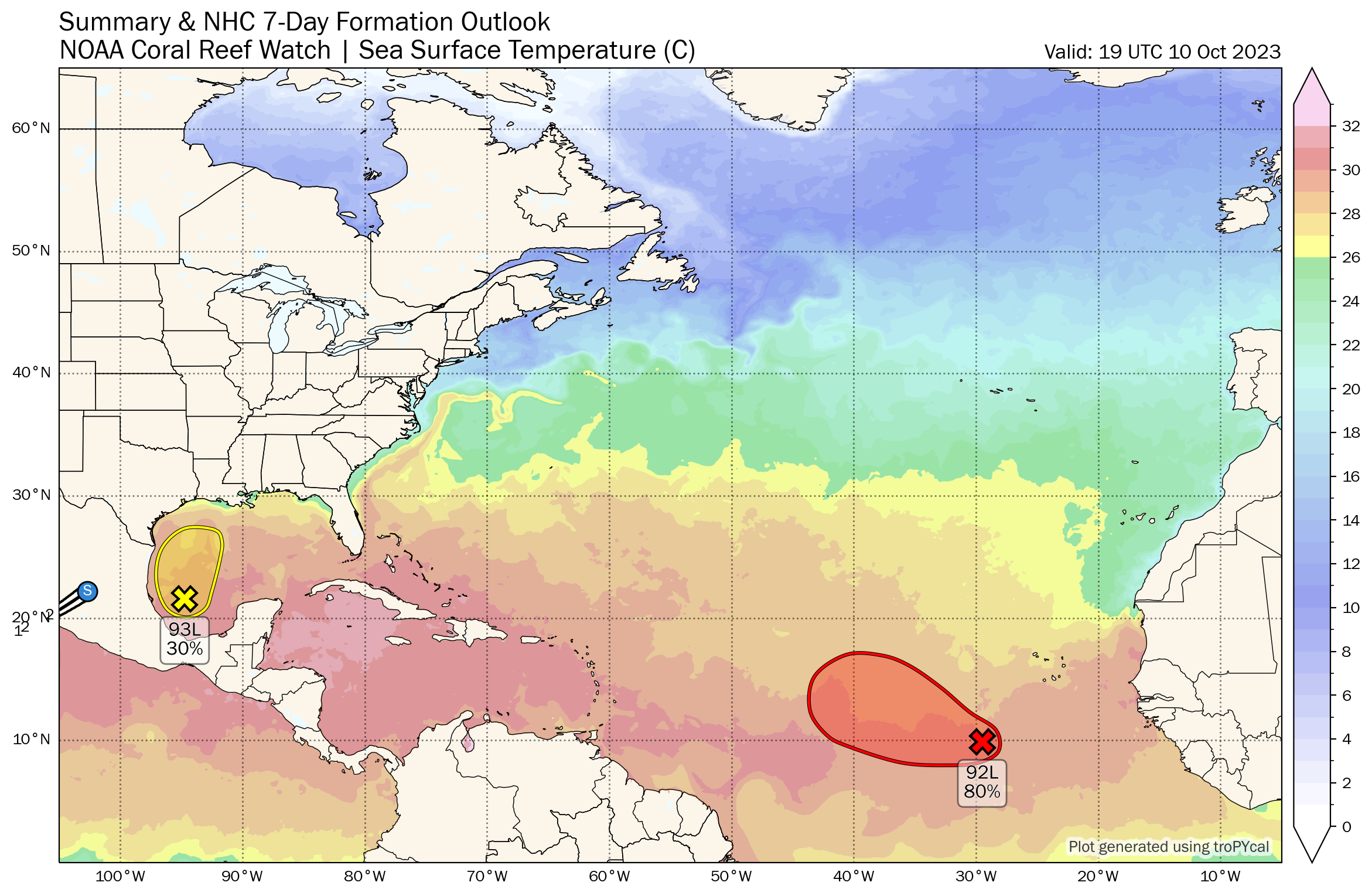
TROPICS: Showers and thunderstorms have not become any better organized this afternoon in association with an area of low pressure over the southwestern Gulf of Mexico. Environmental conditions appear only marginally favorable and this system has a short window to develop further over the next day or so. By tomorrow morning, the system is forecast to merge with a developing frontal boundary over the western Gulf of Mexico. An Air Force Reserve Reconnaissance aircraft is in route to investigate the system this afternoon and will provide more information about the system’s structure.
Regardless of tropical cyclone development, the system is forecast to produce gale-force winds over portions of the northern Gulf of Mexico by tomorrow, and potentially heavy rainfall along the Gulf Coast by the latter portion of this week. NHC gives the system a 30 percent chance of becoming a tropical depression or storm.
And, a broad area of low pressure located several hundred miles southwest of the Cabo Verde Islands continues to produce a large area of showers and thunderstorms. This activity has become a bit more concentrated while also showing signs of organization, and environmental conditions appear conducive for additional development. A tropical depression is likely to form during the next couple of days while the system moves west-northwestward or northwestward across the eastern and central tropical Atlantic. This feature will likely turn north and won’t be a threat to land. NHC gives it an 80 percent chance of development.
ON THIS DATE IN 2018: Destructive Hurricane Michael made landfall near Mexico Beach with winds of 160 mph. It became the first Category 5 hurricane to make landfall in the contiguous United States since Andrew in 1992. It was the third-most intense Atlantic hurricane to make landfall in the contiguous United States in terms of pressure, behind the 1935 Labor Day hurricane and Hurricane Camille in 1969. Michael was the first Category 5 hurricane on record to impact the Florida Panhandle, the fourth-strongest landfalling hurricane in the contiguous United States, in terms of wind speed, and the most intense hurricane on record to strike the United States in the month of October.
At least 74 deaths were attributed to the storm, including 59 in the United States and 15 in Central America. Michael caused an estimated $25.1 billion in damage. Along the Florida panhandle, the cities of Mexico Beach and Panama City suffered the worst of Michael, incurring catastrophic damage from the extreme winds and storm surge. Numerous homes were flattened and trees felled over a wide swath of the panhandle. A maximum wind gust of 139 mph was measured at Tyndall Air Force Base before the sensors failed. Peak storm surge inundation was 9-14 feet from Mexico Beach to Indian Pass.
Look for the next video briefing here by 6:00 a.m. tomorrow…
Category: Alabama's Weather, ALL POSTS, Weather Xtreme Videos
About the Author (Author Profile)
James Spann is one of the most recognized and trusted television meteorologists in the industry. He holds the AMS CCM designation and television seals from the AMS and NWA. He is a past winner of the Broadcast Meteorologist of the Year from both professional organizations.Subscribe
If you enjoyed this article, subscribe to receive more just like it.


