Rain Moving Northward Through Wednesday
RADAR CHECK: Rain is falling this afternoon in Alabama as far north as Grove Hill, Greenville, and Luverne. This is ahead of a surface low in the western Gulf of Mexico that is moving slowly east/northeast. Otherwise the sky is mostly cloudy across Alabama this afternoon with temperatures in the 65-72 degree range. Occasional rain will continue over South Alabama tonight.
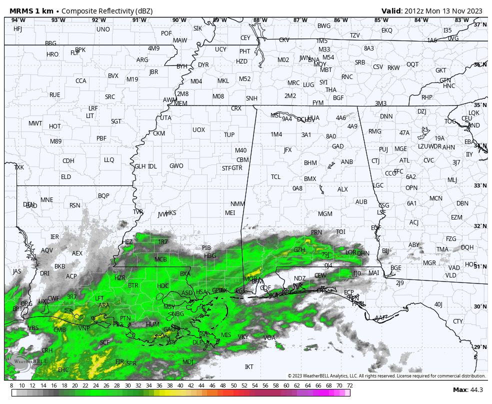
Rain will become widespread over the southern half of the state tomorrow, and statewide Wednesday as a surface low moves along a stalled front near the Gulf Coast. Some lingering light rain is possible in scattered spots Thursday, and a cold front will bring a chance of showers to the state late Friday and Friday night (nothing heavy).
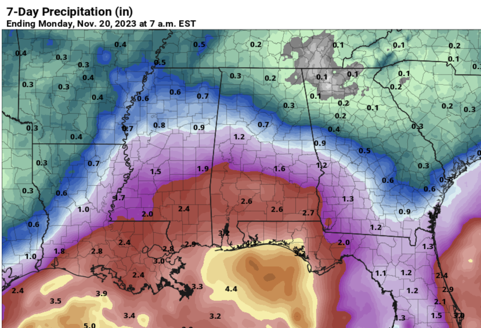
The southern half of Alabama will see beneficial rain this week, with amounts between 2 and 3 inches for most communities. The central counties will see around one inch, and rain totals over the Tennessee Valley will be light, generally under 1/4″.
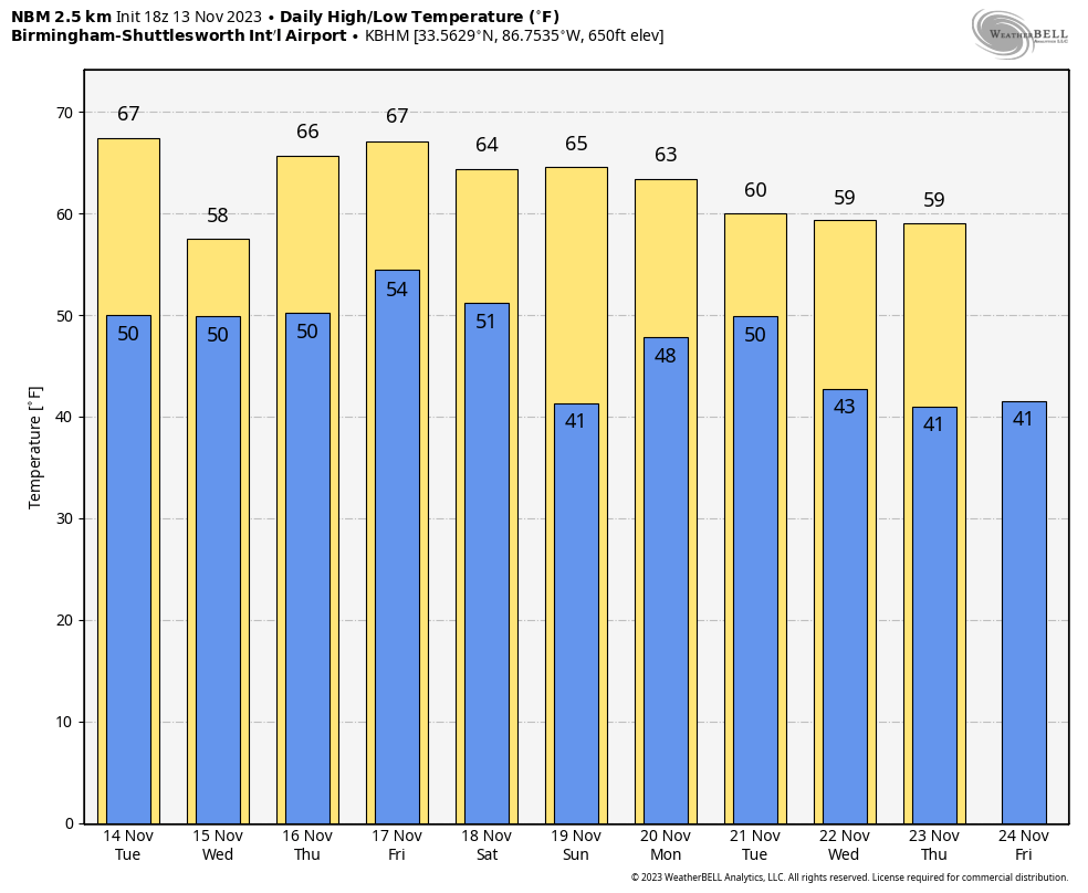
THE ALABAMA WEEKEND: Dry air moves into the Deep South, and the weekend will feature mostly sunny pleasant days and fair cool nights. Highs generally in the 60s, lows mostly in the 40s.
NEXT WEEK: Rain will return to the state, and possibly a few strong thunderstorms. Models are not in good agreement concerning the timing, but the rain could arrive as early as Monday, continuing through Tuesday and possibly Wednesday. At the moment it looks like the rain will gone by Thanksgiving Day… temperatures will be near average for late November. See the video briefing for maps, graphics, and more details.
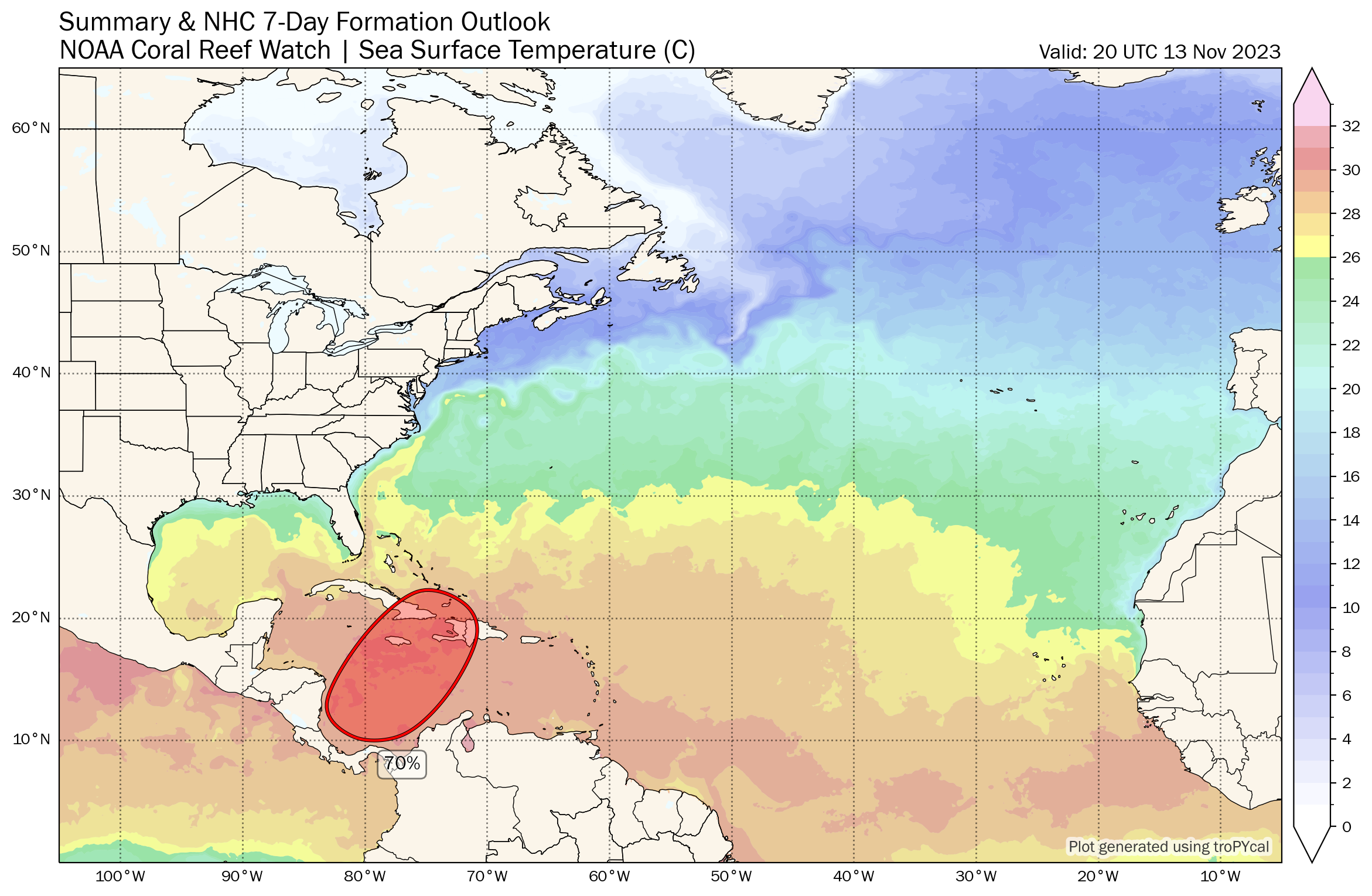
TROPICS: A broad area of low pressure is expected to form over the southwestern Caribbean Sea in the next few days. Environmental conditions appear favorable for additional development of this system thereafter, and a tropical depression is likely to form late this week while the system begins moving northeastward across the western and central portions of the Caribbean Sea.
Interests in Jamaica, Haiti, and the Dominican Republic should monitor the progress of this system. Regardless of development, this system has the potential to produce heavy rains over portions of the Caribbean coast of Central America and the Greater Antilles towards to latter portions of this week. NHC now gives this a 70 percent chance of development over the next seven days.
If a depression or storm does form in the region, it will move northeast and won’t be a threat to the contiguous U.S.
ON THIS DATE IN 1946: General Electric scientists produced snow in the Massachusetts Berkshires in the first modern-day cloud seeding experiment. Scientist Vincent Schaefer dropped six pounds of dry ice pellets into a cloud over Pittsfield, MA. The cloud seeding experiment produced snowfall, as a 4-mile long cloud was converted into snow flurries. The success of the experiment became the basis of many weather modification projects.
Look for the next video briefing here by 6:00 a.m. tomorrow…
Category: Alabama's Weather, ALL POSTS, Weather Xtreme Videos
About the Author (Author Profile)
James Spann is one of the most recognized and trusted television meteorologists in the industry. He holds the AMS CCM designation and television seals from the AMS and NWA. He is a past winner of the Broadcast Meteorologist of the Year from both professional organizations.Subscribe
If you enjoyed this article, subscribe to receive more just like it.


