Midday Nowcast: Heavy Rainfall, Some Strong Storms, and Increasing Flood Threat
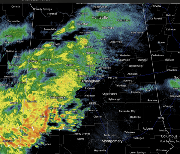
WET AND STORMY: Rain is ongoing across Alabama today, and heavier rain and storms are increasing in coverage and will continue to do so through the afternoon, evening, and overnight hours. Some strong and severe storms are possible, but flooding will be the main concern with this event the next 24 hours.
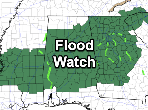
A flood watch is in effect for much of the state as rainfall totals will be in the 2-4 inch range. Parts of Central Alabama are likely to receive over 4 inches of rain over the next 24 hours, and if we get training rain and storms, some locations could see over 6 inches of rain.
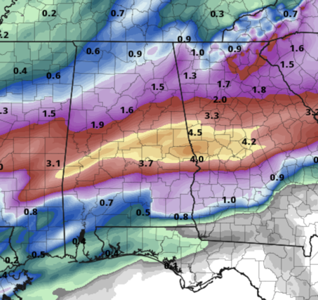
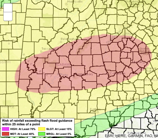
This would cause significant flash flooding. All of Alabama is included in a risk of excessive rainfall, with much of Central Alabama included in a moderate risk for excessive rainfall. If you live in a flood prone area pay attention to flood and flash flood warnings if they are issued. And never, ever drive through flood waters…TURN AROUND, DON’T DROWN!!!
As far as the severe weather threat, this remains is very conditional threat, and high resolution models suggest any surface based instability will be confined to the southern third of the state, south of U.S. 80. A few storms over South Alabama tonight could produce strong winds, and an isolated tornado or two can’t be ruled out.
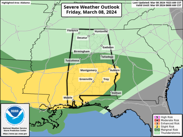
This is where the SPC has the “slight risk” (level 2/5) of severe storms, south of a line from Eutaw to Jemison to Alexander City. A “marginal risk” (level 1/5) extends as far north as Birmingham. Though rain and storms are ongoing across Alabama, the core threat for the stronger storms will come from 6PM this evening-8AM tomorrow morning.
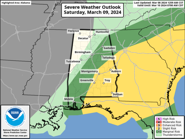
Heavier storms should exit Southeast Alabama by 8AM and we should be left with some lingering showers during the morning, but most of tomorrow should be dry for Alabama. We may see some clearing by afternoon as drier air begins to work into the state. Highs tomorrow will be in the upper 60s and low 70s.
SUNDAY: Sunshine is back for the second half of the weekend. Along with bright sunshine, Sunday will be cooler with highs in the upper 50s and lower 60s. Sunday night will be chilly as lows fall back into the upper 30s.
NEXT WEEK: A drier weather pattern settles into Alabama next week with plenty of sunshine and very comfortable temperatures. Highs Monday will be in the 60s, but low to mid 70s are expected the rest of the week. The next significant rain event most likely will come at some the following weekend (March 15/16). Way too early to know if severe storms will be an issue, but tis the season and we will be watching trends over the next seven days.
BEACH FORECAST CENTER: Get the latest weather and rip current forecasts for the beaches from Fort Morgan to Panama City on our Beach Forecast Center page. There, you can select the forecast of the region that you are interested in visiting.
WORLD TEMPERATURE EXTREMES: Over the last 24 hours, the highest observation outside the U.S. was 111.2F at Birni-N’Konni, Niger. The lowest observation was -71.5F at Vostok, Antarctica.
CONTIGUOUS TEMPERATURE EXTREMES: Over the last 24 hours, the highest observation was 90F at Falcon Village, TX. The lowest observation was -39F at Peter Sinks, UT.
Category: Alabama's Weather, ALL POSTS, Severe Weather
About the Author (Author Profile)
Macon, Georgia Television Chief Meteorologist, Birmingham native, and long time Contributor on AlabamaWX. Stormchaser. I did not choose Weather, it chose Me. College Football Fanatic. @Ryan_StinnetSubscribe
If you enjoyed this article, subscribe to receive more just like it.


