Snow Ends Tonight; Single Digit Lows Possible Early Tomorrow
RADAR CHECK: Snow remains widespread south of a line from Thomasville to Montgomery to Roanoke this afternoon. This will go down as an historic winter storm for the Gulf Coast; many spots across Mobile and Baldwin counties have seen over five inches of snow, and it is still falling. Roads are snow covered and dangerous across South Alabama, and travel is highly discouraged. Snow will end from west to east this evening, and it should be completely out of the state by midnight.
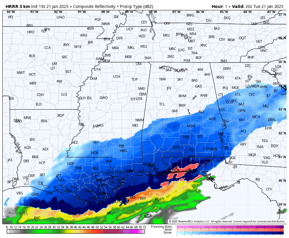
The snow this evening will likely remain south of the I-20 corridor (Tuscaloosa, Birmingham, Anniston).
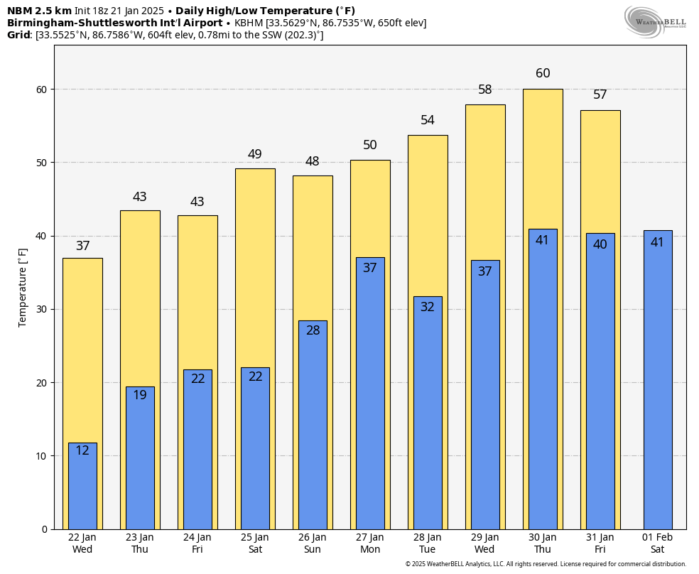
Tomorrow morning will be the coldest morning of the week with lows in the 6-14 degree range over the northern 2/3 of the state; upper teens are likely down to the Gulf Coast.
A disturbance could bring a few flurries to North Alabama Thursday, otherwise the weather will be dry over the latter half of the week with warmer afternoons; highs will be in the 40s by Thursday and Friday.
THE ALABAMA WEEKEND: Saturday will be dry… after a low in the 18-25 degree range, expect a high close to 50 degrees. Clouds increase Saturday night, and some rain will likely move into the northern half of the state Sunday. The chance of rain will continue into Monday… See the video briefing for maps, graphics, and more details.
ON THIS DATE IN 2010: A tornado touched down in Huntsville over the northern part of Redstone Arsenal. The tornado nearly paralleled I-565 to the south, passing over Memorial Parkway, northern sections of downtown Huntsville, and Five Points before dissipating as it moved up Chapman Mountain. The tornado was down for just over four miles, and three people were injured.
Look for the next video briefing here by 6:00 a.m. tomorrow…
Category: Alabama's Weather, ALL POSTS, Weather Xtreme Videos
About the Author (Author Profile)
James Spann is one of the most recognized and trusted television meteorologists in the industry. He holds the AMS CCM designation and television seals from the AMS and NWA. He is a past winner of the Broadcast Meteorologist of the Year from both professional organizations.Subscribe
If you enjoyed this article, subscribe to receive more just like it.


