Scattered Strong Storms This Evening Over North Alabama
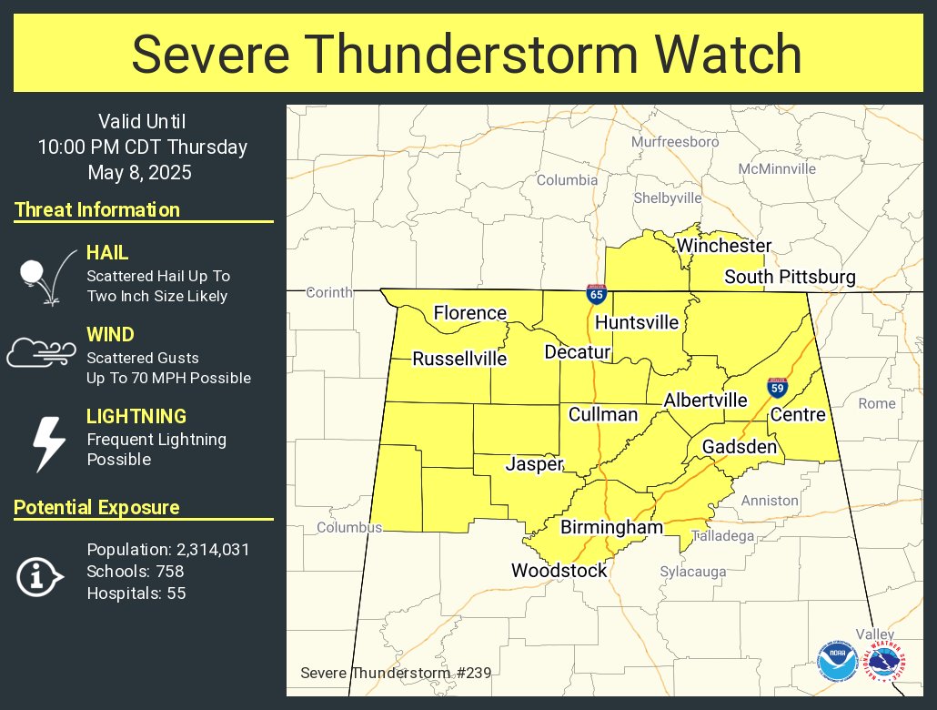
RADAR CHECK: Scattered strong thunderstorms are pushing into Northwest Alabama this afternoon, otherwise with a partly sunny sky temperatures are mostly in the 80s. A severe thunderstorm watch has been issued for the northern third of the state until 10pm… heavier storms that form this evening will be capable of producing hail and strong, gusty winds. Scattered storms should be over by midnight; lows tonight will be in the 60s.
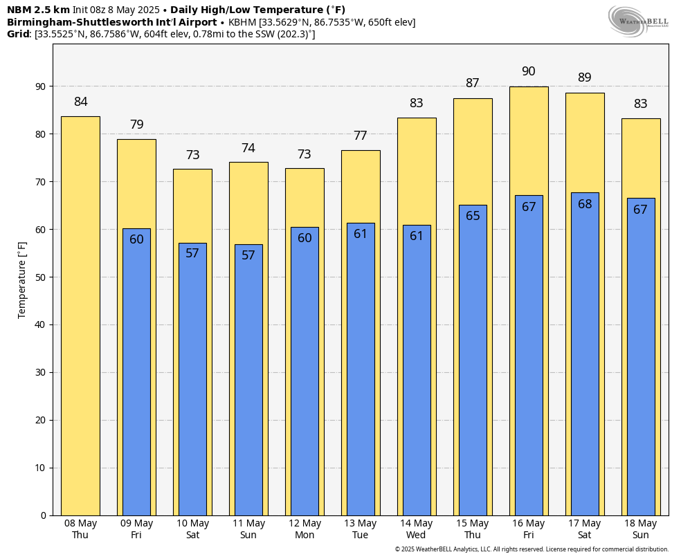
TOMORROW AND THE WEEKEND: The weather will remain somewhat unsettled with a risk of showers and a few thunderstorms each day. But, understand it certainly won’t rain all day, and the sun will break out at times. Most, but not necessarily all, of the showers will come from around 2 until 11 p.m.. and while some thunder is possible we expect no severe storms. Highs will be in the 70s.
NEXT WEEK: Showers remain possible Monday and Tuesday, but the weather will be dry Wednesday through Friday as an upper ridge builds in from the south. Highs remain in the 70s Monday and Tuesday, but by the end of the week the high will be around 90 degrees for a preview of summer. See the video briefing for maps, graphics, and more details.
ON THIS DATE IN 2024: A total of 15 tornadoes touched down across North Alabama. Two were rated EF-3; one moved passed near Henagar, one west of Athens. There were a total of eight injuries; no fatalities. There were two tornadoes in South Alabama from the same event, bringing the statewide total to 17.
Look for the next video briefing here by 6:00 a.m. tomorrow…
Category: Alabama's Weather, ALL POSTS, Weather Xtreme Videos
About the Author (Author Profile)
James Spann is one of the most recognized and trusted television meteorologists in the industry. He holds the AMS CCM designation and television seals from the AMS and NWA. He is a past winner of the Broadcast Meteorologist of the Year from both professional organizations.Subscribe
If you enjoyed this article, subscribe to receive more just like it.


