Unsettled Weather Continues Through Tomorrow
RADAR CHECK: Bands of showers and thunderstorms continue across Alabama early this morning… at daybreak some of the heaviest rain was over Chambers, Randolph, and Cleburne counties on the eastern side of the state.
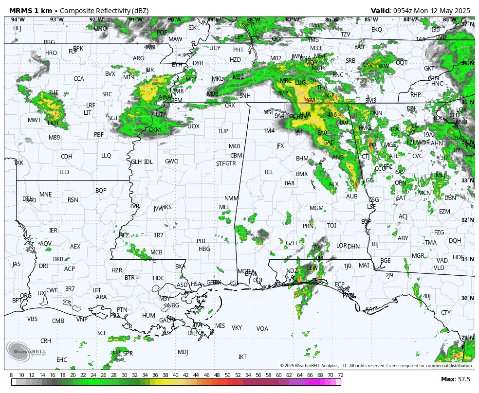
We will continue to forecast occasional showers and a few thunderstorms today and tomorrow thanks to a very slow moving upper low just to the west. It won’t rain all day, and the sun will peek out at times, but expect rain at times and possibly a heavy downpour. We don’t expect any severe storms by classic definition today (winds of 58 mph or higher, or 1″ diameter hail or larger). Highs will be in the 70s.
We should mention that showers will be fewer in number near the Gulf Coast, and far South Alabama should be mostly dry tomorrow as the upper low begins to open up and lift out.
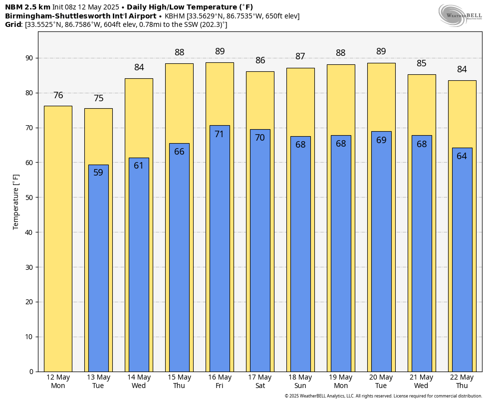
REST OF THE WEEK: Wednesday will be drier with just a few scattered showers over the northern and eastern counties. With a partly sunny sky temperatures rise into the mid 80s. Then, Thursday will be dry with a high in the 86-90 degree range. Most of the day Friday will be very warm and dry, but a few showers and storms could drop into North Alabama late in the day ahead of a cold front.
THE ALABAMA WEEKEND: That front will drift southward and become nearly stationary, which means there will be some risk of at least scattered showers and thunderstorms both Saturday and Sunday. Not as wet as the weekend we just experienced, but some rain will be possible at times along with a thunderstorm or two. We expect a mix of sun and clouds both days with highs in the mid to upper 80s.
NEXT WEEK: The week will be warm with highs in the 80s. For now we don’t see any major rain/storm events, but there could be a day or two with some risk of “scattered afternoon showers and thunderstorms”… See the video briefing for maps, graphics, and more details.
ON THIS DATE IN 1997: A towering F1 tornado ripped its way through the middle of Miami, Biscayne Bay, and Miami Beach right after lunch Monday, smashing cars and windows and tossing trees skyward.
ON THIS DATE IN 2022: One of the most extensive severe weather outbreaks of 2022 occurred as a derecho moved from eastern Nebraska into Minnesota, producing dozens of tornadoes and widespread damaging winds. Winds gusted as high as 100 mph.
Look for the next video briefing here by 3:00 this afternoon… enjoy the day!
Category: Alabama's Weather, ALL POSTS, Weather Xtreme Videos
About the Author (Author Profile)
James Spann is one of the most recognized and trusted television meteorologists in the industry. He holds the AMS CCM designation and television seals from the AMS and NWA. He is a past winner of the Broadcast Meteorologist of the Year from both professional organizations.Subscribe
If you enjoyed this article, subscribe to receive more just like it.


